 Hail
began to fall, hail shaft seen on the right side. Awesome supercell developing with
inflow winds measured at 30-40mph sustained!
Hail
began to fall, hail shaft seen on the right side. Awesome supercell developing with
inflow winds measured at 30-40mph sustained!Area Chased: S TX PAN / W TX / NW TX
Discussion: Started out at our favorite spot, Aspermont, TX. We left in late morning through a vicious lightning storm (that a proper term?). Basically a weak elevated line moved through with some spotty heavy precip and extraordinary CG. We jokingly picked Turkey as our town to get hit for the day, mainly due to a friend of ours that got struck by Turkey's a day or two before which left his window bashed in.
Pictures:


 Hail
began to fall, hail shaft seen on the right side. Awesome supercell developing with
inflow winds measured at 30-40mph sustained!


 Winds were measured along the tail cloud looking west, with a
wallcloud developing under a rather elongated base. The beaver tail looking NNE,
with wallcloud and dust being lifted into the inflow tail.
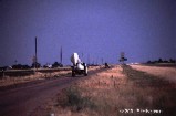 The UMass 3cm and mm radars were scanning this storm.
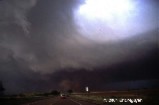
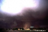 Turkey, Texas, rapid rotation aloft and at the surface with dust.
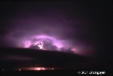
 Storm still rages on near midnight, hour after producing tornado.