- SUPERCELL STORM STRUCTURE
- SUPERCELLS - OUTFLOW - MAMMATUS
The storm
galleries of Eric Nguyen
-
-
- SUPERCELLS / CONVECTION
-
- Storm structure is my passion in storm observing. My
success in each chase usually is determined by the success I had in observing a severe
storm that had some good structure associated with it. Whether it's mammatus,
striations, wallclouds, sunsets, or anything that catches my eye and is interesting, I'll
consider it a success. Supercells are obviously my favorite mode of severe
storm. However, a stacked plate shelf is just as amazing if not more so then a
typical supercell. Thus if there is a threat for such a phenomena, I'll try to stay
ahead of it and go for the structure shot. I have three main headings that I place
structure pictures under, supercells, outflow, and mammatus.
-
-
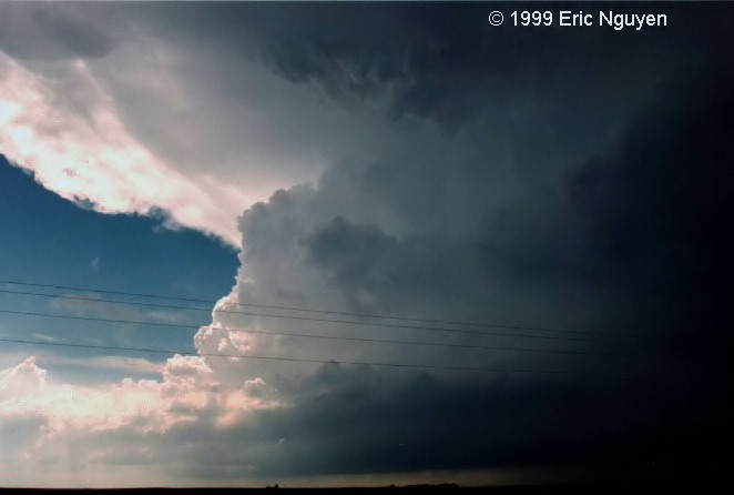
 Strong convective cell
developing in Northern Oklahoma, which evolved into a long-lived supercell.
Strong convective cell
developing in Northern Oklahoma, which evolved into a long-lived supercell.-


 A series of images from a supercell that develop near Limon,
Colorado on June 2, 2005. Baseball to softball sized hail was being reported on I-70
west of Limon.
A series of images from a supercell that develop near Limon,
Colorado on June 2, 2005. Baseball to softball sized hail was being reported on I-70
west of Limon.-
 Some photogenic convection in northwest South Dakota on June 28,
2005.
Some photogenic convection in northwest South Dakota on June 28,
2005.-


 We quickly noticed that our cell that developed near
Springer, NM, began to get some amazing structure. So we ignored the rest of the
hail and dove south to get some structure shots. This storm morphed into a beautiful
LP supercell. This was observed on June 3, 2003.
We quickly noticed that our cell that developed near
Springer, NM, began to get some amazing structure. So we ignored the rest of the
hail and dove south to get some structure shots. This storm morphed into a beautiful
LP supercell. This was observed on June 3, 2003.-
 An LP supercell at 10pm west of Kit Carson, Colorado. Taken
June 2, 2005.
An LP supercell at 10pm west of Kit Carson, Colorado. Taken
June 2, 2005.-


 Strong convection near Gainesville, Texas. This eventually evolved into
a supercell that dropped 3 tornadoes near the town of Anna, Texas. Taken May 9,
2006.
Strong convection near Gainesville, Texas. This eventually evolved into
a supercell that dropped 3 tornadoes near the town of Anna, Texas. Taken May 9,
2006.-
 This is a developing supercell near Crow Agency, Montana, taken
June 8, 2006.
This is a developing supercell near Crow Agency, Montana, taken
June 8, 2006.-
 Intense convection near Turkey, Texas, on May 3, 2003.
-

 Developing supercell west of Scottsbluff, Nebraska, taken June
10, 2006.
Developing supercell west of Scottsbluff, Nebraska, taken June
10, 2006.-


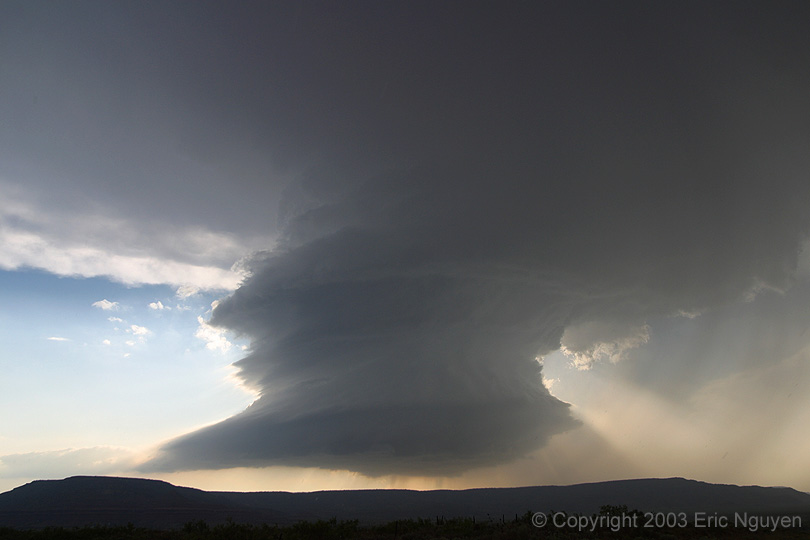
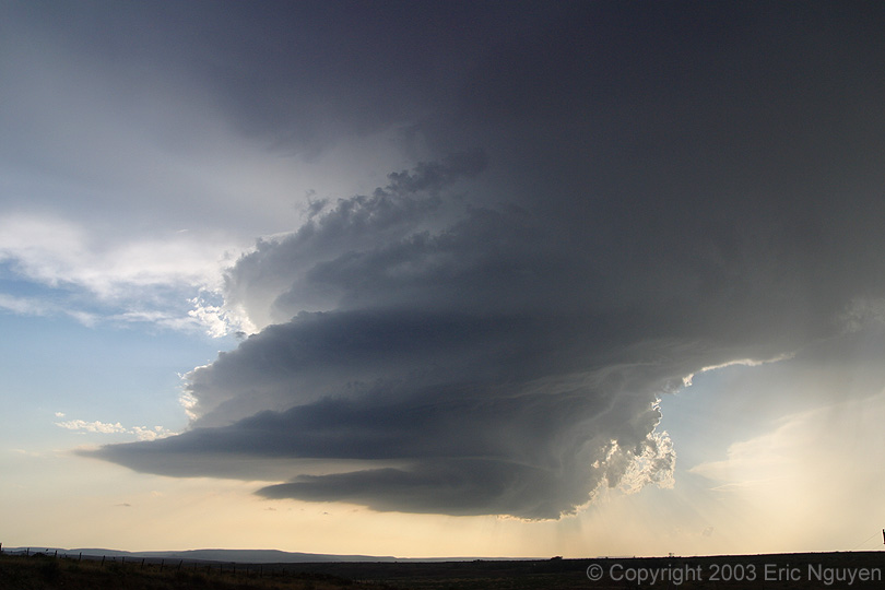
 A long-lived
classic to LP supercell on June 3, 2003. The structure was beautiful as the storm
moved southward along the higher terrain of eastern New Mexico.
A long-lived
classic to LP supercell on June 3, 2003. The structure was beautiful as the storm
moved southward along the higher terrain of eastern New Mexico.
 A
gorgeous LP supercell over Will Rogers World Airport in Oklahoma City, OK, on May 26,
2004. We observed this storm from Elk City to OKC for hours, however, it wasn't
until it turned into an LP that things got interesting. Prior to this, the storm
occasionally had large wallclouds that got undercut by cold outflow.
A
gorgeous LP supercell over Will Rogers World Airport in Oklahoma City, OK, on May 26,
2004. We observed this storm from Elk City to OKC for hours, however, it wasn't
until it turned into an LP that things got interesting. Prior to this, the storm
occasionally had large wallclouds that got undercut by cold outflow.

 A
beautiful LP supercell in central Texas on June 1, 2004. Both images combined shows
the entire storm as it was too close to get it all on one shot.
A
beautiful LP supercell in central Texas on June 1, 2004. Both images combined shows
the entire storm as it was too close to get it all on one shot.
 A
second supercell in Eastern New Mexico during sunset on June 3, 2003. After our
initial long-lived LP supercell dissipated and moved east, another LP formed to our west
and went to our north. This allowed us to get some sunset shots, however, a bolt
from the blue occurred and I luckily had my shutter open to do one last time
exposure! This was the only CG we observed with this storm.
A
second supercell in Eastern New Mexico during sunset on June 3, 2003. After our
initial long-lived LP supercell dissipated and moved east, another LP formed to our west
and went to our north. This allowed us to get some sunset shots, however, a bolt
from the blue occurred and I luckily had my shutter open to do one last time
exposure! This was the only CG we observed with this storm.-

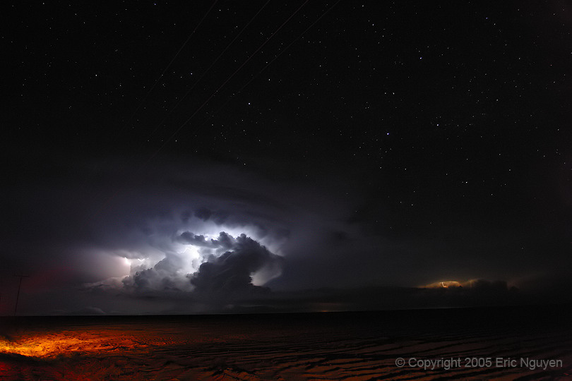
 A nighttime severe storm on the Colorado prairie on June 2, 2005.
-

 An
amazing supercell that lasted for hours now giving us an incredible view as it moves off
to the northeast, passing over Sioux Falls, SD. We observed 11 tornadoes with this
storm over far southeastern South Dakota. June 24, 2003 was certainly a day to
remember for many that day.
An
amazing supercell that lasted for hours now giving us an incredible view as it moves off
to the northeast, passing over Sioux Falls, SD. We observed 11 tornadoes with this
storm over far southeastern South Dakota. June 24, 2003 was certainly a day to
remember for many that day.-
 Striated barber-pole LP supercell as it developed a tornado near
Wanblee, South Dakota. Shot was taken on June 7, 2005, looking west.
Striated barber-pole LP supercell as it developed a tornado near
Wanblee, South Dakota. Shot was taken on June 7, 2005, looking west.
-
 Interesting supercell structure from the west side on June 28,
2005. Image was taken in northwest South Dakota.
Interesting supercell structure from the west side on June 28,
2005. Image was taken in northwest South Dakota.
-
 May 6,
2001 near Gene Autry, OK. This is the third wall cloud of the day after the first
one produced a photogenic tornado. Notice the incredible vault structure, RFD notch,
and inflow tail. The view is looking west as it moved east with an area on the left
having moderate rotation.
May 6,
2001 near Gene Autry, OK. This is the third wall cloud of the day after the first
one produced a photogenic tornado. Notice the incredible vault structure, RFD notch,
and inflow tail. The view is looking west as it moved east with an area on the left
having moderate rotation.
-
 A rapidly
rotating wallcloud near Binger, Oklahoma on May 9, 2003. This view is looking west
as this region had very strong rotation. The inflow tail from the north is blasting
into the wallcloud, however, there seems to be stable air that is ingesting into the area
that hurt our chances for a tornado. This storm continued towards the OKC metro area
in which we observed an F3 tornado crossing I-35 in Oklahoma City.
A rapidly
rotating wallcloud near Binger, Oklahoma on May 9, 2003. This view is looking west
as this region had very strong rotation. The inflow tail from the north is blasting
into the wallcloud, however, there seems to be stable air that is ingesting into the area
that hurt our chances for a tornado. This storm continued towards the OKC metro area
in which we observed an F3 tornado crossing I-35 in Oklahoma City.
-
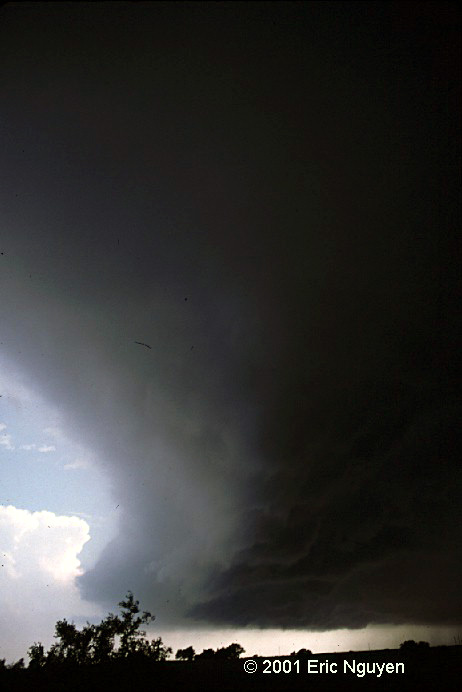
 This was
taken on May 25, 1999. This was a vicious wallcloud that had some intense vertical
motion from the inflow tail to the updraft base. A large hook on radar was observed
and a brief tornado was reported, however, we never saw this. Note how low the base
of this wallcloud is! This wallcloud eventually got wrapped in heavy rain and hail
as it turned into an HP beast.
This was
taken on May 25, 1999. This was a vicious wallcloud that had some intense vertical
motion from the inflow tail to the updraft base. A large hook on radar was observed
and a brief tornado was reported, however, we never saw this. Note how low the base
of this wallcloud is! This wallcloud eventually got wrapped in heavy rain and hail
as it turned into an HP beast.-

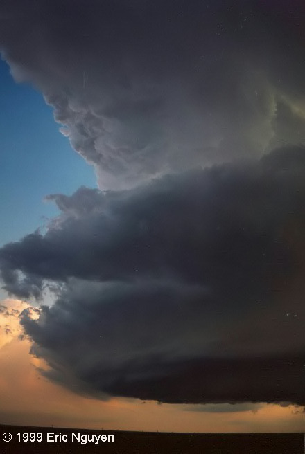
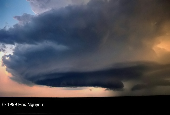
 Here is a
supercell east of Jayton, TX on May 25, 1999. The LP supercell shown on the right
image was casting a shadow on the storm to our east, shown on the left image. We
were treated to a gorgeous LP during sunset which ended a very successful storm day.
Here is a
supercell east of Jayton, TX on May 25, 1999. The LP supercell shown on the right
image was casting a shadow on the storm to our east, shown on the left image. We
were treated to a gorgeous LP during sunset which ended a very successful storm day.-

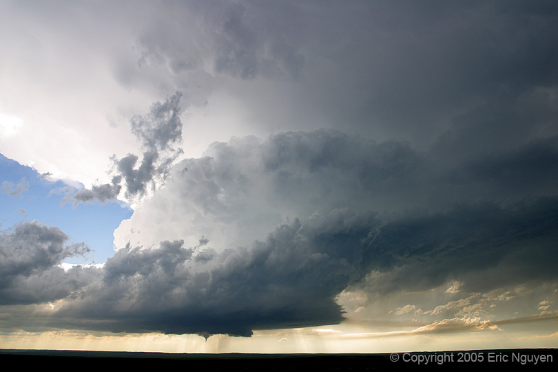
 This is a low topped supercell near Cordell, OK, on May 5,
2001. It initially began as a mass of weak convection that turned into a low topped
exploding convective tower. Early on it had a large cone funnel that last a minute
or two before dissipating. Twenty minutes later it produced a small tornado south of
Cordell.
This is a low topped supercell near Cordell, OK, on May 5,
2001. It initially began as a mass of weak convection that turned into a low topped
exploding convective tower. Early on it had a large cone funnel that last a minute
or two before dissipating. Twenty minutes later it produced a small tornado south of
Cordell.-
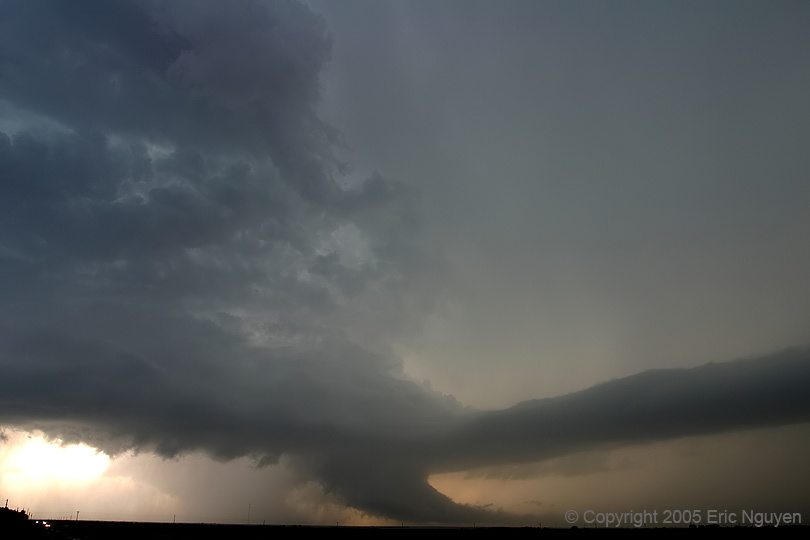
 Supercell structure near Girard, Texas, after producing multiple
tornadoes. Taken on June 12, 2005.
Supercell structure near Girard, Texas, after producing multiple
tornadoes. Taken on June 12, 2005.-


 Just after driving under the meso, we flank the supercell to the
east and are surprised to see some stunning structure, including vorticies embedded in the
striations. Images were taken June 7, 2005 near Okaton, South Dakota.
Just after driving under the meso, we flank the supercell to the
east and are surprised to see some stunning structure, including vorticies embedded in the
striations. Images were taken June 7, 2005 near Okaton, South Dakota.-
 A newly
developing supercell near Meade, KS, on May 31, 1999. This storm began to produce
grapefruit sized hail measured at 5 inches which busted out my window as well as many
others. This produced a large tornado near Sitka, KS as well as a few other smaller
tornadoes.
A newly
developing supercell near Meade, KS, on May 31, 1999. This storm began to produce
grapefruit sized hail measured at 5 inches which busted out my window as well as many
others. This produced a large tornado near Sitka, KS as well as a few other smaller
tornadoes.-
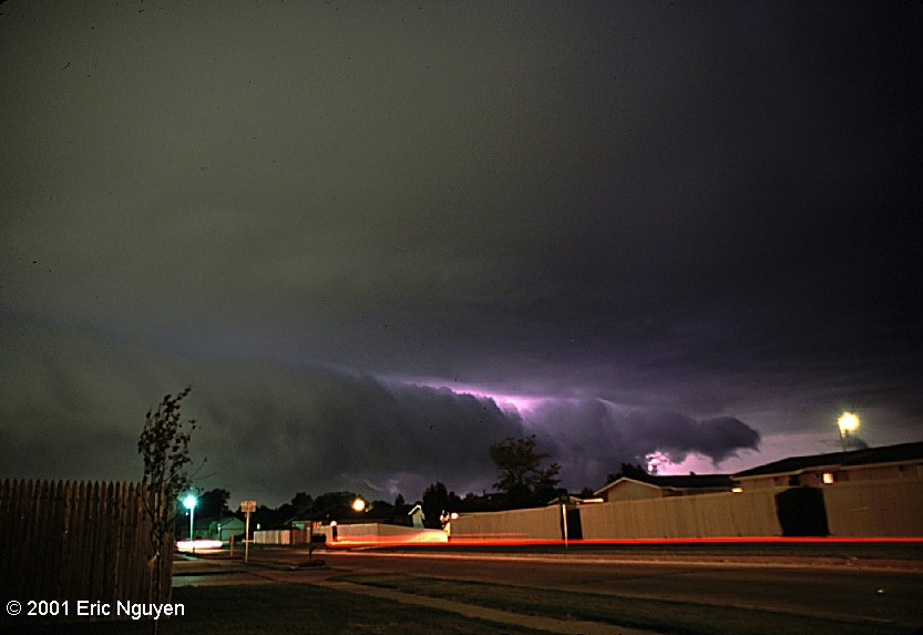
 Even
at midnight our supercell was still rotating like crazy. This previously produced a
tornado about an hour ago crossing 287 which resulted in the closure of that highway.
The image was taken west of Wichita Falls, TX, as it moved northeast into southern
Oklahoma. We observed this storm for 8 hours beginning from Plainview, TX, to
Wichita Falls, TX, which spans several hundred miles. May 29, 2001.
Even
at midnight our supercell was still rotating like crazy. This previously produced a
tornado about an hour ago crossing 287 which resulted in the closure of that highway.
The image was taken west of Wichita Falls, TX, as it moved northeast into southern
Oklahoma. We observed this storm for 8 hours beginning from Plainview, TX, to
Wichita Falls, TX, which spans several hundred miles. May 29, 2001.
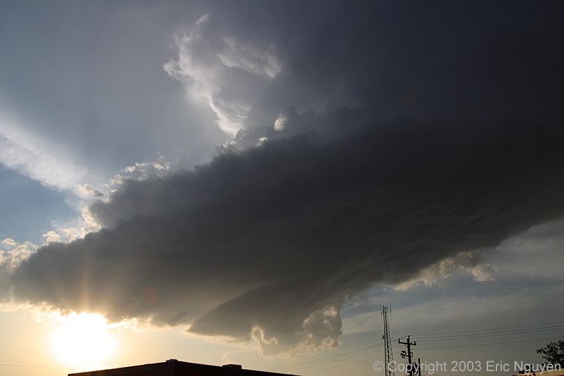
OUTFLOW
-
 Cold
outflow is causing this shelf cloud to reach the surface. A few people reported this
as a wallcloud on the ground, however, this is merely the leading edge of very cold
outflow as this once tornadic supercell turns HP. This storm began to produce 3 - 4
inch hail as it moved towards Woodson, TX, on April 5, 2003.
Cold
outflow is causing this shelf cloud to reach the surface. A few people reported this
as a wallcloud on the ground, however, this is merely the leading edge of very cold
outflow as this once tornadic supercell turns HP. This storm began to produce 3 - 4
inch hail as it moved towards Woodson, TX, on April 5, 2003.-

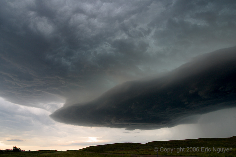
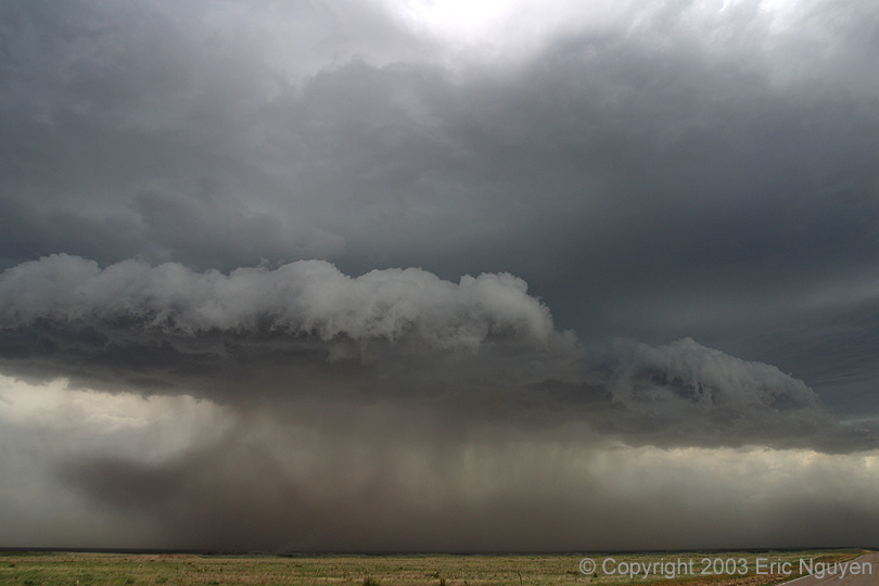
 A gorgeous
shelf in the vicinity of a wind farm near Sublette, Kansas, June 1, 2003.
A gorgeous
shelf in the vicinity of a wind farm near Sublette, Kansas, June 1, 2003.-

 After a supercell gusted out, we were treated to a
cool shelf cloud near Miles City, Montana.
After a supercell gusted out, we were treated to a
cool shelf cloud near Miles City, Montana.-

 Images of an elevated shelf near Scottsbluff, Nebraska, on June 10, 2006.
 -
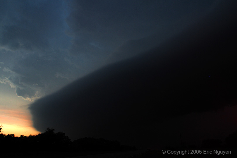
 Passage of a shelf cloud associated with a large HP supercell
near Munday, Texas, on May 13, 2005.
Passage of a shelf cloud associated with a large HP supercell
near Munday, Texas, on May 13, 2005.-

 Strong outflow and large hail were being reported with this HP
forward-flank mesocyclone near Denver, Colorado, on June 3, 2005.
Strong outflow and large hail were being reported with this HP
forward-flank mesocyclone near Denver, Colorado, on June 3, 2005.-


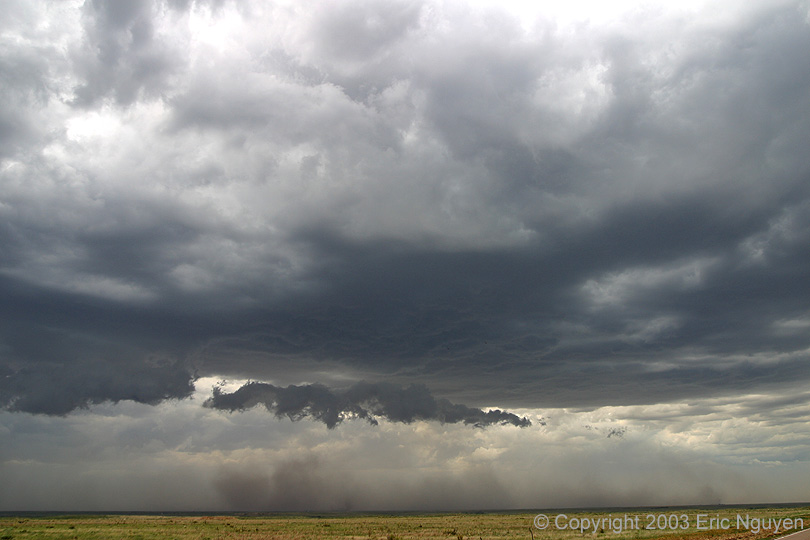
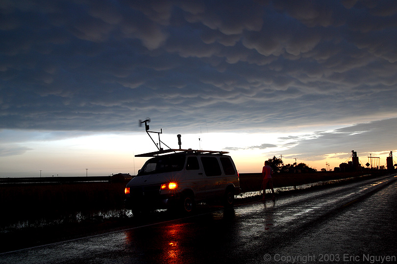
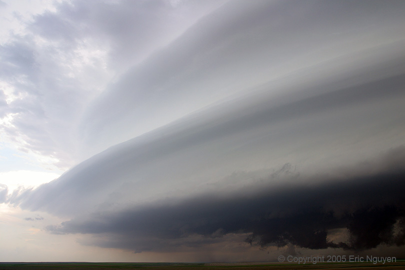
 Some
convection developed in a rather dry boundary layer resulting in an immediate forward
propagating linear complex. For that reason, we stayed ahead of it waiting for a
decent shelf to form. Later that day a gorgeous stacked plate shelf developed over
southwest Kansas on June 1, 2003.
Some
convection developed in a rather dry boundary layer resulting in an immediate forward
propagating linear complex. For that reason, we stayed ahead of it waiting for a
decent shelf to form. Later that day a gorgeous stacked plate shelf developed over
southwest Kansas on June 1, 2003.-
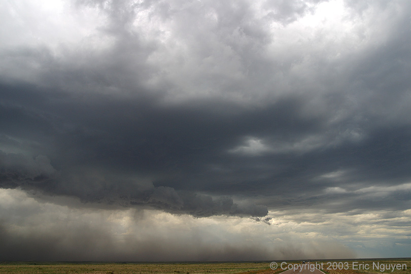
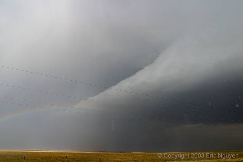
 Here is
an impressive shelf cloud along the TX/OK borders on April 15, 2000. We originally
were expected supercells that day, however, the shear and weaker cap supported a linear
convective mode. We still were treated to this impressive site!
Here is
an impressive shelf cloud along the TX/OK borders on April 15, 2000. We originally
were expected supercells that day, however, the shear and weaker cap supported a linear
convective mode. We still were treated to this impressive site!-
 A very
cool looking gust front moving through Norman just after the OU football game ended.
This view is looking westward as a line of severe storms moves east into our
county. This was shot with slide film on a time exposure.
A very
cool looking gust front moving through Norman just after the OU football game ended.
This view is looking westward as a line of severe storms moves east into our
county. This was shot with slide film on a time exposure.-
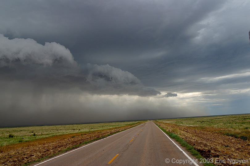
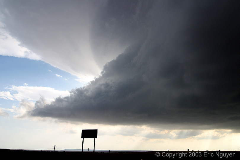
 A
passing shelf cloud on May 20, 2001 in southern Oklahoma. Notice the sharp contrast
between blue skies and dark clouds, there was a decent temperature gradient as well.
A
passing shelf cloud on May 20, 2001 in southern Oklahoma. Notice the sharp contrast
between blue skies and dark clouds, there was a decent temperature gradient as well.-
 Monster
shelf cloud with sustained winds at 70-80mph behind it, on May 27, 2001 near Sitka, KS.
With strong northwest flow and abundant instability, a large derecho developed and
moved southward at 50-60 mph!
Monster
shelf cloud with sustained winds at 70-80mph behind it, on May 27, 2001 near Sitka, KS.
With strong northwest flow and abundant instability, a large derecho developed and
moved southward at 50-60 mph!-
MAMMATUS
 Mammatus over O'Neill, Nebraska, on May 7, 2005.
-
 Some mammatus clouds near
Scottsbluff, Nebraska, on June 10, 2006.
Some mammatus clouds near
Scottsbluff, Nebraska, on June 10, 2006.
-
 Lots of
mammatus behind a squall line along the TX / NM border, on June 13, 2003.
Lots of
mammatus behind a squall line along the TX / NM border, on June 13, 2003.
-


 Some mammatus in eastern New Mexico on June 2,
2003. Photos can't seem to capture the true essence of what it is like to look up
and see these huge cotton balls in the sky, but I do my best.
Some mammatus in eastern New Mexico on June 2,
2003. Photos can't seem to capture the true essence of what it is like to look up
and see these huge cotton balls in the sky, but I do my best.
-
 Here are
some mammatus from a spectacular supercell north of Enid, OK on June 21, 1998.
Here are
some mammatus from a spectacular supercell north of Enid, OK on June 21, 1998.
-
Many
of these images appear in the photo book
by Mike Hollingshead
and Eric Nguyen (now available)

Last Update:
05/30/09
- THIS PAGE AND ITS IMAGES ARE
COPYRIGHTED BY ERIC NGUYEN.
- ANY REPRODUCTION OF THIS PAGE
AND/OR ANY OF ITS CONTENTS IS A VIOLATION OF FEDERAL LAW.
 Strong convective cell
developing in Northern Oklahoma, which evolved into a long-lived supercell.
Strong convective cell
developing in Northern Oklahoma, which evolved into a long-lived supercell.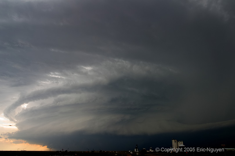

 A series of images from a supercell that develop near Limon,
Colorado on June 2, 2005. Baseball to softball sized hail was being reported on I-70
west of Limon.
A series of images from a supercell that develop near Limon,
Colorado on June 2, 2005. Baseball to softball sized hail was being reported on I-70
west of Limon. Some photogenic convection in northwest South Dakota on June 28,
2005.
Some photogenic convection in northwest South Dakota on June 28,
2005.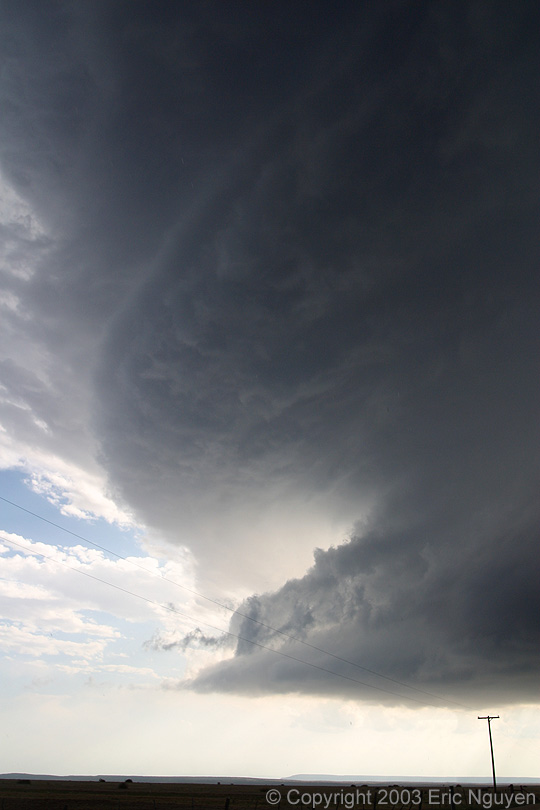
 We quickly noticed that our cell that developed near
Springer, NM, began to get some amazing structure. So we ignored the rest of the
hail and dove south to get some structure shots. This storm morphed into a beautiful
LP supercell. This was observed on June 3, 2003.
We quickly noticed that our cell that developed near
Springer, NM, began to get some amazing structure. So we ignored the rest of the
hail and dove south to get some structure shots. This storm morphed into a beautiful
LP supercell. This was observed on June 3, 2003. An LP supercell at 10pm west of Kit Carson, Colorado. Taken
June 2, 2005.
An LP supercell at 10pm west of Kit Carson, Colorado. Taken
June 2, 2005.

 Strong convection near Gainesville, Texas. This eventually evolved into
a supercell that dropped 3 tornadoes near the town of Anna, Texas. Taken May 9,
2006.
Strong convection near Gainesville, Texas. This eventually evolved into
a supercell that dropped 3 tornadoes near the town of Anna, Texas. Taken May 9,
2006. This is a developing supercell near Crow Agency, Montana, taken
June 8, 2006.
This is a developing supercell near Crow Agency, Montana, taken
June 8, 2006. Intense convection near Turkey, Texas, on May 3, 2003.
 Developing supercell west of Scottsbluff, Nebraska, taken June
10, 2006.
Developing supercell west of Scottsbluff, Nebraska, taken June
10, 2006.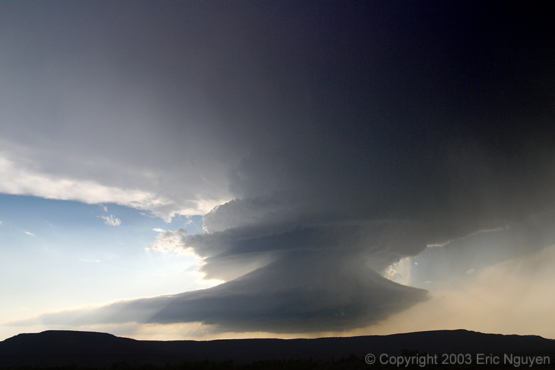
 A long-lived
classic to LP supercell on June 3, 2003. The structure was beautiful as the storm
moved southward along the higher terrain of eastern New Mexico.
A long-lived
classic to LP supercell on June 3, 2003. The structure was beautiful as the storm
moved southward along the higher terrain of eastern New Mexico.