- INSTRUMENTATION & RADAR
- MOBILE AND FIXED INSTRUMENTATION
& RADAR
- 5 cm (C-band) SMART-R's
- (Shared Mobile Atmospheric Research and
Teaching Radar)


 Images
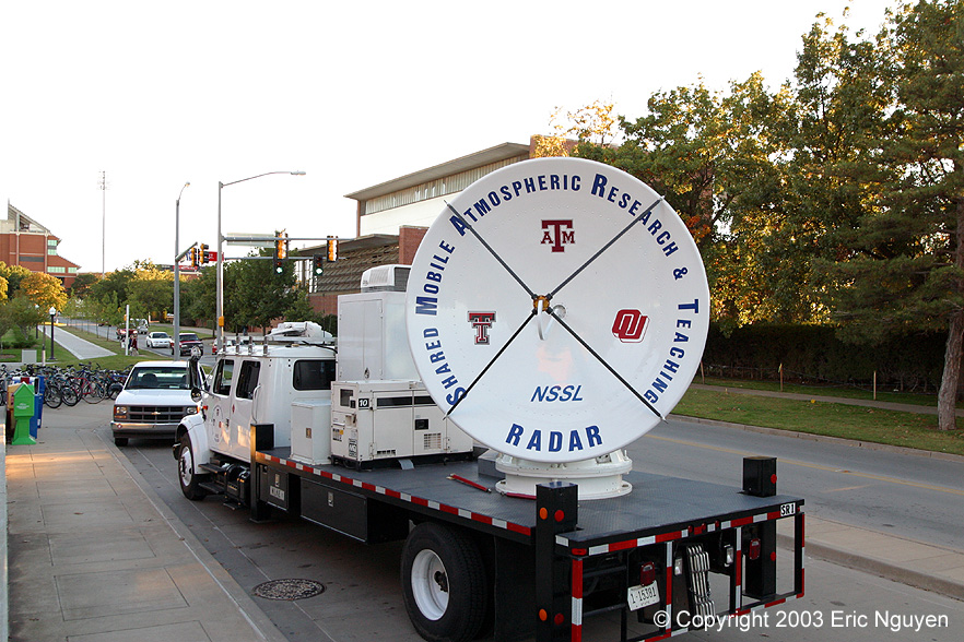
of SR-1 housed at the NSSL garage. It's a 5cm Doppler radar with an 8 foot diameter
dish mounted on a large truck. There are two in existence, SR-1 and SR-2. They
are used to study convective weather, precipitation physics, hurricanes, etc.
Images
of SR-1 housed at the NSSL garage. It's a 5cm Doppler radar with an 8 foot diameter
dish mounted on a large truck. There are two in existence, SR-1 and SR-2. They
are used to study convective weather, precipitation physics, hurricanes, etc.
-

 Image of
both the SMART-R's together. Both radars are a collaborative research program with
the National Severe Storms Laboratory, University of Oklahoma, Texas Tech, and Texas
A&M University.
Image of
both the SMART-R's together. Both radars are a collaborative research program with
the National Severe Storms Laboratory, University of Oklahoma, Texas Tech, and Texas
A&M University.
-


 Both
SMART-R's get ready as they head for the east coast in pursuit of hurricane Isabel.
Both
SMART-R's get ready as they head for the east coast in pursuit of hurricane Isabel.
-

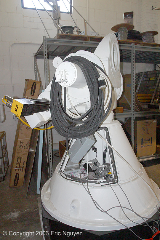
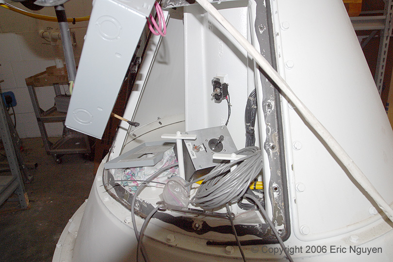
 Images of
the pedestal and antenna.
Images of
the pedestal and antenna.
-


 Images
of the SMART-R's including Dr. Biggerstaff, our radar expert at the University of Oklahoma
and also one of the lead investigators of the SMART-R Radar Program.
Images
of the SMART-R's including Dr. Biggerstaff, our radar expert at the University of Oklahoma
and also one of the lead investigators of the SMART-R Radar Program.
-


 Images
of SR-1 on display outside of the meteorology department at the University of Oklahoma.
Images
of SR-1 on display outside of the meteorology department at the University of Oklahoma.
-


 Images
of the transmitter / receiver for SR-2.
Images
of the transmitter / receiver for SR-2.
-

 SR-2's
pedestal and inside the cab prior to departure for our radar lab.
SR-2's
pedestal and inside the cab prior to departure for our radar lab.
-


 Dr.
Biggerstaff explained the radars in great detail and gave us scenarios of possible weather
events which we applied to the radar. There are many possible settings to run the
radar which we tailored to our given scenario prior to transmitting. It was an
amazing learning experience!
Dr.
Biggerstaff explained the radars in great detail and gave us scenarios of possible weather
events which we applied to the radar. There are many possible settings to run the
radar which we tailored to our given scenario prior to transmitting. It was an
amazing learning experience!
-
-
- 3 cm (X-band) NO-XP
- (NSSL-OU X-band Polarimetric Radar)
-
-


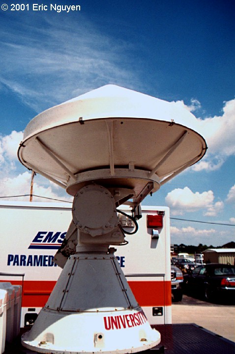
 Pedestal and antenna for the new mobile X-band polarimetric
radar.
Pedestal and antenna for the new mobile X-band polarimetric
radar.
-


 Various images of the pedestal, both inside and out.
-
3 cm (X-band)
Doppler On Wheels


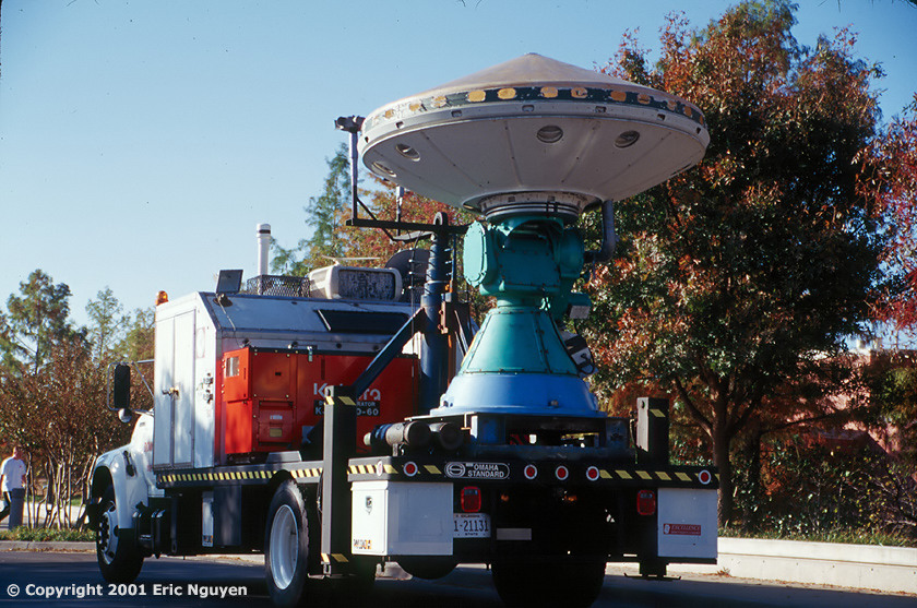
 The DOW (Doppler On Wheels) program is owned by the Center for
Severe Weather Research (CSWR) located in Boulder, CO. Many modifications and
upgrades have been performed by NCAR (National Center for Atmospheric Research). The
Doppler on Wheels Project is ran by Josh Wurman, now director of CSWR. Both DOW's
continue to explore rare, short-lived, and small scale phenomena. Research ranges
from supercell/tornadogenesis research in the ROTATE Project to Homeland Security
Research.
The DOW (Doppler On Wheels) program is owned by the Center for
Severe Weather Research (CSWR) located in Boulder, CO. Many modifications and
upgrades have been performed by NCAR (National Center for Atmospheric Research). The
Doppler on Wheels Project is ran by Josh Wurman, now director of CSWR. Both DOW's
continue to explore rare, short-lived, and small scale phenomena. Research ranges
from supercell/tornadogenesis research in the ROTATE Project to Homeland Security
Research.

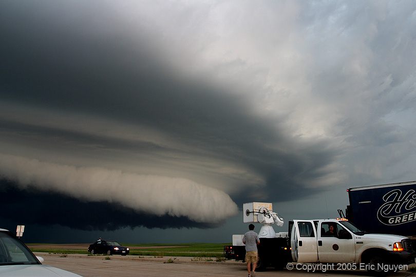
 DOW 3 in action as it scans an HP supercell near Munday, Texas,
on May 13, 2005.
DOW 3 in action as it scans an HP supercell near Munday, Texas,
on May 13, 2005.


 Various images of the Rapid DOW, supported by the National
Science Foundation. Notice the mascot they have on their hood.
Various images of the Rapid DOW, supported by the National
Science Foundation. Notice the mascot they have on their hood.


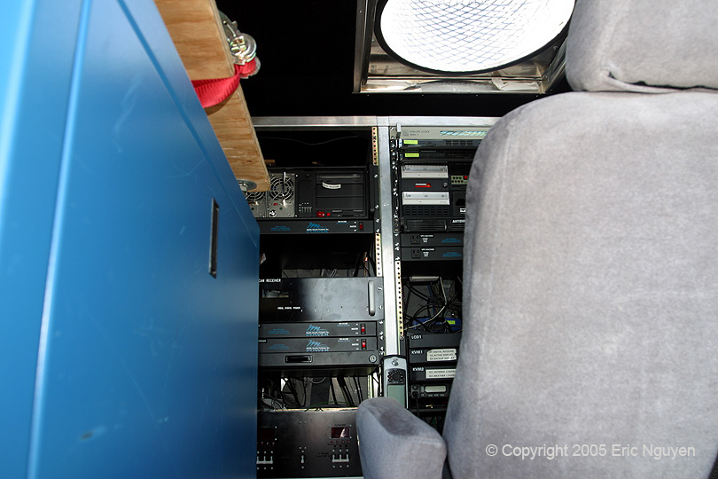
 More images of the RAPID DOW antenna. Third image shows
some of the computing systems, the blue enclosure houses the transmitter. Last image
shows the RAPID DOW scanning a weak tornado north of Hill City, Kansas.
More images of the RAPID DOW antenna. Third image shows
some of the computing systems, the blue enclosure houses the transmitter. Last image
shows the RAPID DOW scanning a weak tornado north of Hill City, Kansas.

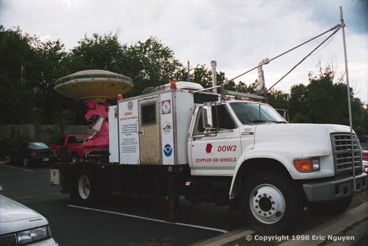
 This
is "DOW 2" awaiting hurricane intercepts in fall of 1998.
This
is "DOW 2" awaiting hurricane intercepts in fall of 1998.


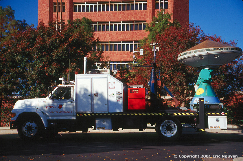
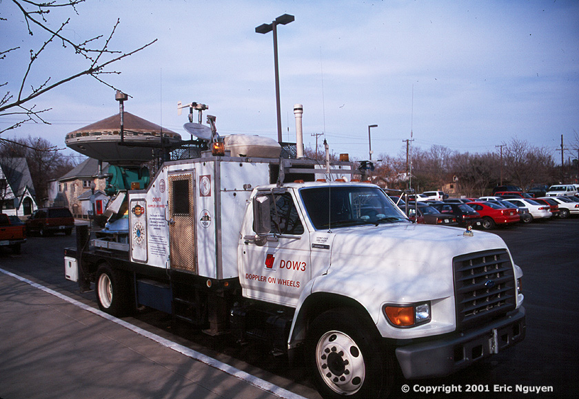
 The
following are pictures of "DOW 3" parked in front of Sarkey's Energy Center
where the Meteorology Department is at OU. At that time, one or two of the DOW's was
parked there every Friday for a radar meteorology course that was taught by Josh
Wurman. DOW 3 has a special portable tower consisting of 3 wind measuring
devices. This tower raises 10 meters high to accurately measure boundary layer
surface winds in hurricanes.
The
following are pictures of "DOW 3" parked in front of Sarkey's Energy Center
where the Meteorology Department is at OU. At that time, one or two of the DOW's was
parked there every Friday for a radar meteorology course that was taught by Josh
Wurman. DOW 3 has a special portable tower consisting of 3 wind measuring
devices. This tower raises 10 meters high to accurately measure boundary layer
surface winds in hurricanes.
- UMass Radars
- 3cm (x-band) & 3 mm (w-band)

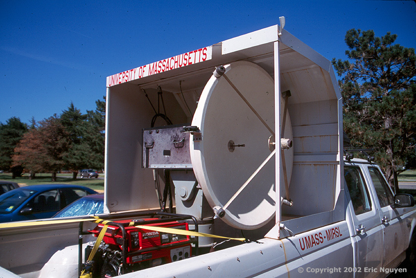
 This is
the Univ. of Massachusetts mobile 3cm radar truck. It debuted the spring of 2001 and
is now dual-polarized. It was paid by the research money gained from the 3 mm
polametric Doppler radar. Bluestein continues to take these radars out ever year in
pursuit of tornadic storms.
This is
the Univ. of Massachusetts mobile 3cm radar truck. It debuted the spring of 2001 and
is now dual-polarized. It was paid by the research money gained from the 3 mm
polametric Doppler radar. Bluestein continues to take these radars out ever year in
pursuit of tornadic storms.
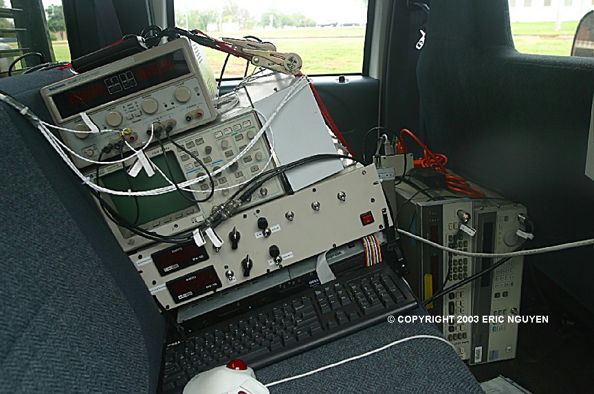
 This is a
picture of the back seat. A few computer components for data processing and
acquisition.
This is a
picture of the back seat. A few computer components for data processing and
acquisition.


 The UMASS 3cm
radar had an upgrade in 2005. Dr. Biggerstaff gave a brief explanation as how spaced
antennas work. "Spaced antennas use two flat plates oriented at an angle to
receive returns with different phases to try and resolve the cross-beam wind
component."
The UMASS 3cm
radar had an upgrade in 2005. Dr. Biggerstaff gave a brief explanation as how spaced
antennas work. "Spaced antennas use two flat plates oriented at an angle to
receive returns with different phases to try and resolve the cross-beam wind
component."

 Image of the
computing inside the 3cm radar as well as a shot of it in action.
Image of the
computing inside the 3cm radar as well as a shot of it in action.


 The University of
Massachusetts tornado radar.
The University of
Massachusetts tornado radar.
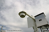
GROUND BASED RADAR

 This is a TDWR
radar at north base near NSSL. Images were taken during sunset.
This is a TDWR
radar at north base near NSSL. Images were taken during sunset.
NSSL MOBILE LABS


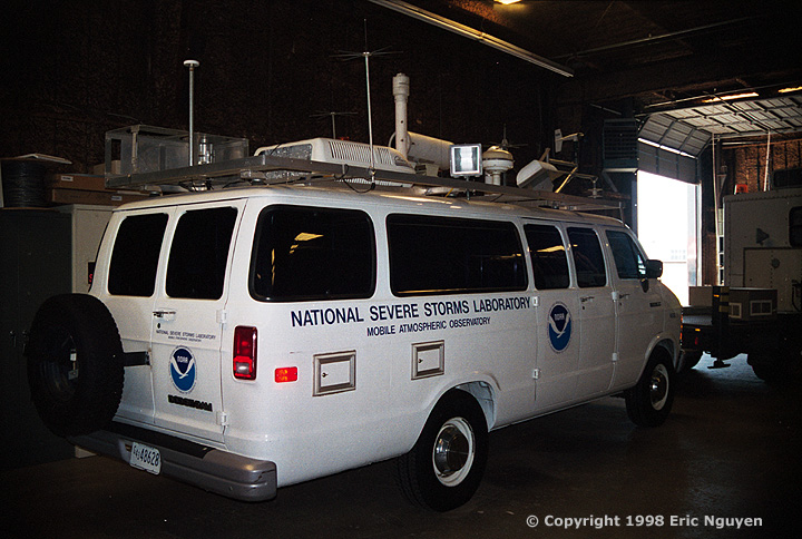
 This is
"NSSL 1". Picture taken at the NSSL's Joint Mobile Research Facility
(JMRF). This van has the most equipment I have ever seen on a moving vehicle.
It no longer exits, a new van "NSSL 5" took its place. Picture taken
July, 1998.
This is
"NSSL 1". Picture taken at the NSSL's Joint Mobile Research Facility
(JMRF). This van has the most equipment I have ever seen on a moving vehicle.
It no longer exits, a new van "NSSL 5" took its place. Picture taken
July, 1998.


 This is
"NSSL 4", used in many projects including Project VORTEX and Project IPEX.
Inside, is the FC's station with laptops, radios, and sounding equipment.
This is
"NSSL 4", used in many projects including Project VORTEX and Project IPEX.
Inside, is the FC's station with laptops, radios, and sounding equipment.

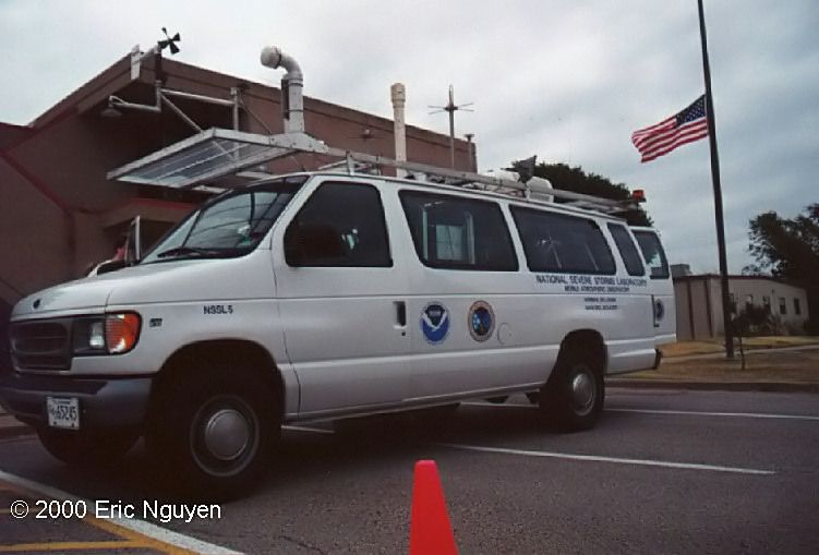
 Here is
the mobile research vehicle, NSSL 5. This was used in Project STEPS during spring of
2000 and Project IPEX during the winter of 2000.
Here is
the mobile research vehicle, NSSL 5. This was used in Project STEPS during spring of
2000 and Project IPEX during the winter of 2000.

 Images
of the NSSL mobile laboratory, "NSSL 6". It was built in 2002-2003 and
will be used for mobile radiosonde launches.
Images
of the NSSL mobile laboratory, "NSSL 6". It was built in 2002-2003 and
will be used for mobile radiosonde launches.

 Images of the
development phase of "NSSL 7" mobile laboratory. Images were taken August
14, 2006.
Images of the
development phase of "NSSL 7" mobile laboratory. Images were taken August
14, 2006.
NSSL/OU MOBILE
MESONETS
-
 The mobile mesonet as of October, 2004. One of the upgrades
includes a fast response thermistor mounted in the front of the rack below the pressure
port.
The mobile mesonet as of October, 2004. One of the upgrades
includes a fast response thermistor mounted in the front of the rack below the pressure
port.

 The
picture on the left shows a close-up of the variety of instruments on the mobile mesonets
in 1999. On the right, a close-up of what's inside those big white boxes. This
one isn't finished yet, but it gives you an idea of the complexity of wiring those things.
The
picture on the left shows a close-up of the variety of instruments on the mobile mesonets
in 1999. On the right, a close-up of what's inside those big white boxes. This
one isn't finished yet, but it gives you an idea of the complexity of wiring those things.
 In late spring of 2000, these six
mobile mesonets were used for Project STEPS. Storms were very scarce on the high
plains during this time, so they came home to Norman for a while.
In late spring of 2000, these six
mobile mesonets were used for Project STEPS. Storms were very scarce on the high
plains during this time, so they came home to Norman for a while.


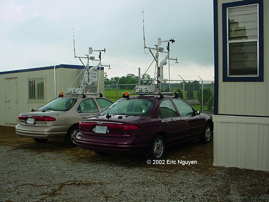
 Images of
the ground instruments for Project IHOP, 2002.
Images of
the ground instruments for Project IHOP, 2002.- More IHOP images and the right hand picture
showing one of the SMART-R Mobile Radars.
 Wiring
setup for a mobile mesonet probe at the NSSL garage.
Wiring
setup for a mobile mesonet probe at the NSSL garage.
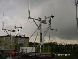
MESONET SITE -
NORMAN, OK
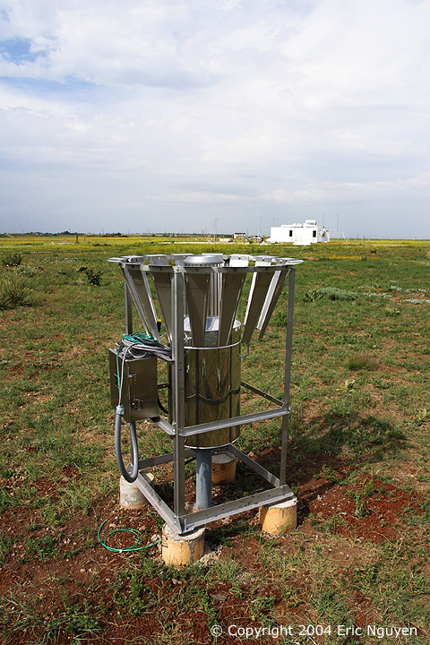
 The Norman,
Oklahoma Mesonet site located at NSSL. The Norman site has many additional
instruments that are not found on regular mesonet sites.
The Norman,
Oklahoma Mesonet site located at NSSL. The Norman site has many additional
instruments that are not found on regular mesonet sites.


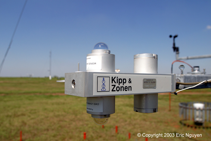
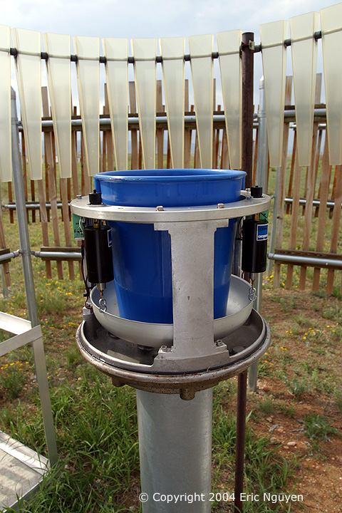
 These images
show a Kipp & Zonen Net Radiometer mounted at about 1.5 meters. It consists of
four sensors which measures the energy balance between incoming short-wave and long-wave
IR radiation versus surface-reflected short-wave and outgoing long-wave IR radiation.
These images
show a Kipp & Zonen Net Radiometer mounted at about 1.5 meters. It consists of
four sensors which measures the energy balance between incoming short-wave and long-wave
IR radiation versus surface-reflected short-wave and outgoing long-wave IR radiation.
 This is a
LI-COR Silicon Pyranometer which measures solar radiation using a silicon photovoltaic
detector.
This is a
LI-COR Silicon Pyranometer which measures solar radiation using a silicon photovoltaic
detector.
 This is an
Apogee IR Thermocouple Transducer which measures sfc skin temperature.
This is an
Apogee IR Thermocouple Transducer which measures sfc skin temperature.
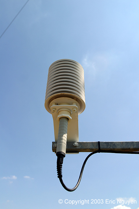
 This is an RM
Young cup anemometer which measures wind speed only. These were mounted at two and
nine meters.
This is an RM
Young cup anemometer which measures wind speed only. These were mounted at two and
nine meters.
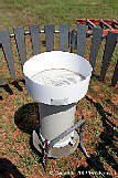
 This is a
tipping bucket rain gauge from Met One Instruments. Surrounding the instrument is a
wind screen which is an effort to reduce errors from localized turbulence induced by wind.
This is a
tipping bucket rain gauge from Met One Instruments. Surrounding the instrument is a
wind screen which is an effort to reduce errors from localized turbulence induced by wind.

 At 1.5 meters
there is a thermistor (left image) that measures the temperature with a 3.6 second time
constant. Also, a Vaisala temperature / RH sensor (right image) using a PRT for
temperature and a capacitive RH chip for RH measurements. Both are mounted in a
self-aspirated 10-plate gill radiation shield made by RM Young. This minimizes
solar radiation errors when winds are generally above 2 m/s.
At 1.5 meters
there is a thermistor (left image) that measures the temperature with a 3.6 second time
constant. Also, a Vaisala temperature / RH sensor (right image) using a PRT for
temperature and a capacitive RH chip for RH measurements. Both are mounted in a
self-aspirated 10-plate gill radiation shield made by RM Young. This minimizes
solar radiation errors when winds are generally above 2 m/s.
 Campbell
Scientific sonic anemometer which allows measurement of 3D wind and temperature.
Below that is a Krypton Hygrometer which is a highly sensitive hygrometer that measures
rapid fluctuations of water vapor.
Campbell
Scientific sonic anemometer which allows measurement of 3D wind and temperature.
Below that is a Krypton Hygrometer which is a highly sensitive hygrometer that measures
rapid fluctuations of water vapor.

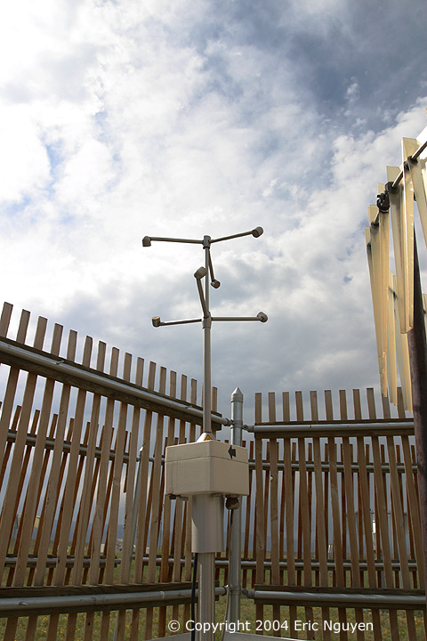
 At 10 meters
the RM Young propeller anemometer measures wind speed and direction.
At 10 meters
the RM Young propeller anemometer measures wind speed and direction.
ASOS SITE -
SPRINGFIELD, CO

 An ASOS site located south of Springfield, CO.


 The typical
instrument suite for an ASOS site, aspirated radiation shield housing the temperature and
dewpoint sensor as well as other instruments.
The typical
instrument suite for an ASOS site, aspirated radiation shield housing the temperature and
dewpoint sensor as well as other instruments.

 A
heated tipping bucket rain gauge with wind shield. Obviously a heated rain gauge in
Colorado is a good idea.
A
heated tipping bucket rain gauge with wind shield. Obviously a heated rain gauge in
Colorado is a good idea.
NCAR ATD - BOULDER,
CO
 Pictured is part of the NCAR Marshall Field Site, where many
instruments are tested out in the middle of nowhere.
Pictured is part of the NCAR Marshall Field Site, where many
instruments are tested out in the middle of nowhere.


 Many
instruments are present including some of the newest technology. Above are sonic
anemometers and various ways of measuring precipitation.
Many
instruments are present including some of the newest technology. Above are sonic
anemometers and various ways of measuring precipitation.


 At NCAR's
Research Aviation Facility located at Colorado's Jefferson County Airport, a C-130Q
Hercules Turboprop is housed in a hanger which studies cloud microphysics.
At NCAR's
Research Aviation Facility located at Colorado's Jefferson County Airport, a C-130Q
Hercules Turboprop is housed in a hanger which studies cloud microphysics.


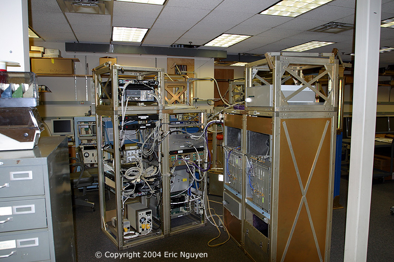
 At NCAR ATD,
many labs responsible for maintaining and fabricating the various instruments that NCAR
scientists use. Pictured from right to left are a dropsonde, the NCAR ELDORA radar
hardware getting an upgrade, and outside, various mobile instrument platforms.
At NCAR ATD,
many labs responsible for maintaining and fabricating the various instruments that NCAR
scientists use. Pictured from right to left are a dropsonde, the NCAR ELDORA radar
hardware getting an upgrade, and outside, various mobile instrument platforms.
Last Update:
06/10/08
- THIS PAGE AND ITS IMAGES ARE
COPYRIGHTED BY ERIC NGUYEN.
- ANY REPRODUCTION OF THIS PAGE
AND/OR ANY OF ITS CONTENTS IS A VIOLATION OF FEDERAL LAW.


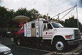
 Images
of SR-1 housed at the NSSL garage. It's a 5cm Doppler radar with an 8 foot diameter
dish mounted on a large truck. There are two in existence, SR-1 and SR-2. They
are used to study convective weather, precipitation physics, hurricanes, etc.
Images
of SR-1 housed at the NSSL garage. It's a 5cm Doppler radar with an 8 foot diameter
dish mounted on a large truck. There are two in existence, SR-1 and SR-2. They
are used to study convective weather, precipitation physics, hurricanes, etc.
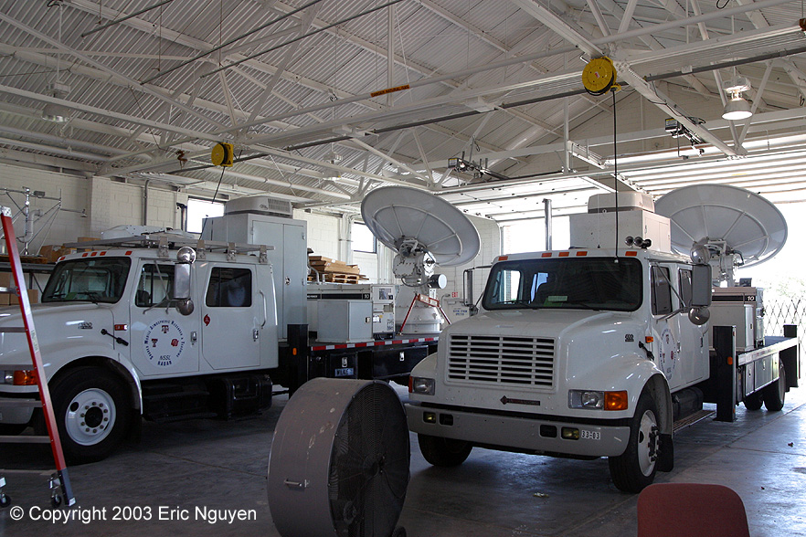 Image of
both the SMART-R's together. Both radars are a collaborative research program with
the National Severe Storms Laboratory, University of Oklahoma, Texas Tech, and Texas
A&M University.
Image of
both the SMART-R's together. Both radars are a collaborative research program with
the National Severe Storms Laboratory, University of Oklahoma, Texas Tech, and Texas
A&M University.

 Both
SMART-R's get ready as they head for the east coast in pursuit of hurricane Isabel.
Both
SMART-R's get ready as they head for the east coast in pursuit of hurricane Isabel.
 Images of
the pedestal and antenna.
Images of
the pedestal and antenna.

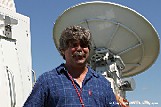
 Images
of the SMART-R's including Dr. Biggerstaff, our radar expert at the University of Oklahoma
and also one of the lead investigators of the SMART-R Radar Program.
Images
of the SMART-R's including Dr. Biggerstaff, our radar expert at the University of Oklahoma
and also one of the lead investigators of the SMART-R Radar Program.

 Images
of SR-1 on display outside of the meteorology department at the University of Oklahoma.
Images
of SR-1 on display outside of the meteorology department at the University of Oklahoma.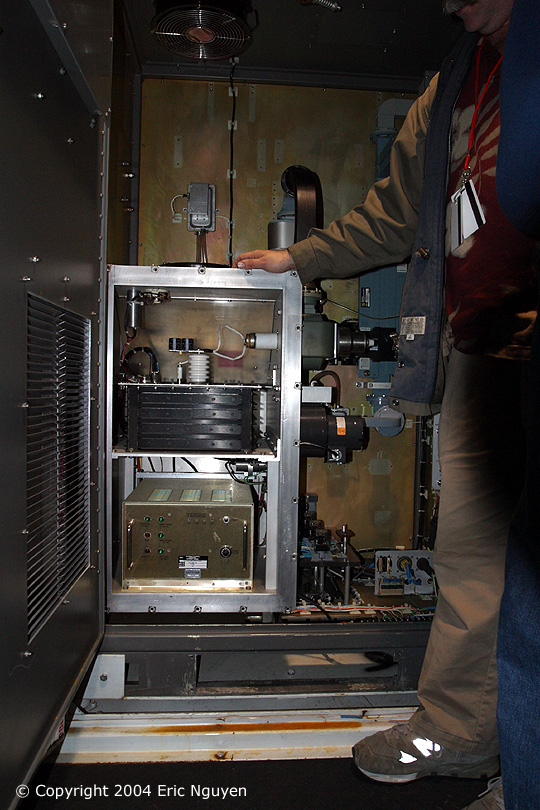

 Images
of the transmitter / receiver for SR-2.
Images
of the transmitter / receiver for SR-2.
 SR-2's
pedestal and inside the cab prior to departure for our radar lab.
SR-2's
pedestal and inside the cab prior to departure for our radar lab.

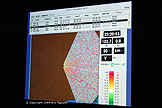
 Dr.
Biggerstaff explained the radars in great detail and gave us scenarios of possible weather
events which we applied to the radar. There are many possible settings to run the
radar which we tailored to our given scenario prior to transmitting. It was an
amazing learning experience!
Dr.
Biggerstaff explained the radars in great detail and gave us scenarios of possible weather
events which we applied to the radar. There are many possible settings to run the
radar which we tailored to our given scenario prior to transmitting. It was an
amazing learning experience!
 Pedestal and antenna for the new mobile X-band polarimetric
radar.
Pedestal and antenna for the new mobile X-band polarimetric
radar.

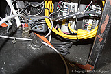
 Various images of the pedestal, both inside and out.