- DECEMBER
| DATE | AREA | OBSERVATIONS |
| NE TX | DAVE FICK AND I OBSERVED A LOW-TOPPED TORNADIC SUPERCELL NEAR BOGOTA, TEXAS. A LARGE TORNADO TOUCHED DOWN FOR A FEW MINUTES BEFORE ROPING OUT. | |
| MARCH 8, 1999 | E TX/W LA | A HIGH RISK DAY ENDED IN A BUST AS EVERYTHING WAS LINEAR. |
| MARCH 17, 1999 | W TX | ENCOUNTERED SOME EARLY SPRING SUPERCELLS. A WALL CLOUD, FUNNEL, AND SOME HEAVY HAIL WERE OBSERVED. |
| MARCH 18, 1999 | N TX | SQUALL LINE, NOTHING SIGNIFICANT OBSERVED. |
| APRIL 2, 1999 | W OK | LARGE HAIL, BRIEF WALL CLOUDS WERE SITED BEFORE OCCLUDING. VERY COLD 76MPH WIND GUST RECORDED FROM A MICROBURST ON THE BACK SIDE OF A SUPERCELL ON I-40 IN W OK. ALSO SOME VERY STRONG RFD WAS OBSERVED THROUGH A FEW CORE PUNCHES. |
| APRIL 9, 1999 | UNK | NOTHING SIGNIFICANT WAS OBSERVED. |
| APRIL 13, 1999 | W TX | VERY INTENSE SUPERCELLS FROM LBB TO ABI. GOLF BALL HAIL, STRONG WINDS, VERY PHOTOGENIC LIGHTNING, AND MULTIPLE WALLCLOUDS WERE ALL OBSERVED. |
| APRIL 14, 1999 | N TX | WATCHED SOME PHOTOGENIC COLD CORE STORMS. NOTHING SIGNIFICANT OBSERVED. |
| APRIL 21, 1999 | W OK | WE VIEWED A RAPIDLY DEVELOPING SUPERCELL BEFORE SPLITTING AWAY INTO NOTHING. OUR ORIGINAL TARGET RECEIVED MULTIPLE TORNADO SIGHTINGS (N OK). |
| APRIL 23, 1999 | N TX | NOTHING SIGNIFICANT WAS OBSERVED. |
| APRIL 25, 1999 | N TX | NOTHING SIGNIFICANT WAS OBSERVED. |
| APRIL 26, 1999 | S/C OK | WE OBSERVED A GORGEOUS EVENING LP SUPERCELL IN CENTRAL OKLAHOMA, ALSO SOME QUARTER SIZED HAIL WAS OBSERVED. |
| MAY 2, 1999 | W TX | NO CONVECTION FIRED. |
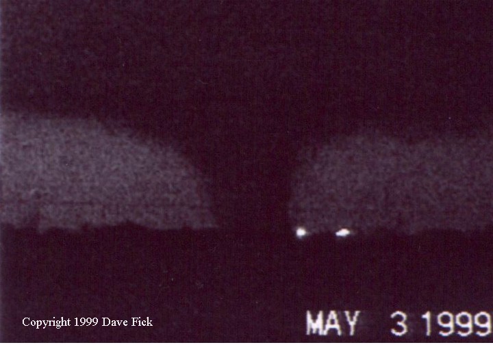
| SW OK / C OK | DAVE FICK AND I CHASED THE MAY 3RD SUPERCELL/TORNADO OUTBREAK. VIOLENT TORNADOES, LARGE HAIL, AND VERY STRONG WINDS WERE ALL OBSERVED ON THIS DAY. | |
| MAY 4, 1999 | E TX | DAVE FICK AND I OBSERVED MORE TORNADIC SUPERCELLS IN E TEXAS DURING ANOTHER SPC HIGH RISK. ONE OR POSSIBLY TWO MORE TORNADOES WERE OBSERVED NEAR PALESTINE, TX. A VERY INTENSE LP / CLASSIC SUPERCELL. |
| MAY 15, 1999 | UNK | NOTHING SIGNIFICANT WAS OBSERVED. |
| MAY 16, 1999 | UNK | NOTHING SIGNIFICANT WAS OBSERVED. |
| MAY 17, 1999 | UNK | NOTHING SIGNIFICANT WAS OBSERVED. |
| W TX | ONE OF MY FAVORITE CHASE DAYS! A FEW NON-TORNADIC SUPERCELLS ACROSS W TX. HP, CLASSIC, AND LP SUPERCELLS WERE OBSERVED AND PHOTOGRAPHED IN ALL ITS SPLENDOR! CHASE BUDDY JAMES CLARK WAS WITH ME ON THIS EXTRAORDINARY DAY! | |
| N TX | MORE INTENSE SUPERCELLS OBSERVED. LARGE HAIL WAS THE MAIN THREAT AS BASEBALL HAIL WAS FOUND ON THE GROUND AND SOME SPARSE BASEBALLS FALLING STILL AS I PASSED THROUGH THE POOR TOWN. ONCE I GOT IN POSITION FOR THE WALLCLOUD IT OCCLUDED AND QUICKLY GUSTED OUT TAKING THE GOLFBALL HAIL SHAFT WITH IT. NEEDLESS TO SAY I DENTED THE HECK OUT OF MY CAR. | |
| SW KS | I GOT ON THE FAMOUS MEADE, KS, TORNADIC SUPERCELL DURING ITS DEVELOPING STAGES. JAMES CLARK AND I MISSED THE BIG SITKA, KS, TORNADO. SOFTBALL HAIL WAS OBSERVED WHICH SMASHED THE FRONT WINDSHIELD. THIS ALSO PRODUCED THE FAMOUS 100+ CHASER CONVERGENCE. OVER ALL, A GORGEOUS CLASSIC TEXT-BOOK TORNADIC SUPERCELL, BUT WITHOUT THE TORNADOES OBSERVED BY US. | |
| N TX | SOME VERY PHOTOGENIC AND DANGEROUS SUPERCELLS WERE OBSERVED. SEVERAL LONG LIVED WALL CLOUDS, BRIEF FUNNELS, AND SOME MODERATE HAIL WAS OBSERVED. THIS PARTICULAR STORM PRODUCED ANTICYCLONIC ROTATION ON THE BACK SIDE, SCARING FOLKS TO TAKE SHELTER ON I-20. ALSO, WEATHERFORD WAS HIT WITH INTENSE FLOODING AND 3 INCH HAIL. | |
| JUNE 5, 1999 | UNK | NOTHING SIGNIFICANT WAS OBSERVED. |
| JUNE 6, 1999 | UNK | NOTHING SIGNIFICANT WAS OBSERVED. |
| JUNE 11, 1999 | UNK | NOTHING SIGNIFICANT WAS OBSERVED. |
| OCTOBER | UNK | NOTHING SIGNIFICANT WAS OBSERVED. |
|
W OK | A LINE QUICKLY FORMED BUT WE GOT IN PERFECT POSITION TO WATCH GUSTNADO AFTER GUSTNADO THAT FORMED ON TOP OF US. IT WAS A FUN CHASE DURING THE OFF-SEASON. |
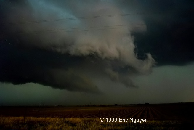
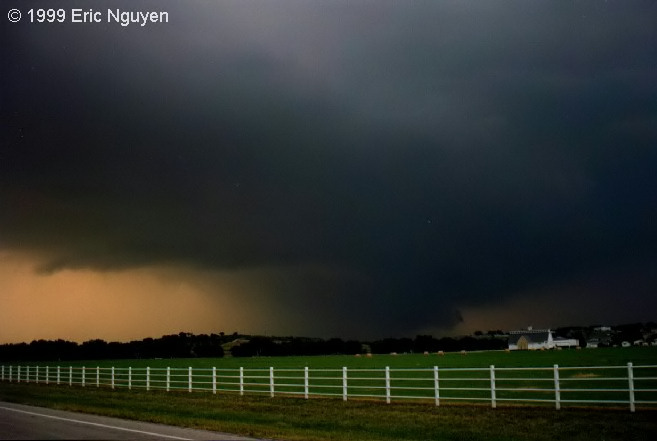
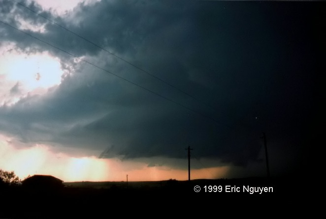
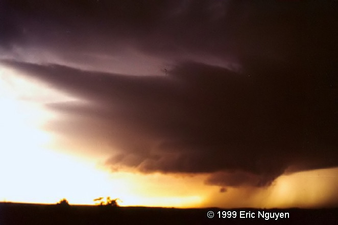
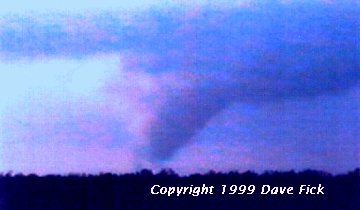
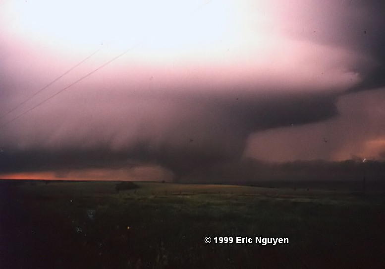
Area Chased: NE TX Discussion: First chase of the season and my chase partner (Dave Fick) and I witnessed a low topped tornadic supercell from about 2 miles away. We went to our target area (Paris, Texas) at about 3pm and went a bit south out of town to watch for signs of convection. We stopped about 5 miles SE of Paris to view some rock hard towers going up to our SW. Rock hard back building on the towers still gave us the impression of multicellular storms getting their act together. About a half hour went by, and the storms appeared to be loosing some intensity. We kept heading SE and went through some rain from a storm's anvil and looking due west we noticed a rapidly evolving wall cloud with scud hanging down. About a minute later a very large funnel came down and touched down about 5:55pm. Location was 5 miles west of Bogata, or 20 miles SE of Paris, Texas (Red River County). Looks rather large, but appeared weak from our view, which was 2 miles east of it. It roped out and we got a glimpse of the storm that caused it. It was a very low topped, sheared updraft storm. After the tornado occluded, the storm died. Other storms fired to our south that had some tornado warnings within the watch box, but most of the storms appeared outflow dominant. Later that day we celebrated with pizza! Pictures:
|
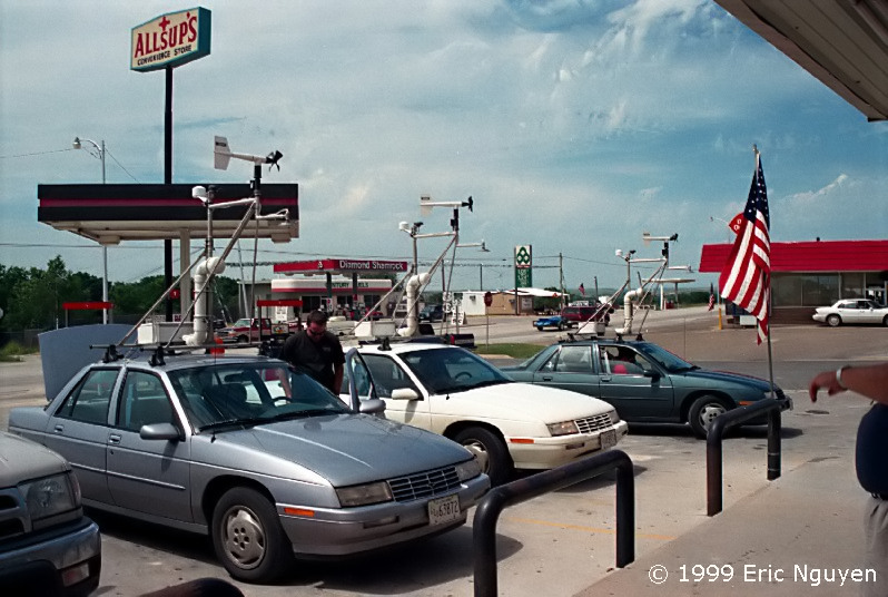
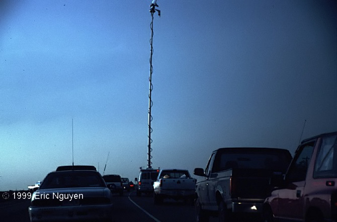
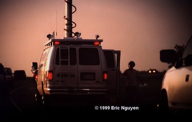
Area Chased: W / C OK Setup: Morning analysis and forecast models had decent shear and very strong CAPE but lacked winds at 500mb and 200mb. SPC mentioned the threat of linear and HP variety of storms. Later as some more data came in including profiler data, the setup looked much more interesting. Extreme instability of CAPE up to 5000 excellent speed and directional shear was now shaping up from NW Texas to Kansas. A short-wave and very strong surface dynamics including a dryline punch was now looking more evident on the surface as the hours progressed. The punch appeared as though it would affect Childress to Altus OK. When we arrived in Childress the dryline already was surging rapidly eastward and my buddy at home mentioned that the current Jayton, Vici and Purcell profilers already have a a near-perfect vertical profile for supercells and tornadoes. The cap was also strengthening which would help in isolation. Only a moderate risk was out and we knew a High Risk would be needed later that day. Later on, a High Risk was issued with some violent damaging tornadoes expected. Discussion: My chase partner (Dave Fick) and I left around 9am toward our target zone from Childress to Altus. We stopped for data at Wichita Falls and saw that SPC had upgraded to a moderate risk. They mentioned that the dryline was expected to move rapidly eastward during the day. We looked at some analysis and saw that SW OK to NW TX looked to be the best place to start. As we continued to Childress up 287, we noticed a large line of growing and dying turkey towers. We immediately got data at Childress and suddenly realized that we were on the dryline and saw the best area to be in SW OK. We jumped back on 287 and took highway 6 toward Altus. A group of high based towers had gone up as well. After a while they began to merge into one single updraft. The base began to lower as precipitation began to fall from the base. It appeared as though our cell was now becoming a supercell. We got just south of this cell and it began to drop golf ball to egg sized hail. We finally broke out of the hail and drove east on highway 62 toward Lawton. Our hopes were very high as this sucker began to exhibit that of a barber pole shaped LP supercell. News of a large tornado being produced got our attention so we got up on a hill and filmed a little of a large tornado of in the distance. Okay, now the bad part. We found our selves in the Ft Sill area due to missing our turn northward. We ended up getting blocked in Fort Sill for quite some time. News of a wedge tornado began to hit the airways. We jetted up 281 toward Anadarko, OK and intercepted a very large rotating mesocyclone. We took a farm road on a hill and setup our cameras just before the meso produced a very large multi vortex tornado. After it got shrouded in moisture, we went north and saw an occasional tornado touch down. We drove under the meso to flank it. Scared that any second one would form over head, we took a east road just before a new tornado formed which began to do power flashes. After that one roped out, a new and large tornado formed just after dark. This again was very large and appeared to be a very violent tornado. We continued to watch this storm as it produced many weak tornadoes, enough of them that we don't even know the total count. We gassed up and headed north to new tornado warnings near Crescent where TV reported a wedge (mile wide) tornado! We passed the DOW team on hwy 35 (near Orlando maybe, not sure where we were) to intercept it in hopes that we would get some video of power flashes illuminating the outer walls of it. Instead, we found ourselves just south of the direct path as the radio said the large tornado was just about to cross Hwy 35 heading toward Still Water. Winds shifted from the SE at about 30 to probably over 50mph from the SW then to NW. The semi in front of us probably didn't know what was going on. When we got back to the spot the truck had been blown over along with a few other semi-trucks taking refuge under an over pass. Tree's and signs were totaled all around the place. We headed down 35 and saw the gridlock from the Moore F-5 tornado. So we went all the way around the Chickasha Tornado's damage path to get back on Hwy 35 and head back to Fort Worth. I hope everyone else was safe on this very dangerous chase. While coming home we passed some other chasers in a new suburban with every single window except the front windshield, had been blasted out. It was pouring down rain from another tornadic supercell to our SW and these guys had to drive through it with *no* windows. People need to realize that many people outside of the very heavily talked about OKC tornado were badly hurt as well. Yes, 44 people are dead and 50+ still missing, but what about those that lived it? There are some of the most brutal injuries from events such as this. There are probably people missing limbs, stabbed eyes, broken bones that are still alive! Therefore my heart goes out to those that were victims of the May 3rd outbreak. To those family members that lost loved ones, those that lost their homes and pets, those that are still trying to recover in the surgery room, those that are picking up the pieces of their homes right now, and especially those that were frantically trying to saved the lives of their fellow Oklahomans / Kansas'ans while their own families were at risk. The NWS and SPC did a great job too. It is not satisfying at all to come home after a chase and find out many people were hurt or killed. Pictures:
|
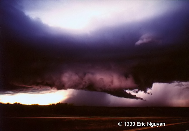
Area Chased: E TX Discussion: My chase partner (Dave Fick) and I left around 11am toward Denton, Texas. We were planning on going east of Denton and waiting for the cells to go east of Tarrant since we wanted to avoid the metro-mess. We drove to northern Dallas County and heard of a few tornado warnings, one to our north, and one to our south. We drove south a bit and decided to head east toward more growing towers. We did some HP storm chasing and decided to head south to a new cell that was totally isolated. So we went south and managed to get just south of this storm east of Palestine. The storm had a rotating barber pole look to it, definitely an LP to classic supercell. It reportedly produced a tornado before. We stayed put and noticed a rotating wall cloud with a funnel to our NW about a mile or two away. A new and very strong area of rotation formed and was rotating so fast that it had cyclonic winds on the ground picking up small debris. Now it appeared that there were two areas of rotation and we booked south to get out of danger. As we did, we got back out and looked north at about a mile or two. A very rapid wall cloud with two funnels now began to touch the ground. I suspect both funnels were one multivortex tornado. This tornado seemed to be fighting very strong inflow that was pushing it back to the north. After that one dissipated another area of rotation began. This one was a bit weaker and reportedly produced a tornado but it was too dark for us to see. I think there wasn't a strong enough RFD to produce any long lived tornadoes. Miles this day = 850. Additional Data:
|
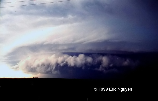
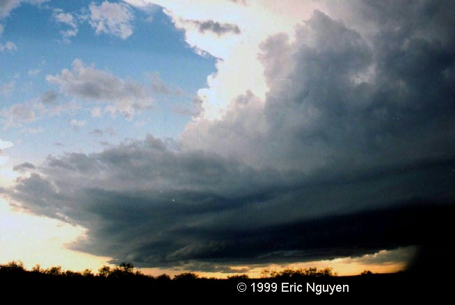
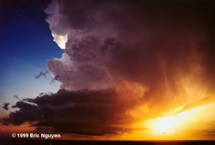
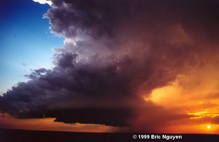
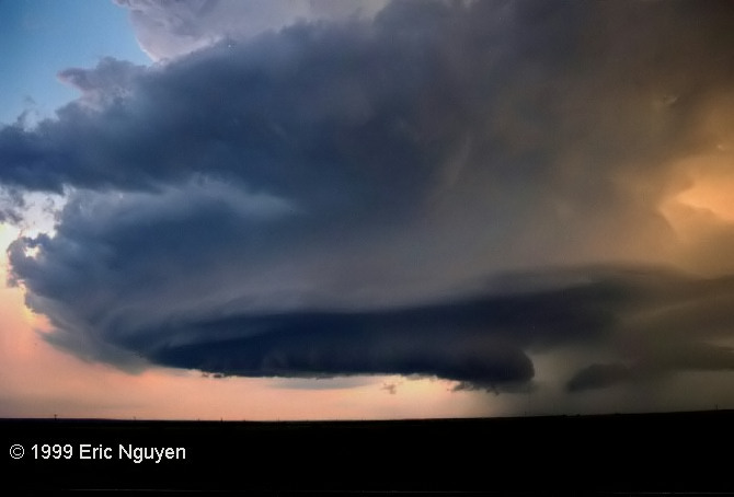
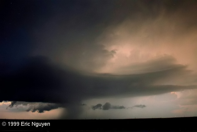
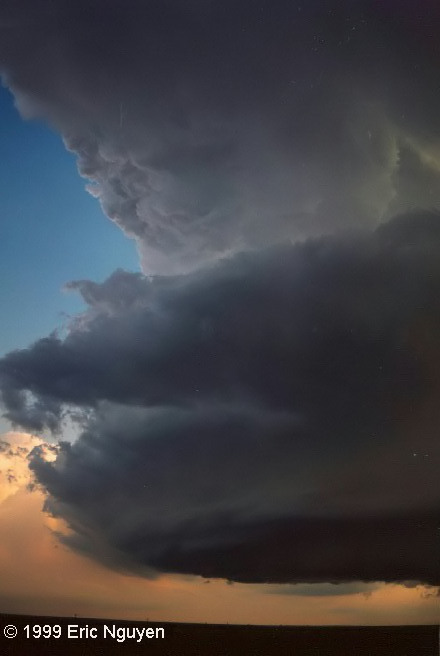
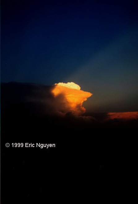
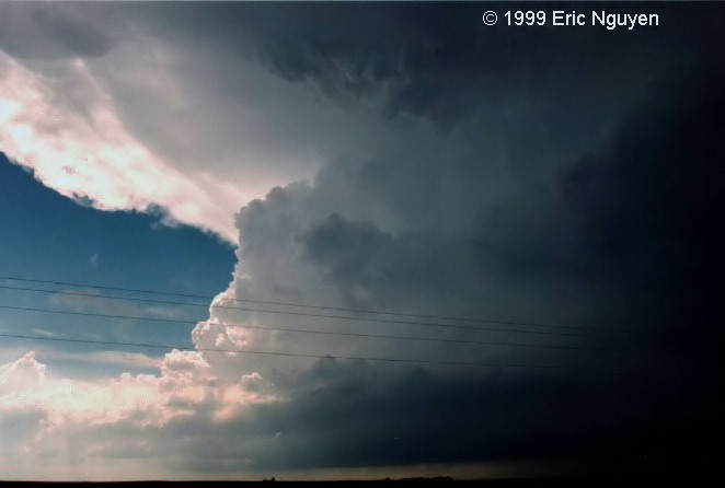
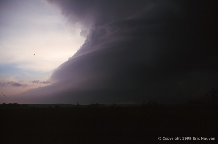
Area Chased: W TX Discussion: My chase buddy James Clark and I left Fort Worth, Texas early in the morning. We stopped at a "Flying J's" just east of Abilene to get some data. The best area looked to be from Lubbock to Amarillo and east of there. With our target area just north of LBB, we jetted northwest to Lubbock. A storm fired up very close to the station to the north so we went north. As we approached it, it already began to develop a wall cloud. Tornado warnings went out, and a severe warning to a cell SE of us. This storm quickly appeared outflow dominant so we stayed in the notch to watch for development. A tornado was reported on the ground briefly but we didn't see it despite having a very good view NE of the wall cloud. Large hail began to fall from this storm as well. We kept on it for a while and then decided to retreat to the east and get a picture of this beauty from a distance. Another supercell appeared to form on the south side of the old outflow dominant cell. This cell moved more southerly than the old one and had more of a classic appearance. It had a very nice wall cloud and a microburst on the back side, probably RFD. This storm kept our eye's glued to it for a while, however we decided to move to the next supercell to our SE. During the process, yet another supercell formed in between the HP and classic supercells. It was a rotating cumulus cloud, soon to be a gorgeous LP Supercell. This was a barber-pole LP with very little precip and a bell shaped wall cloud to top it off. I set up the tripod and snapped roll after roll of film as James video taped it with a super-wide angle lens. We then retreated south and east to get a better view. The view could not have been any more gorgeous as the sun began to set and highlighted the supercell in oranges, reds, and yellows. We were starving at this point so went to the Dairy Queen about 5 miles from the LP in the nearest town. We saw Carson Eads, Tim Marshal, and Pioneer Productions getting some food there as well. Before entering, Pioneer Productions told us about their hail encounter of baseballs. Apparently, they were chasing with Carson and Tim to get some video and they decided to hit the hail core for some hail video. Pioneer's new rented Explorer got a flat in the middle of the hail shaft, destroying the body and windows. As we were leaving, the LP began to move more south than before and then new tornado warnings were issued on it. So we stopped and did some lightning on a west Texas back road. In the process, while out in the middle of nowhere while the car was stopped, things got WILD. Not a sound was going on, only some very light distant thunder. Suddenly we began to hear yipping, barking, and squealing. "Hmm, must be some coyotes out here" I said to James. About a minute later, the intensity of their yipping and the numbers increased dramatically. After another minute passed, it was so loud that we could barely hear each other talk. James was inside the car, me out with my tripod, and I wondered if I was at any risk. That was it, I was pretty terrified as both sides of the road must have been covered with coyotes! It was extremely loud now and they could probably see us at this point on both sides of the road. No one else was around but us, so I threw my tripod in my car and jumped in. Right when I shut my door, the noises from the coyotes from BOTH sides of the road completely stopped! Not a sound was heard for the rest of the five minutes we stood in the car, wondering what happened to all the noise. We called it a night and headed back to DFW. Miles 900
|
Area Chased: N TX Discussion: I got in early that morning from chasing out near Lubbock on the 25th so I slept in. At 4pm I woke up to hear the tone alert of NOAA radio, which said a tornado watched had been issued for my area. I quickly got ready and drove west on I-20 toward Weatherford, Texas. I drove south on 171 then jumped on 51 south from Weatherford toward Grandbury, Texas. When I arrived to Grandbury, there were baseballs everywhere and cars off in fields and in ditches under trees. These folks went WAY out of their way to get away from this hail. I drove south a bit more and saw the wall cloud to my east that had sparked a tornado warning moments before. I finally got in good position to view it from the south when it occluded and gusted out. A buddy caught up with me, Mr. Cohen, and he caught up just in time for the hook of the storm to gust the hell out and attack us with 1+ inch hail. The hail broke the cups of my anemometer, dented the hell out of my vehicle, broke the windshield wiper parts, and broke my ham antenna. After this, I called it a night and went back home to Fort Worth, Texas. Pictures:
|
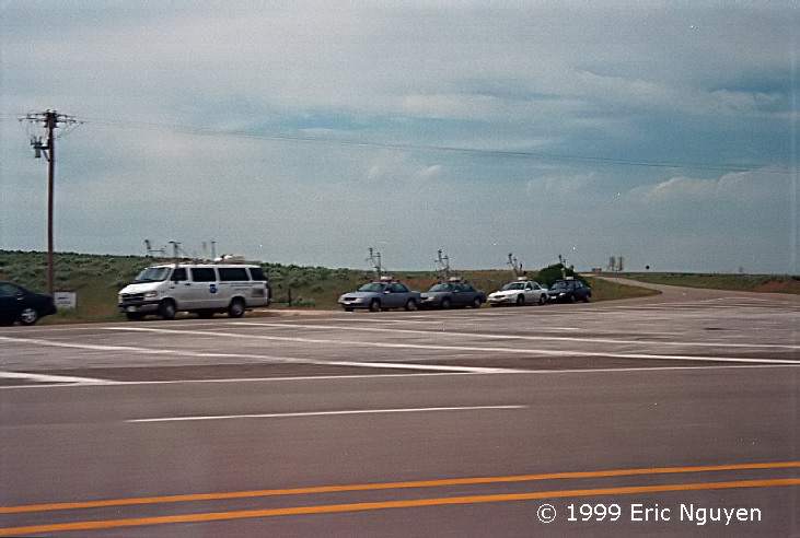
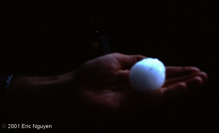
Area Chased: SW / S KS Discussion: Chase buddy James Clark and I left DFW around 10pm with some other chasers toward western Oklahoma the night before. We made it as far as Elk City, OK and stayed the night in a hotel. The next day we got up around 8am and got what ever data we could as both of us had left our laptop power adapters at home. We targeted Woodward to Canadian. We booked north and east toward the Texas panhandle and got a little more data at a truck stop. Proceeding west we stopped at Canadian, Texas at a gas station. VORTEX was there getting refreshments and I chatted with a college buddy of mine doing VORTEX that day, and he said the van had just launched a balloon a few minuets ago just north of us. He gave us the frequency they were on and we drove north and listened in on the results. Turns out the cap was very strong, a 2.2 C cap was in place with CAPE robbers embedded within the thermodynamic structure aloft. So we booked north as did VORTEX to SW KS. Immediately, we began to observe rock hard towers to our north along the KS border. Once we arrived under the base, we could see pure updraft to our west, very little precip to the north and a nice beaver tail to our north stretching east. Hail began to wrap around this gorgeous rounded updraft. We were at Meade, KS getting base ball hail which shattered my window, so I turned around. We were pretty much on the back side the whole time. Later on we got in a bit better position on a road we thought would be ideal. As we approached we noticed what looked like a circus of cars ahead. We quickly found a parking spot with the others and video taped to our west. North of us looked eerie and green so we went north a few miles and experience some intense outflow winds. It was pretty much over so we booked south, as many others did, toward Woodward. There, we stopped at a pizza place and were surprised to see over 30 chasers inside waiting for their pizzas. More were constantly coming in as the evening wore on. Miles driven = 900 Pictures:
|
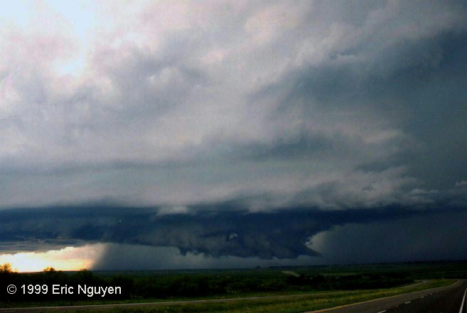
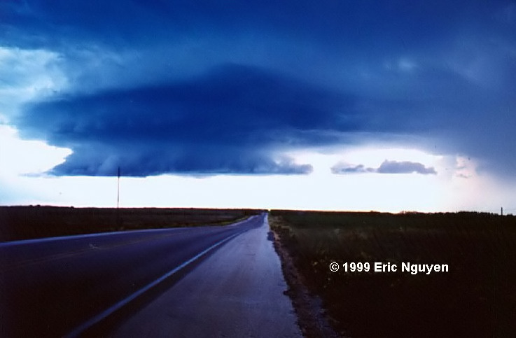
Area Chased: N TX Discussion: The previous day, I had chased up in Kansas. My chase buddy and I could not make it back to DFW so we stopped at the OK border and slept a few hours. We then got home at 10am and both of us went to bed. I woke up at 5pm to a tone alert. Tornado watch has been issued, MCD revealed good potential for tornadic supercells moving SE on a boundary. I went west of Hwy 20 toward Weatherford and noticed a supercell about 10 miles to my north with a wall cloud. It appeared a bit high based so I kept heading west toward tail end Charlie. I followed the northern inflow band to the southern most supercell. Multiple inflow bands from all directions went into this storm with a easterly beaver tail. I went south from Weatherford on 171/51 and encountered a gorgeous supercell. It was propagating SE with an awesome wall cloud, spiraling inflow bands, and a very long beaver tail to the east. Baseball hail, major flooding and anticyclonic rotation was all observed in Weatherford on Hwy 20. People on Hwy 20 under the anticyclone were taking cover under the over pass. The storm was due west of me and back lit by the sun. After a while, it took a lunge SE and formed another very intense wall cloud. After about 10 minutes the storm was now dried up on its west side and it appeared to be on a downward trend. Yet another cell to my south bared a new severe warning. I decided to head back home since it was getting dark. Pictures:
|
LAST UPDATE 7/1/05

 Here is the
SPC outlook for that day. It was the third outlook that upgraded to the high risk
category. This included both Wichita and Oklahoma City.
Here is the
SPC outlook for that day. It was the third outlook that upgraded to the high risk
category. This included both Wichita and Oklahoma City. This is the
SPC's outlook for May 4, 1999 at around 9am. There was talk by the NWS in Fort
Worth that if the dryline didn't advance as fast as forecasted that the DFW area would
need to be upgraded to a High Risk. Results were too many storms that became outflow
dominant very quickly.
This is the
SPC's outlook for May 4, 1999 at around 9am. There was talk by the NWS in Fort
Worth that if the dryline didn't advance as fast as forecasted that the DFW area would
need to be upgraded to a High Risk. Results were too many storms that became outflow
dominant very quickly.