- 2007 April 21
- © Copyright 2007 Eric Nguyen
-
- Chase Area: West Texas
- Amos Magliocco and I targeted Plainview,
Texas, for the development of tornadic supercells later that day. We arrived early
to our target and spent several hours at a hotel WiFi spot in Plainview, waiting for
convection to fire. The question that day was moisture, which seemed to creep
northward out of eastern Mexico. By the time storms developed, we had finally
reached dewpoints near 60F. Something we didn't expect, was a weak northwest to
southeast temperature gradient near Plainview. Also, surface winds backed and
increased into the 25-30mph range as strong surface pressure falls began to occur in
southeast New Mexico. Every time we did a data check, the area we were in appeared
to be the most favorable for long-lived supercells.

-
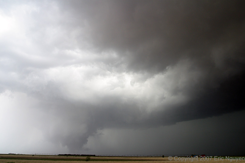
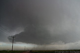
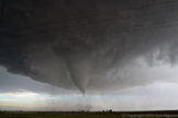
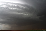
- Tornado #1 - Olton, Texas
- Amos and I left Plainview, Texas, when
storms developed in our target area to our immediate southwest. The air was quite
dry with dewpoints in the upper 40's, so we waited for the storm to reach the deeper
moisture closer to Hwy 385. We drove east on Hwy 70 through Olton, Texas, and went
south on Hwy 385. It appeared to be high based as we expected, so we decided to
drive back north and east on Hwy 70 to flank it, rather then east and north. This
ended up being the best move we made all day. As the storm came into view, we began
to see funnels under the updraft. Structure and inflow was rapidly improving with
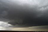
time. The tornado touched down at approximately 2355 UTC 6-8 miles SW of Olton,
Texas. As the tornado approached, we moved east more to get out of the rain and
hail. We stopped just east of Olton, Texas, and watched the tornado pass to our
south and cross Hwy 70 hitting three homes.


-
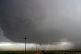
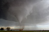
- Tornado #1 Continues - Hart, Texas
- The structure was amazing to watch, as the
rotation observed in the midlevels of this storms was very strong. This is probably
some of the fastest motion I've ever seen on a storm. The tornado continued
north-northeast and became a large cone tornado. The tornado roped out at 0035 UTC.
A second tornado developed from a new wallcloud east of the Olton tornado, however
this tornado was short-lived.


-
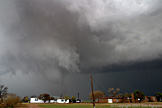
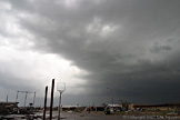
- Supercell Continues - Southwest of Tulia, Texas
- The storm didn't seem as organized as
previously observed, however it did develop a wallcloud or two. We also saw some
anticyclonic swirls to our north as we slowly crawled northward.

-
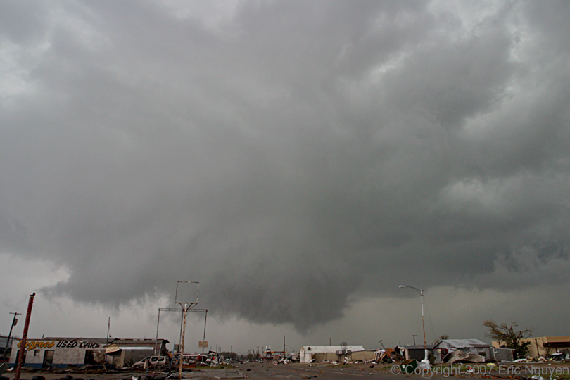
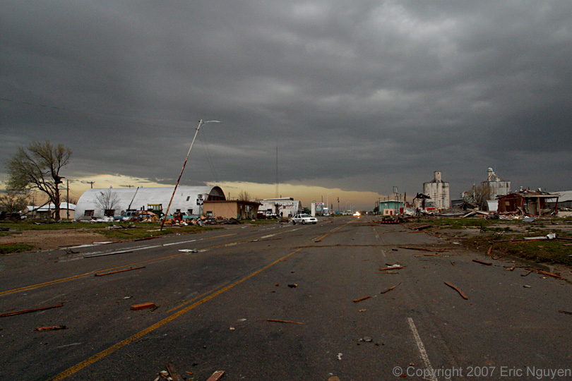
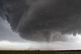
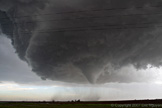
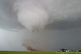
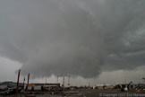
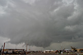
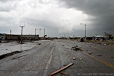
- Tornado #3 - Tulia, Texas
- We observed a third tornado that went
through the western side of Tulia, Texas, destroying many industrial buildings and a few
homes. A Ford dealership was also hit, blowing out the windows in all of the cars as
well as the building itself. It's tough to see, but multiple vorticies were observed
under the wallcloud as well as a debris cloud lofting debris into the air. A
satellite tornado was observed to our northeast on the outer edge of the mesocyclone.
The destruction in Tulia was quite scary. On our way north to Amarillo,
Texas, we observed a 5th tornado east of Hwy 27.


-
- © Copyright 2007 Eric Nguyen
-
- or