- 2007 April 03
- © Copyright 2007 Eric Nguyen
-
- Chase Area: North Texas
- Weak vertical shear and very strong CAPE was
present along a slowly southward moving cold front. When convection fired, the front
was on top of DFW, which strong convection developing near Grandbury, downtown Fort Worth,
and Irving. I liked the area south of DFW where winds were backed some as a kink
showed up in the front. The surface was roughly 84/72 for most of the day with winds
backed southeast at times. Storm motions were southward, so I positioned myself
south of downtown Fort Worth with a great view of the new updrafts developing over
downtown. Amos Magliocco and Rob Hall converged on that point as well, just around
the time the first severe thunderstorm warning was issued.

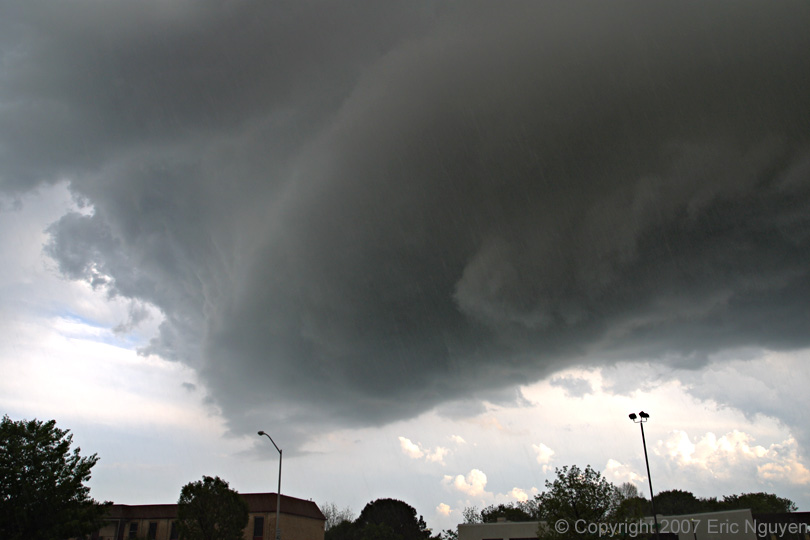
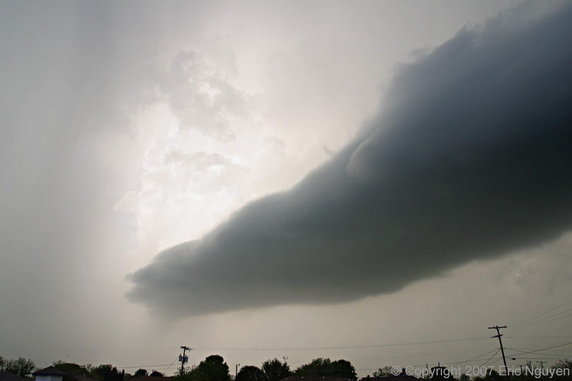
- Supercell Moving South
- Just south of downtown Fort Worth, our storm
began to show organized weak rotation with occasional needle funnel spin-ups. Small
hail up to nickel sized was observed near McCart and I-20.

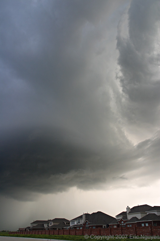
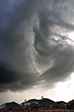
- Structure Time
- West of Edgecliff Village, our storm began
to shrink and had decent structure for several minutes, as a new updraft developed back
towards the west near Benbrook.


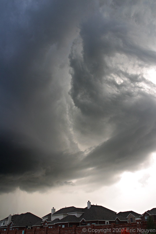
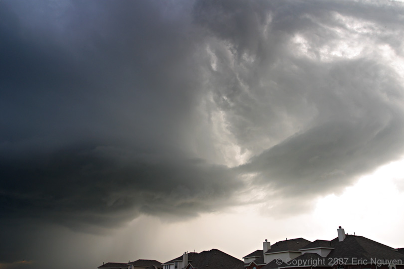
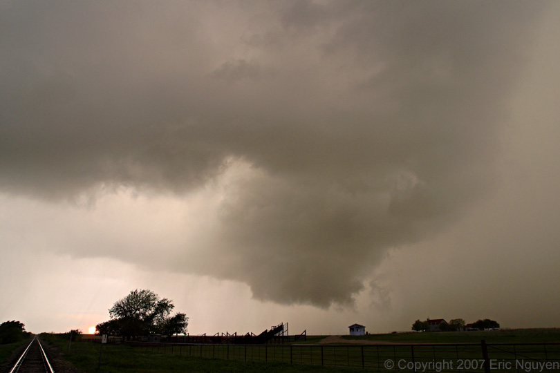
- Supercell at Sunset
- We drove south and observed a rotating
wallcloud south of Lake Benbrook. This updraft was engulfed in rain and small hail,
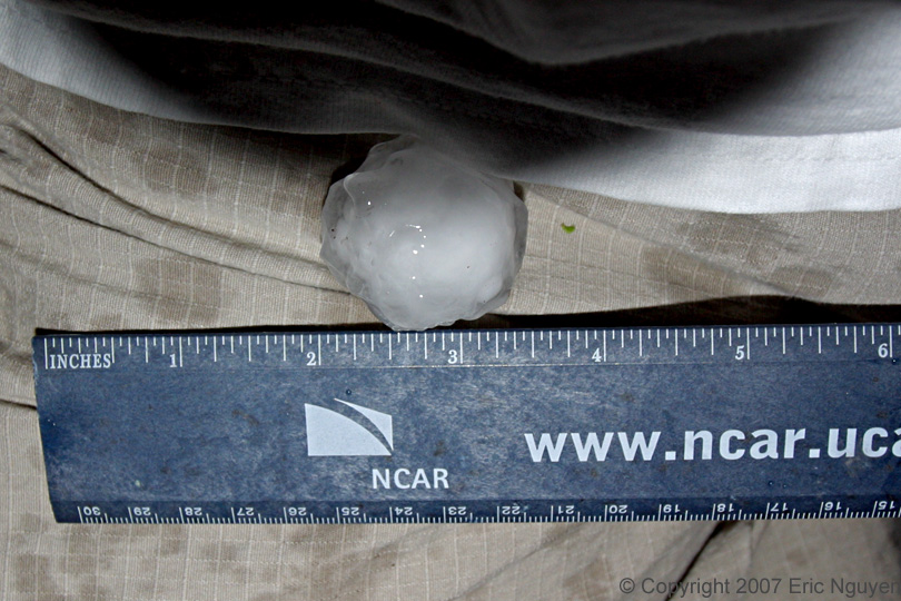
so we drove southwest towards Grandbury. Rob and I encountered 1.5 inch hail north
of Grandbury, Texas. We stopped to get food in Grandbury at dark, and heard about
the Arlington, Texas, tornado.


- © Copyright 2007 Eric Nguyen
-
- or