- 2007 February 24
- © Copyright 2007 Eric Nguyen
-
- Chase Area: Central Kansas
- Scott Blair, Scott Currens, and myself
targeted southeast of Salina, Kansas, for the possibility of low-topped tornadic
supercells. At 1200 UTC the 500mb low was located in extreme northeast New Mexico
moving eastward. 1200 UTC DDC sounding showed impressive lapse rates which were dry
adiabatic from just above the surface to 500mb, with 500mb DDC temperature of -25C.
The surface low was located southwest of Hays, Kansas, and was forecasted to move slowly
eastward during the day. With time the pocket of midlevel cold air (~ -22C) was
overspreading the warm sector, which typically yields extreme mid and low level lapse
rates, which is needed for intense convection. Instead, mobile surface
observations averaged ~55F/52F in the vicinity of these storms. The morning
watervapor showed a modest dryslot working its way into southern Kansas with a line of
storms exiting central Kansas. This appeared to be a classic "cold core"
scenario unfolding. The only problem was the midlevel dryslot wasn't strong and/or
large enough to clear out the narrowing warm sector. Visible satellite during the
day showed a line of cumulus developing on the dryline from Wichita to Salina, Kansas.
Only a thin area east of the cumulous line cleared out and I don't think it was
enough for strong low-level lapse rates.

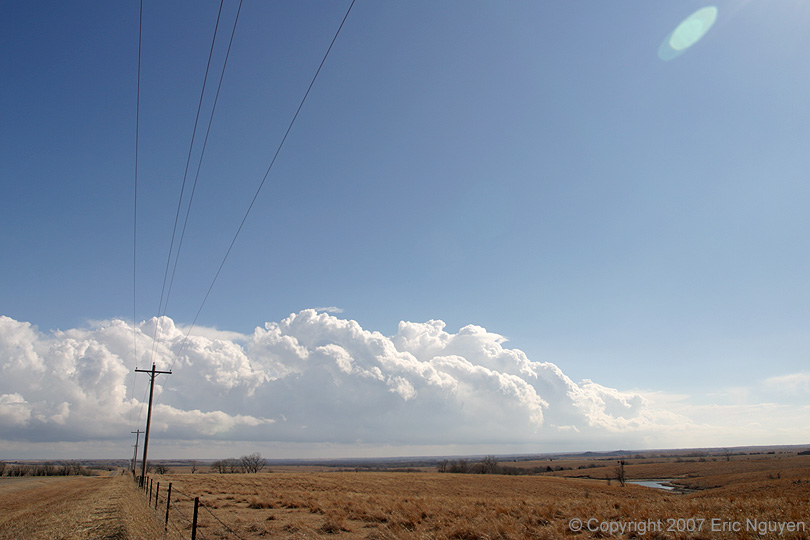
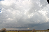
- The Dryline Arc
- As we drove south out of Salina, Kansas, and
then east out of Lindsborg, we stopped to photograph the deeper moisture and arc of clouds
that developed on the dryline to our north and west. First image is looking
northwest as the dryline arcs back to the surface low just south of Russell, Kansas.
We could see intense convection occurring southwest of Russell and Scott Currens and I
figured if it wasn't tornadoing, it would shortly, giving the cold core setup.
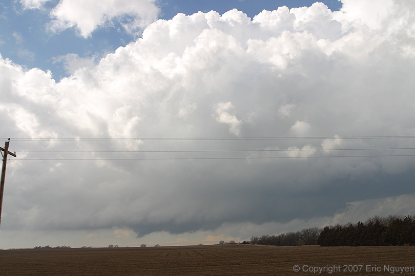
Second image shows convection developing to our east with pretty decent clearing
occurring. With time though, they moved off the dryline and into a more cooler and
cloudy environment.
- Supercell North of Marion, Kansas
- We finally got a decent low-topped supercell
with a rotating base. A wallcloud and funnel rapidly developed, with the funnel
lasting just under seven minutes. With time, however, the base became more elongated
and the updraft weakened. I was so sure that it would produce a tornado, I never
took any stills while I got close to it with a cone shaped funnel. Storms throughout
the day had similar results, we would observe a nice low-topped rotating supercell with
funnels embedded in a wallcloud, and the storm would quickly fall apart. View of
these images is looking west as the storm was moving slowly northwestward. When we
reached I-70, we got a visible satellite loop and saw a tiny cloud free warm sector north
of Salina, Kansas. We drove west back towards the surface low and observed other
rotating storms with one having a large funnel, but these all quickly dissipated as they
moved west. Images looking west at the Marion, Kansas, supercell.

- Muddy Mess
- As I was driving through the small town of
Ramona, Kansas, I took a wrong turn onto a road that was instantly black muddy clay.
The SUV in front of me and myself had four-wheel-drive, else we wouldn't have made
it. Even with four-wheel-drive, we barely made it through that road, since we were
going up hill, and the strong south winds were pushing our vehicles into the ditch, which
was filled with muddy water. I would never intentional take a road like that, even
with 4x4. The vehicle a mile behind me didn't make it. While driving north on
Hwy 77, I stopped to view a storm to my south, and saw this poor vehicle stranded about
15-20 meters down the road from the main paved highway. There was no way anyone but
a tractor was going to get them out. Most of the rural roads had plenty of gravel,
but some isolated black clay roads were observed.

- © Copyright 2007 Eric Nguyen
-
- or