Area Chased: W TX
Discussion: Amos Magliocco, Scott Blair, Jason Poliette, and myself left our hotel in AMA and went SE on 287. There was on going convection to our N and NE that sustained a gust front just north of 287. The threat for supercells on this boundary appeared extremely marginal giving how strong the cold pool was and the undercutting nature that would ensue.
We dove south towards some convective towers near Turkey, and then Metador, TX. Neither seemed to organize very well. New storms formed on the tail end south of Spur, TX. We dove south and encountered a violent supercell northwest of Jayton, TX. We observed many tornadoes including an orange dusty wedge. When the storm began to get seeded by the southern storm, Amos and myself drove east of the storm getting some awesome structure shots. We dove south towards the southern storm, but found it to be too outflow dominant to be tornadic. We chased it until sunset and found a nice hidden dinner place in Jayton, TX. Amos, Scott, Jason, and myself met up with Bob Fritchie and Rachael Sigler for dinner.
Pictures:
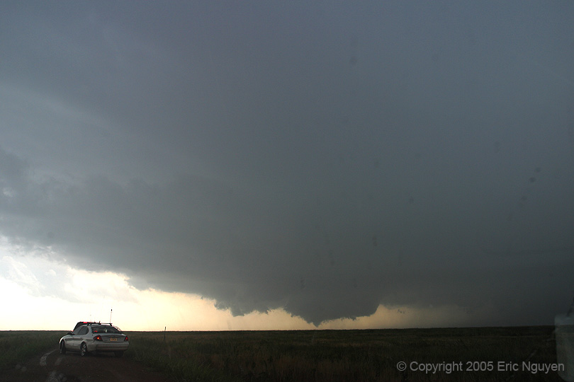
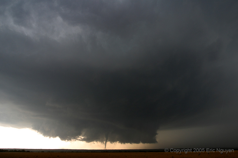
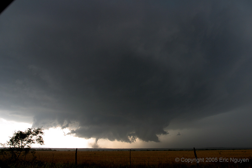
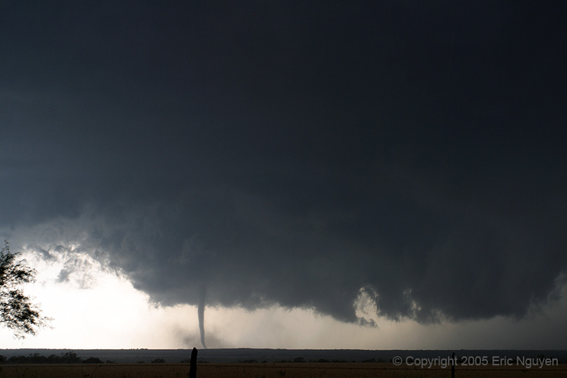
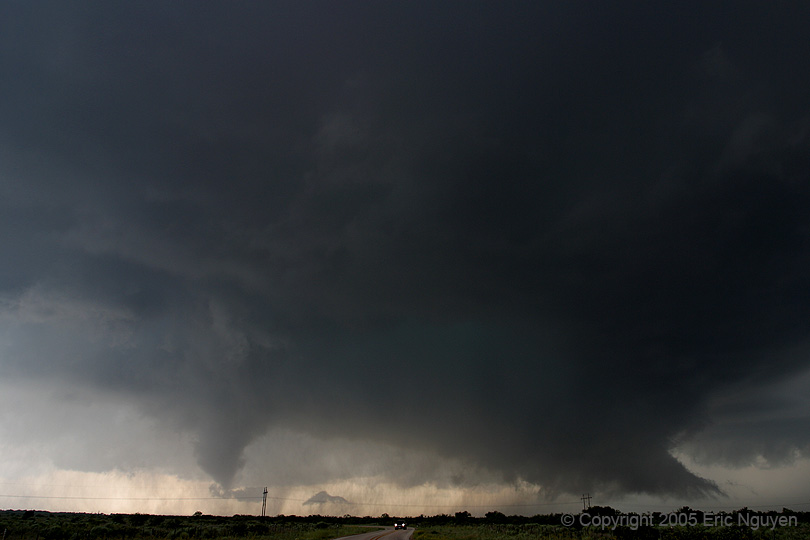
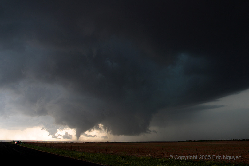
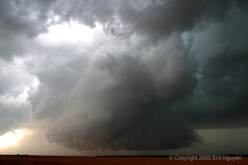
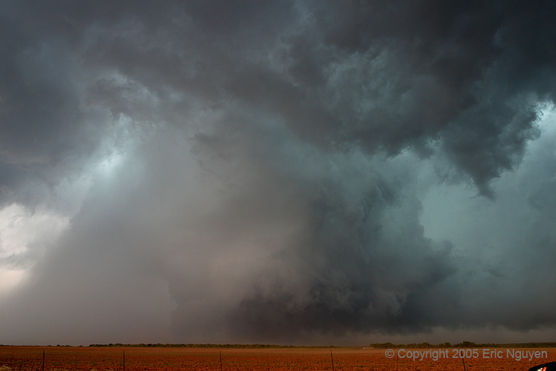
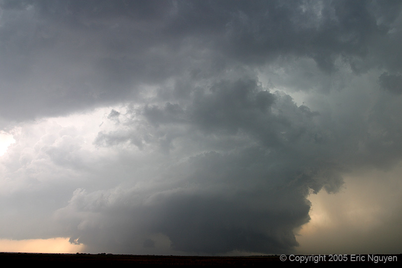
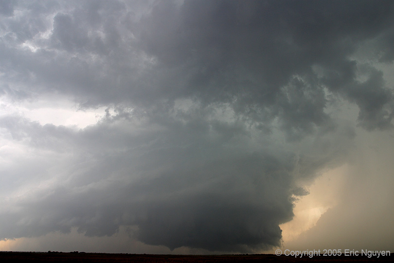
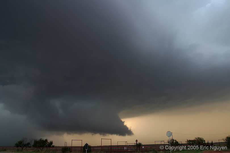
 We
dove south towards this storm and immediately realized this was going to be a very
significant storm.
We
dove south towards this storm and immediately realized this was going to be a very
significant storm.


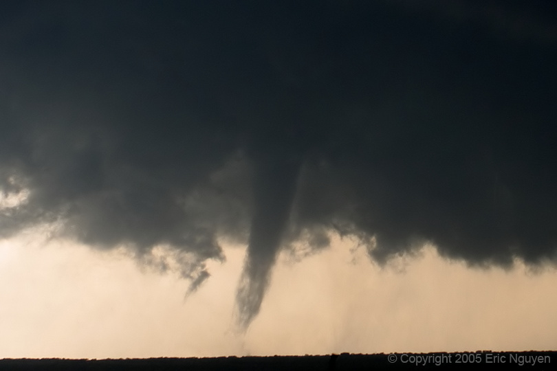
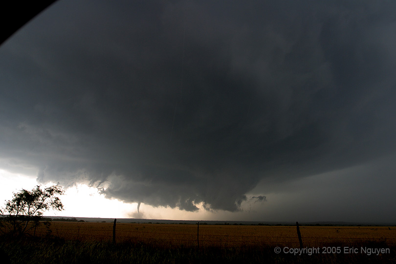
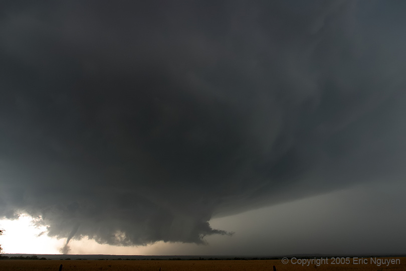
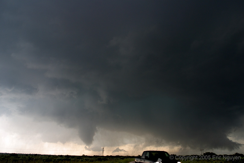
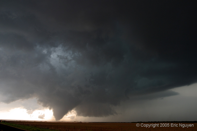
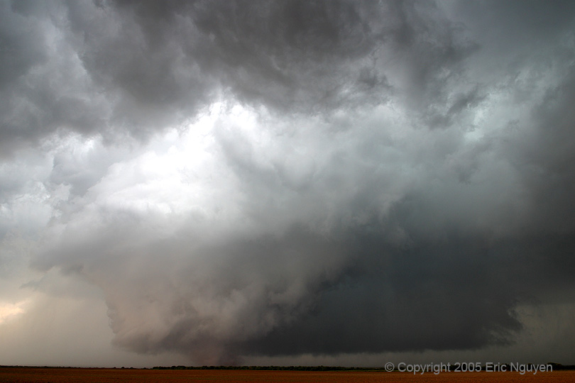
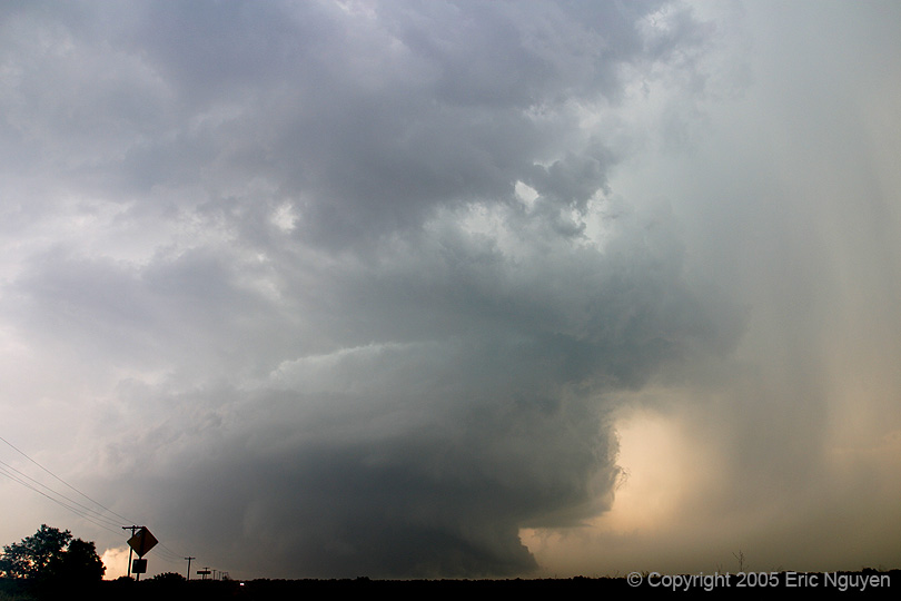
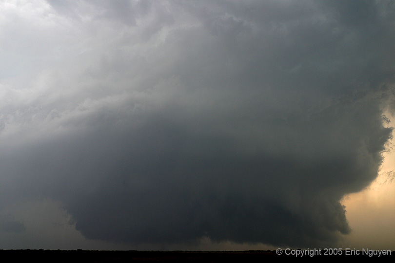
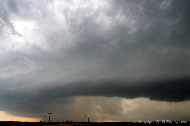
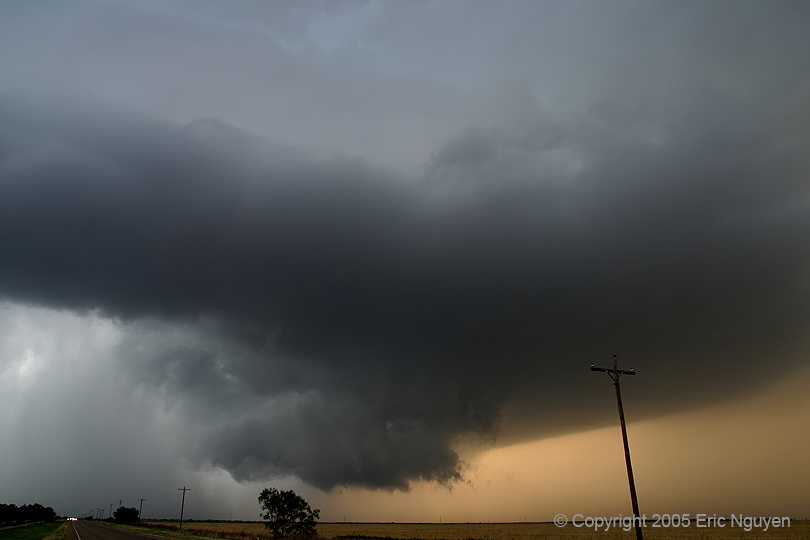
 The view was
incredible, and luckily my placement allowed me to shoot structure.
The view was
incredible, and luckily my placement allowed me to shoot structure.
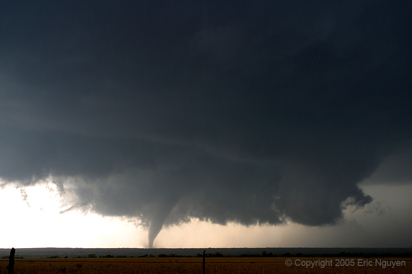
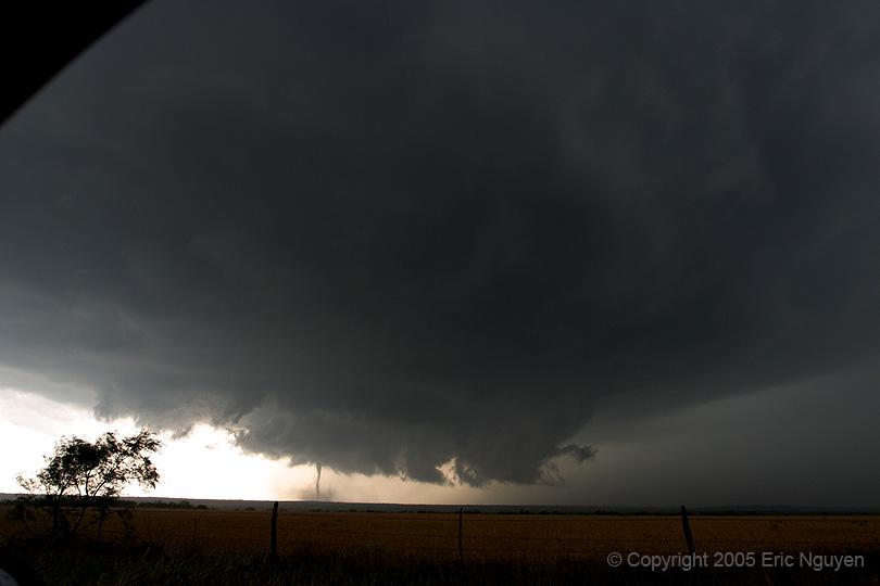
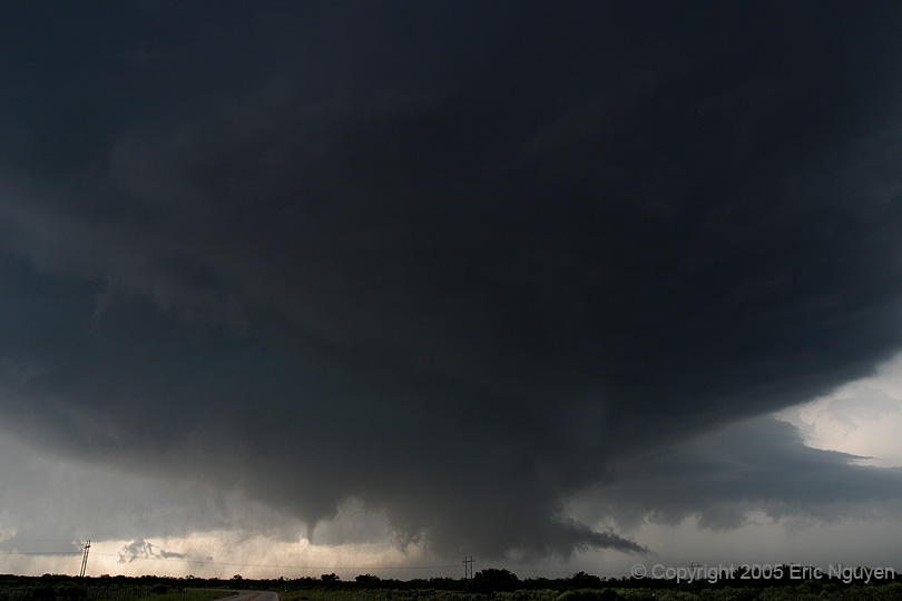
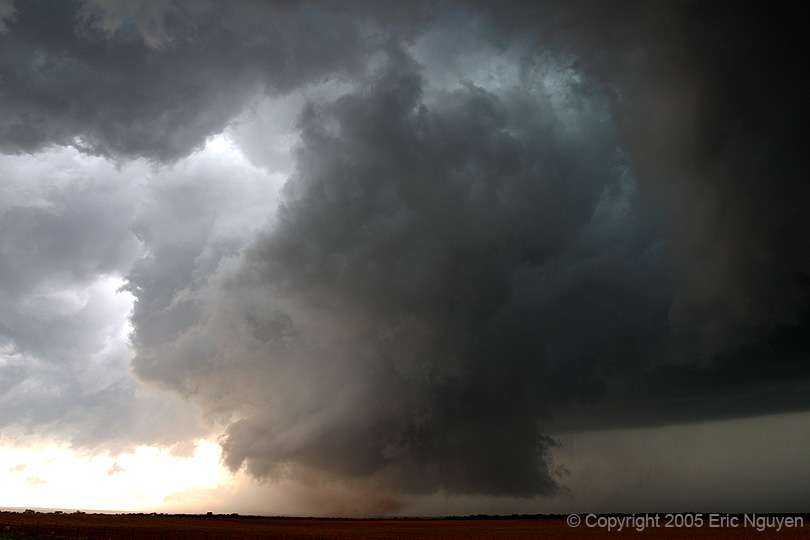
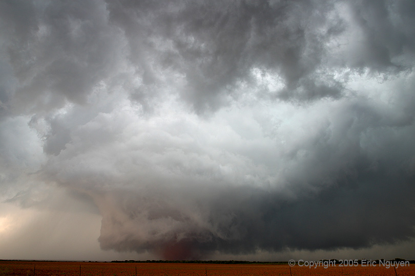
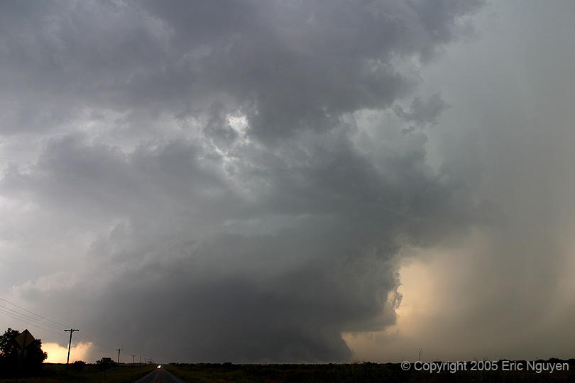
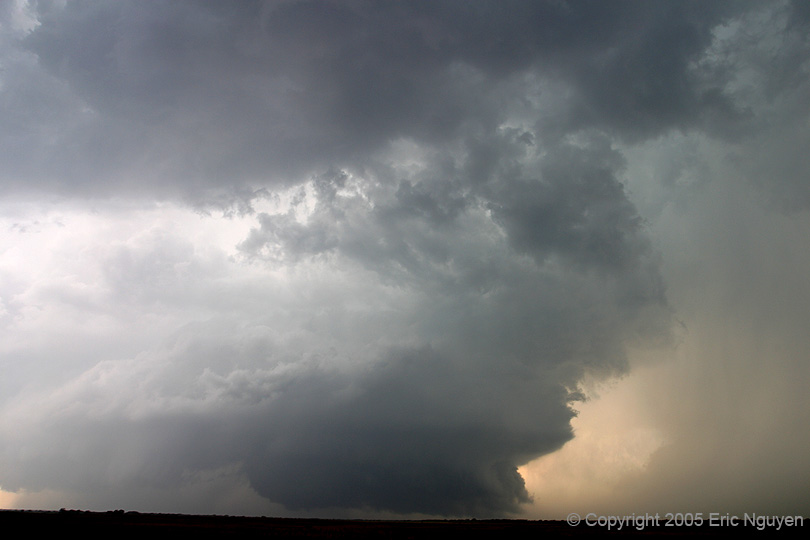
 More
tornadic structure shots.
More
tornadic structure shots.
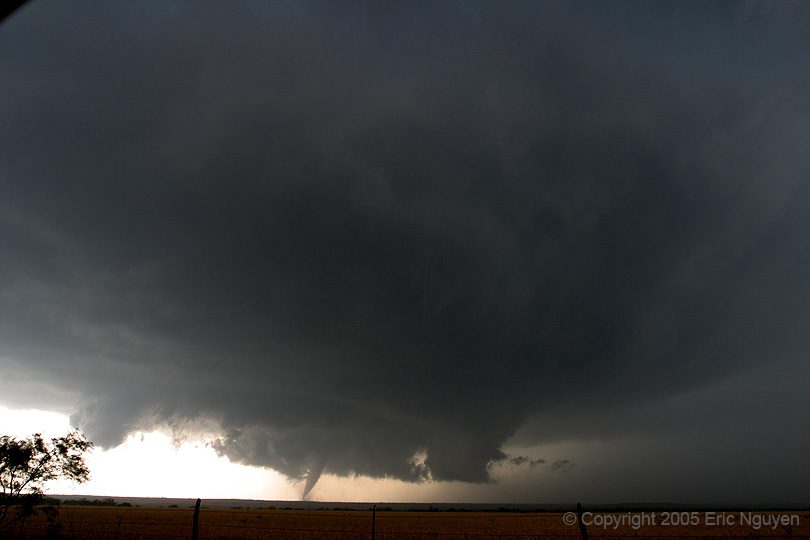
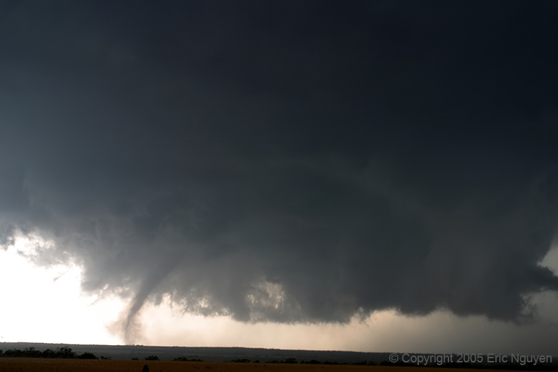
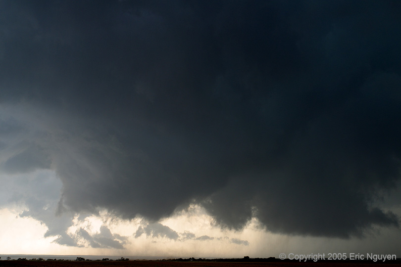
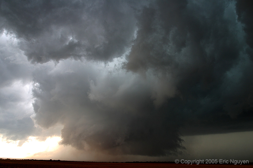
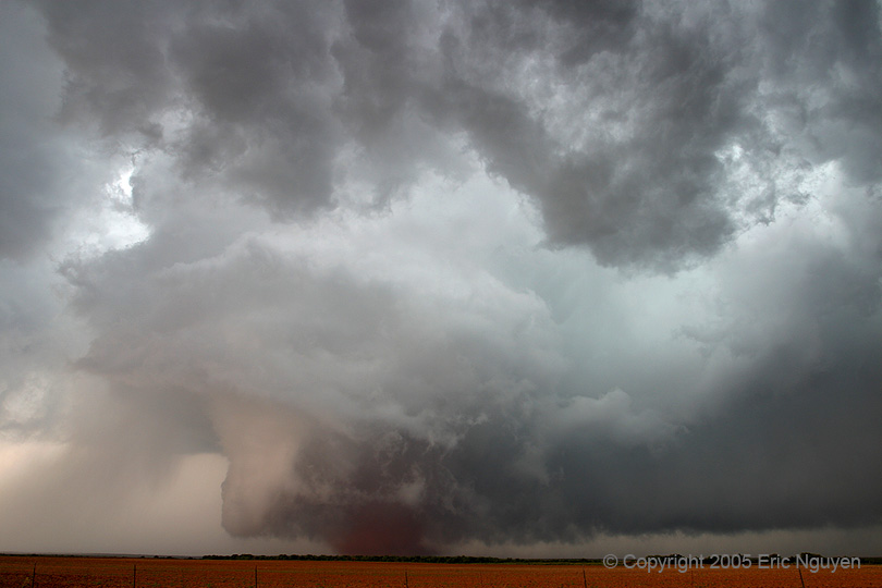
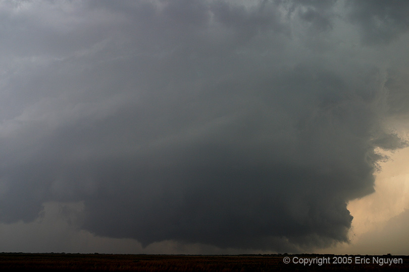
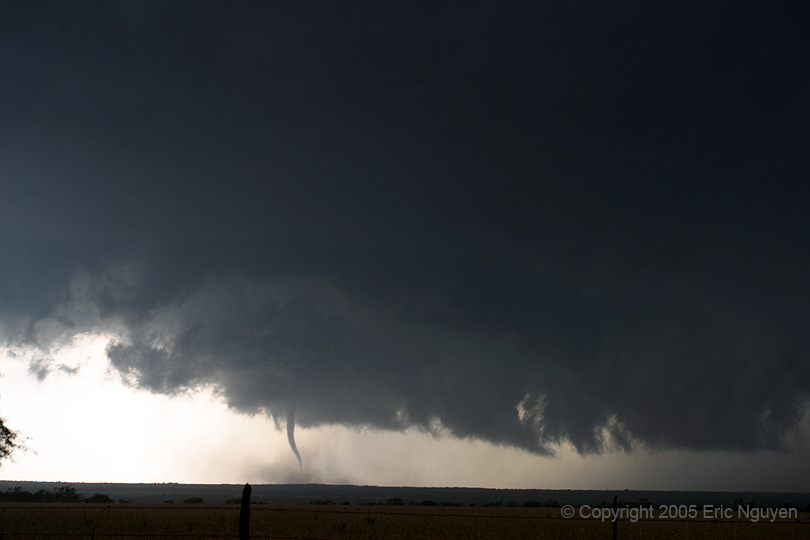 Continued
shots of the first tornado we observed.
Continued
shots of the first tornado we observed.
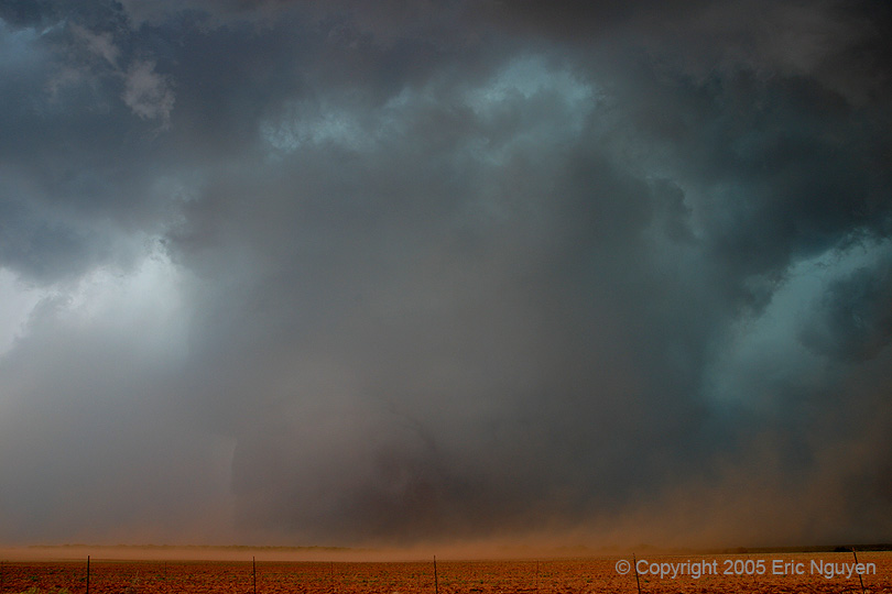
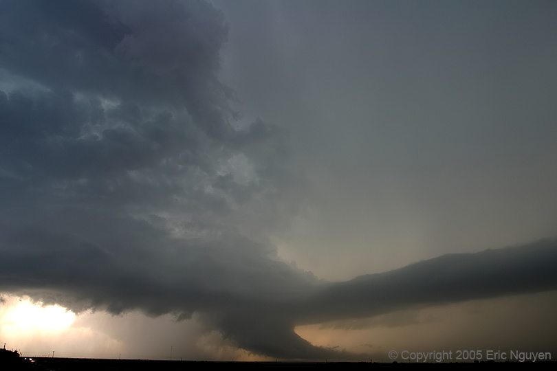
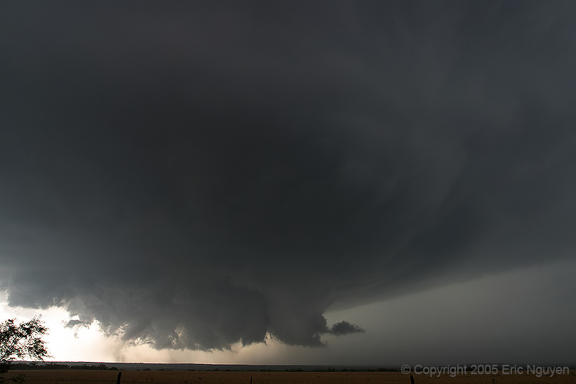 The tornado
began to dissipate and the far right hand image shows what's left of the tornado with weak
debris cloud.
The tornado
began to dissipate and the far right hand image shows what's left of the tornado with weak
debris cloud.
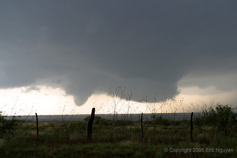
 We dove south to flank it and were treated to another brief tornado SE of the first
tornado.
We dove south to flank it and were treated to another brief tornado SE of the first
tornado.
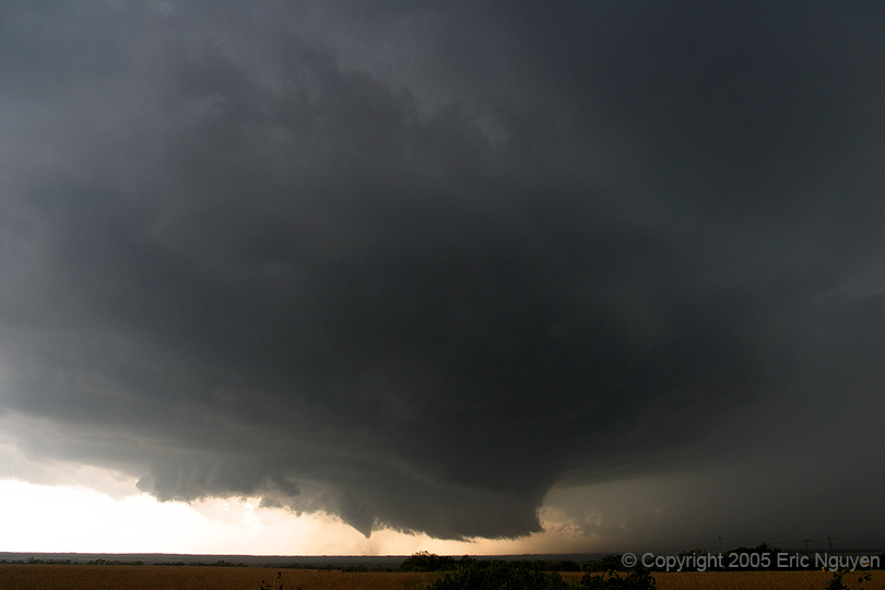
 A bowl shaped funnel with multiple vortices developed, view is
looking WNW.
A bowl shaped funnel with multiple vortices developed, view is
looking WNW.


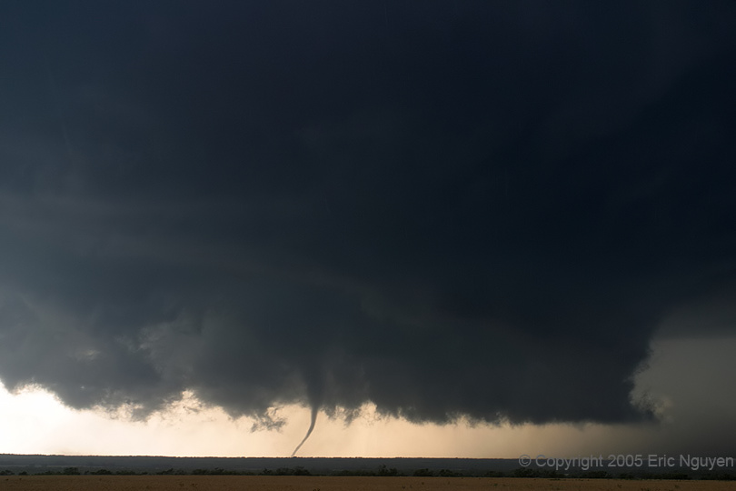
 This bowl
shape morphed into a large cone tornado as it came out of a valley.
This bowl
shape morphed into a large cone tornado as it came out of a valley.


 Shot of Amos
taking a still as it began to show signs of occlusion and intensification.
Shot of Amos
taking a still as it began to show signs of occlusion and intensification.

 The tornado
morphed into a dusty wedge tornado.
The tornado
morphed into a dusty wedge tornado.

 Very tight mesocyclone and associated large tornado.
 We finally got cut off by the RFD and got some strong winds at our location.
 Amos and I
drove east and got a view of the whole storm. It then began to produce yet another
tornado! It's hard to see in the first few shots.
Amos and I
drove east and got a view of the whole storm. It then began to produce yet another
tornado! It's hard to see in the first few shots.
 Some more
images of structure and the tornado. It looks like an easy shot, but it was actually
quite hard. It was raining steadily and lightning was too close for comfort.
So I could run up the hill since my car was in a valley, take a few pictures, and if it
looked like the tornado dissipated I would run back down the hill to take shelter in the
car. Then Amos would say it looks like it might be touching down again, so I would
run up back up the hill and risk the lightning. :-)
Some more
images of structure and the tornado. It looks like an easy shot, but it was actually
quite hard. It was raining steadily and lightning was too close for comfort.
So I could run up the hill since my car was in a valley, take a few pictures, and if it
looked like the tornado dissipated I would run back down the hill to take shelter in the
car. Then Amos would say it looks like it might be touching down again, so I would
run up back up the hill and risk the lightning. :-)
 The storm began to weaken rapidly, but not without some
incredible structure. Nice smooth beaver tail extended from the storm well to our
NE.
The storm began to weaken rapidly, but not without some
incredible structure. Nice smooth beaver tail extended from the storm well to our
NE.
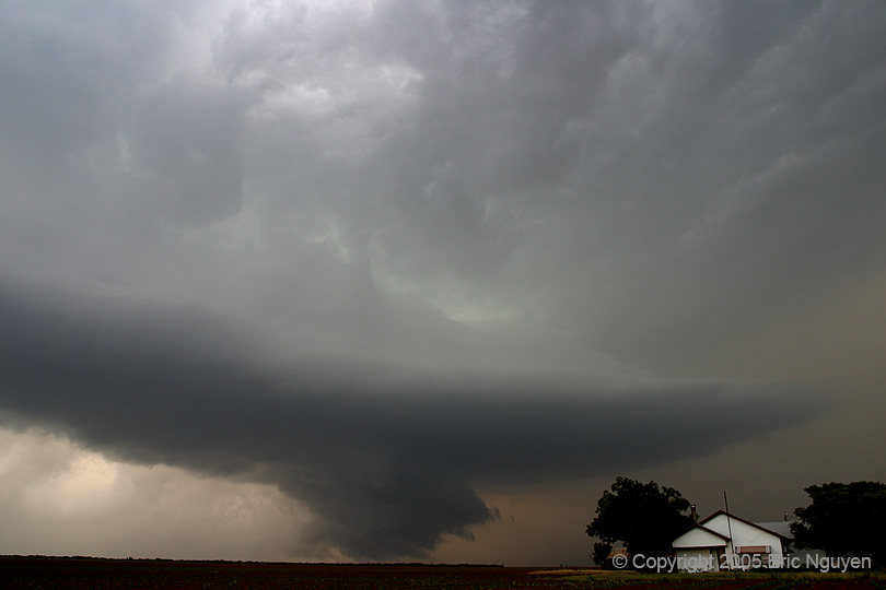
 The second
supercell was briefly tornadic and then became HP. The structure on it was nice, and
it occasionally had wallclouds before getting undercut.
The second
supercell was briefly tornadic and then became HP. The structure on it was nice, and
it occasionally had wallclouds before getting undercut.
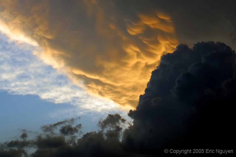 We were treated to a gorgeous mammatus display just before we ate
dinner at a small diner in Jayton, TX.
We were treated to a gorgeous mammatus display just before we ate
dinner at a small diner in Jayton, TX.