Area Chased: N KS
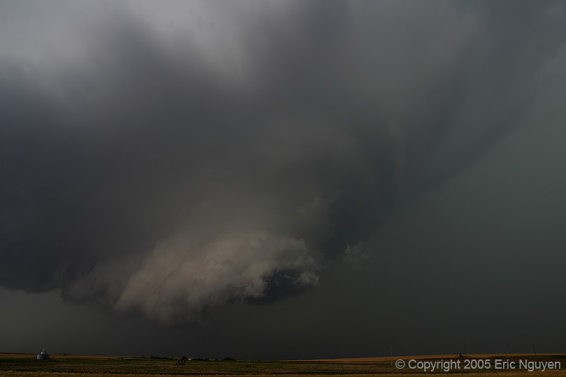
Discussion: Scott Blair and I targeted Colby, KS. Shear and instability appeared very favorable for supercells ahead of the sfc low & dry punch. An outflow boundary developed late in the period from convection in NE KS and moved SW just past Hill City, KS. Hill City throughout the day had east winds with a 10F temp drop behind the boundary. Just west of this boundary was a N-S dryline. By 2pm storms were developing along the outflow boundary and dryline close to the NE/KS border. Our storm fired due SW of Hill City and moved NE until it hit this boundary. It stopped on the boundary and barely moved eastward and at times moved ESE.
We observed ~8 tornadoes including a wedge just south of Hill City, KS, that moved north into town damaging 4 homes. For locations of these tornadoes, I'll have to go back and look at the GPS log. Storm reports show all of the tornado locations I think, as I don't have time for many details.
We got on 2 supercells this day. The first one that started W of Hill City, KS, which eventually became HP so we dove south to the storm near I-70 near Ellis, KS. We got on it before it produced the second tornado of many. It wasn't uncommon today to see satellite tornadoes that weren't counted, and two tornadoes on the ground at once.
Pictures:

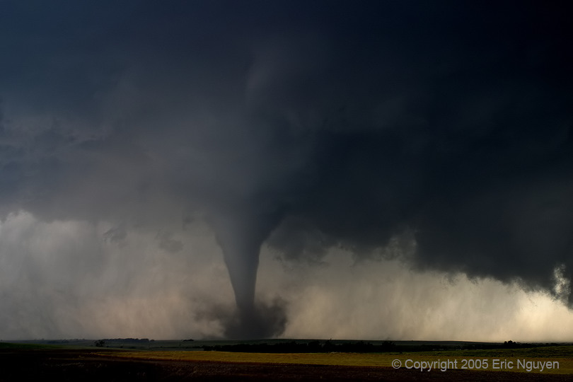

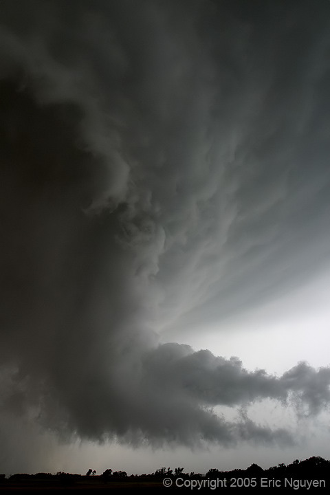
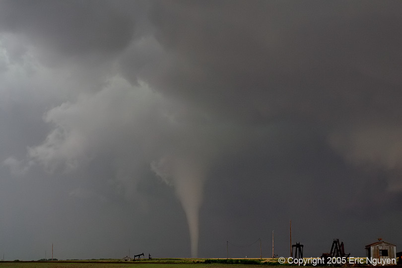
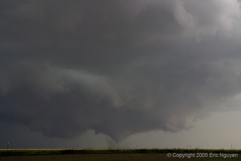
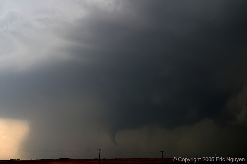
 Tornado
rapidly developed and several minutes later was a stove pipe tornado picking up dirt.
The inflow tail was vigorously ingesting inflow from the north.
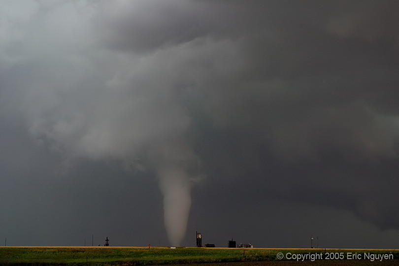
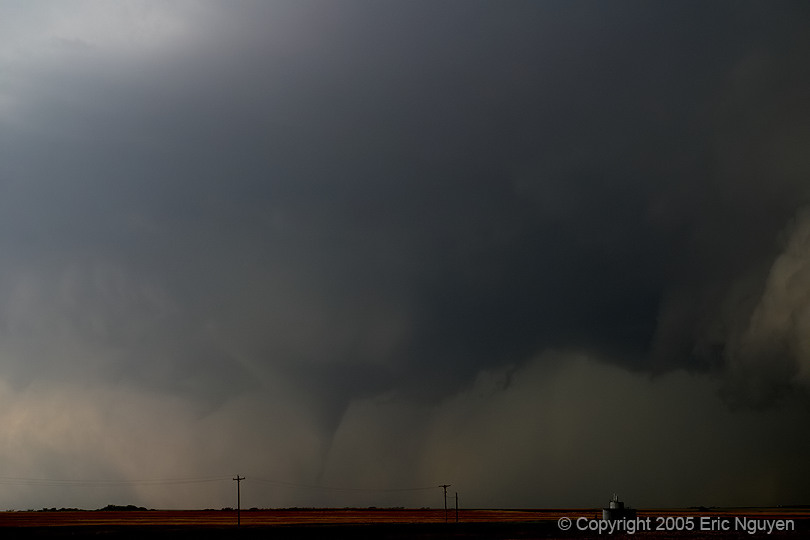
Tornado
rapidly developed and several minutes later was a stove pipe tornado picking up dirt.
The inflow tail was vigorously ingesting inflow from the north.
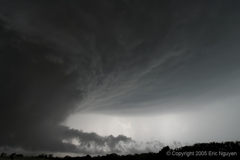
 More images
of the tornado just before it got wrapped in rain. The structure was amazing!!
More images
of the tornado just before it got wrapped in rain. The structure was amazing!!
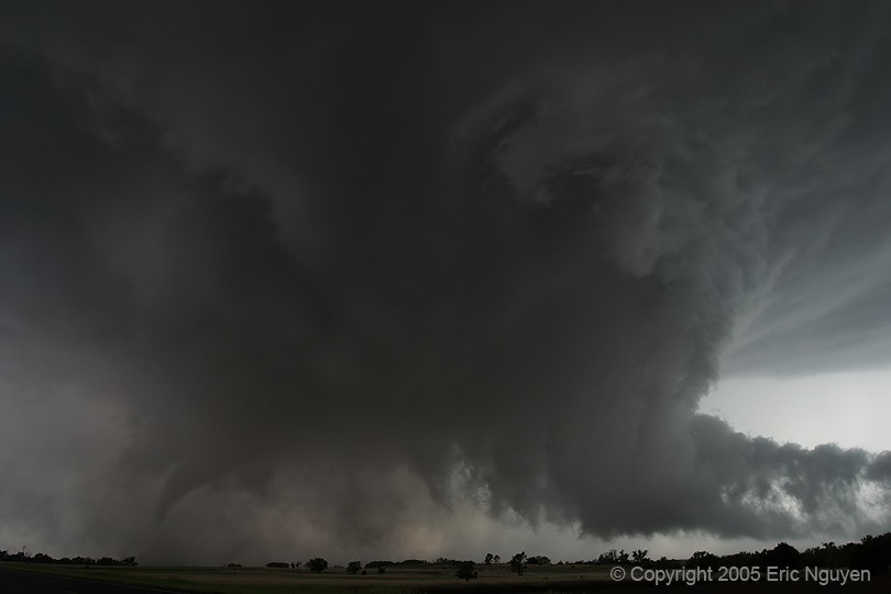
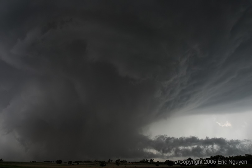
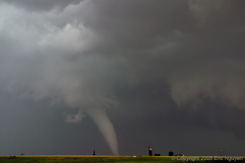
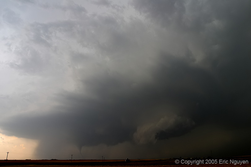
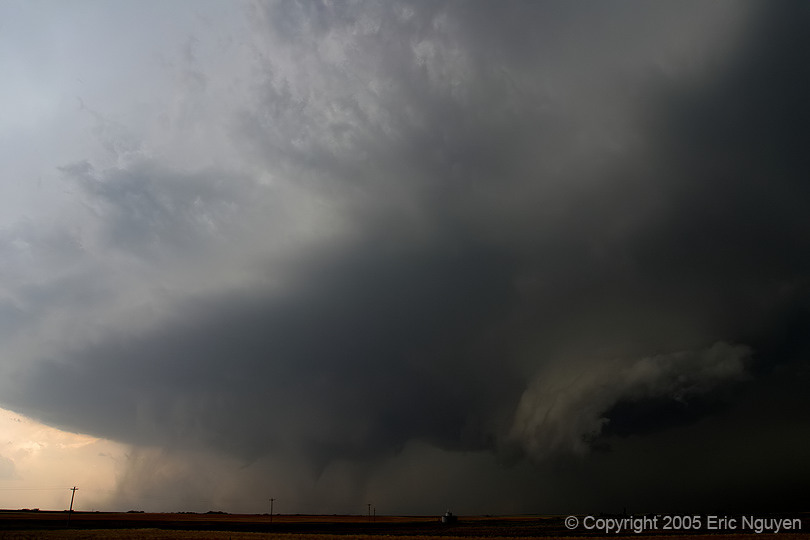
 The tornado
seemed to reorganize and despite the right hand side of the meso having incredible
rotation, the tornado developed more to the south. Multiple vorticies were observed
with the second circulation on the right hand side of the image. Very weird.
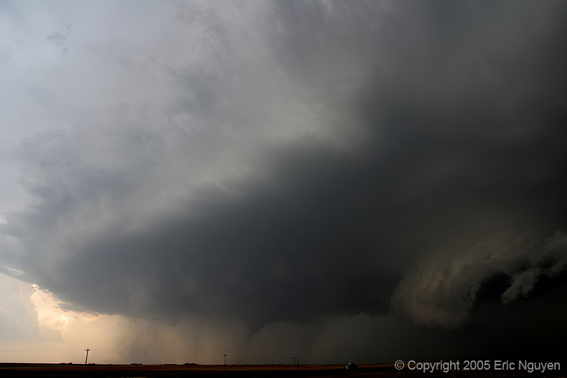
The tornado
seemed to reorganize and despite the right hand side of the meso having incredible
rotation, the tornado developed more to the south. Multiple vorticies were observed
with the second circulation on the right hand side of the image. Very weird.


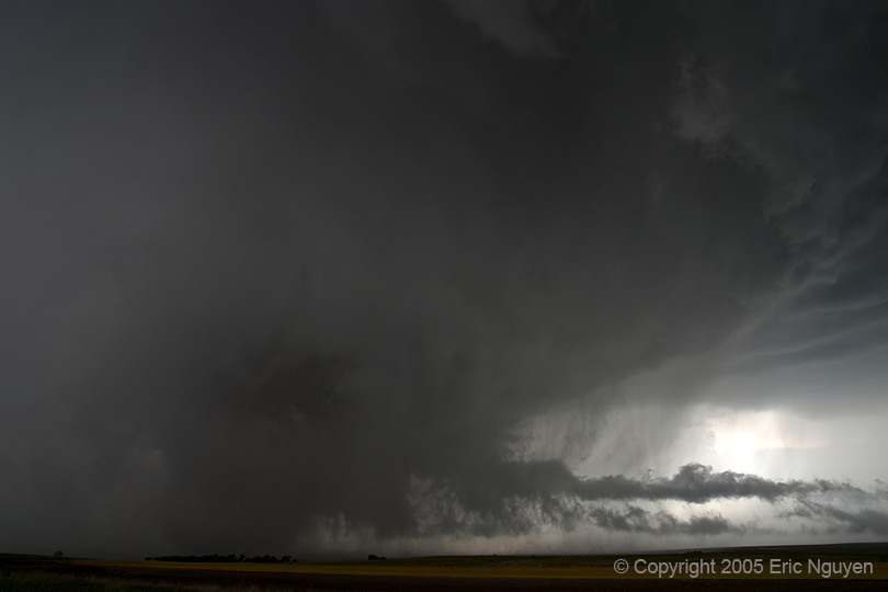
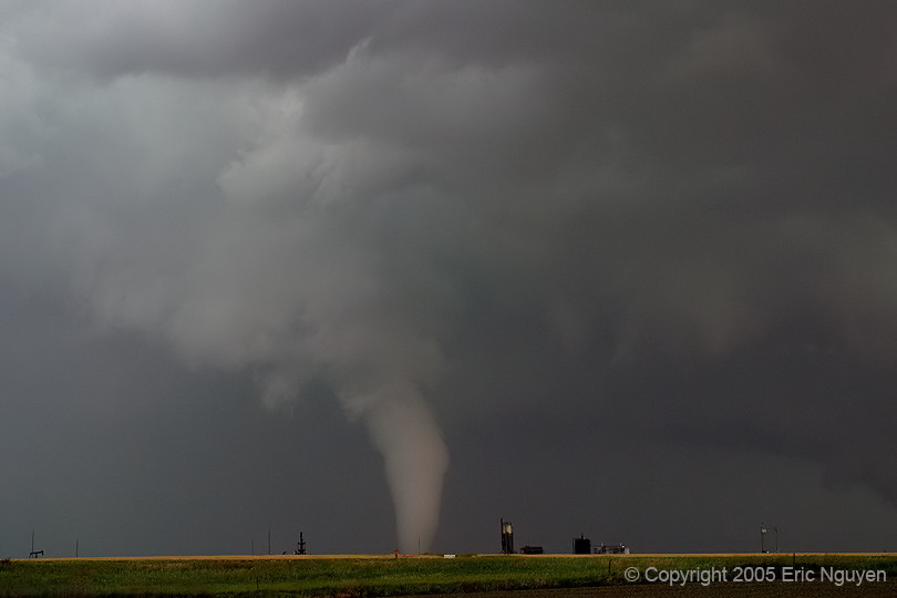
 More tornado
images as the rain wasn't a problem.
More tornado
images as the rain wasn't a problem.
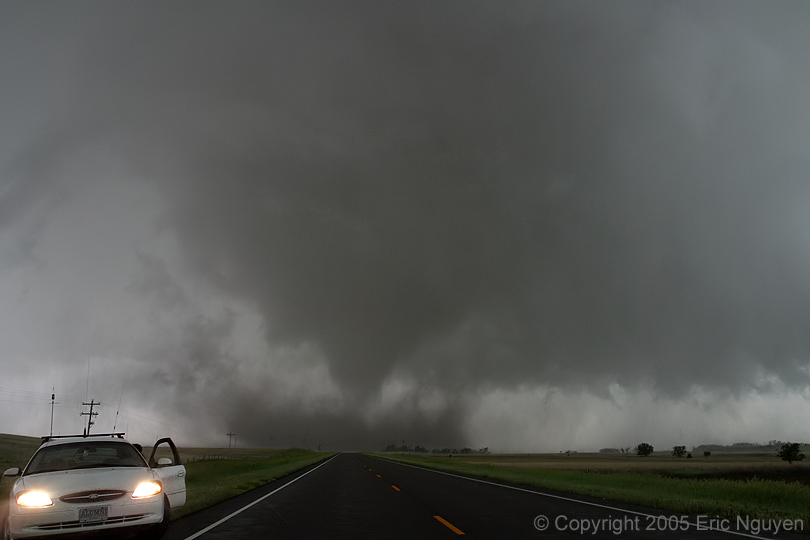
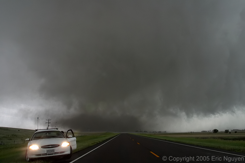

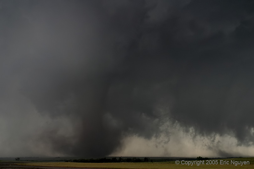
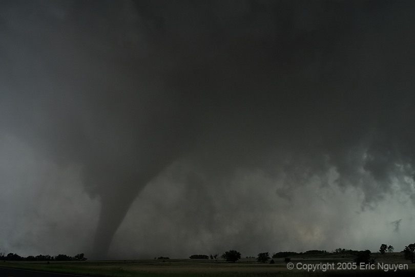
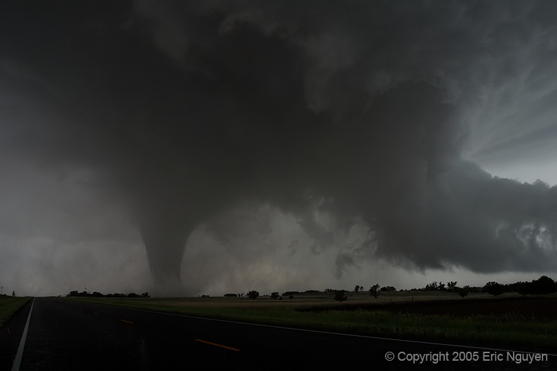
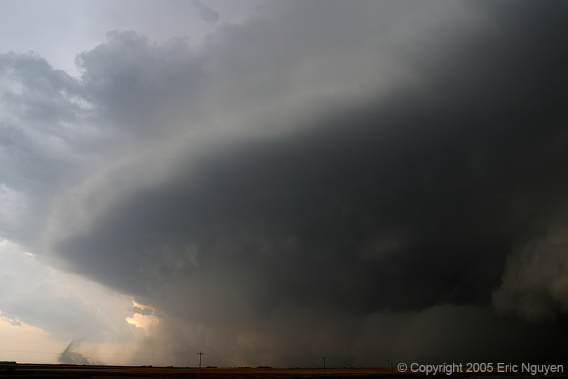
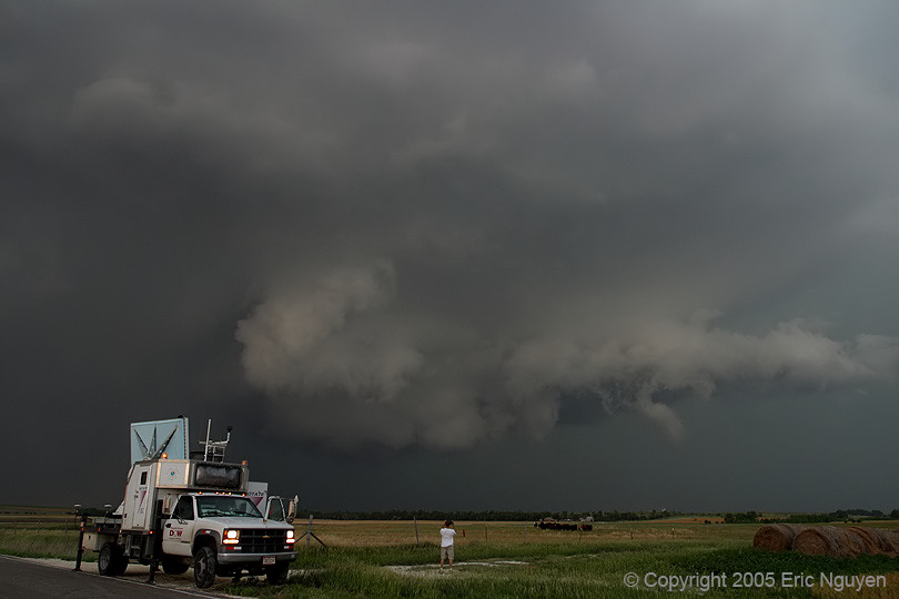
 The tornado
reached highway 283 and began to move northward towards our position. We were a mile
south of Hill City and were very worried about it wiping out the town. I went a
little north of where Scott Blair and I were originally to get a shot of the wedge and his
car together. The roar from this tornado was amazing!!
The tornado
reached highway 283 and began to move northward towards our position. We were a mile
south of Hill City and were very worried about it wiping out the town. I went a
little north of where Scott Blair and I were originally to get a shot of the wedge and his
car together. The roar from this tornado was amazing!!
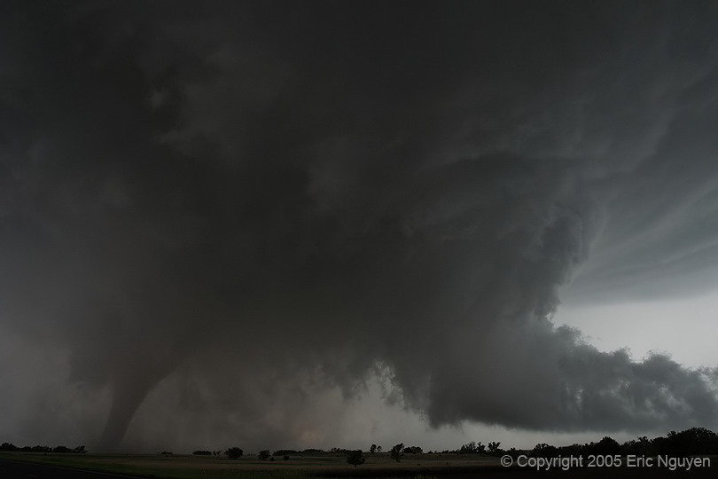
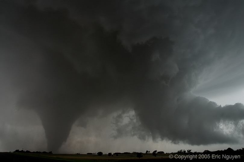
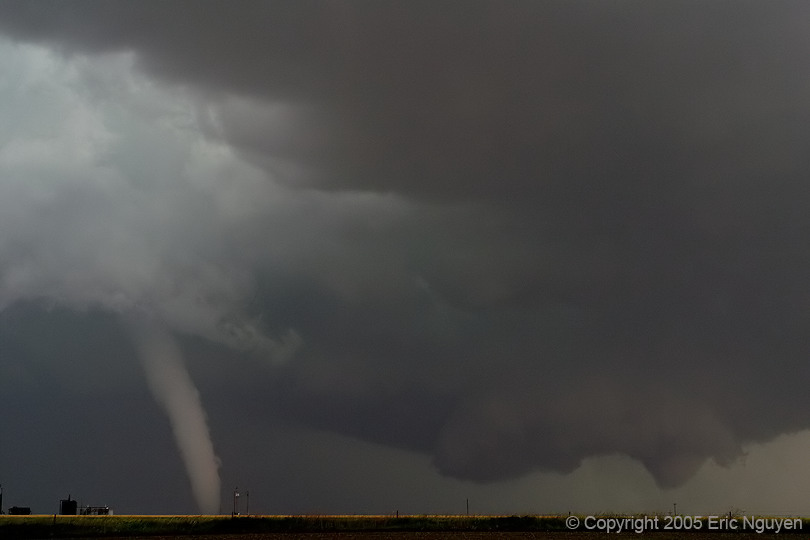
 North of
Palco, KS, we observed two other tornadoes at the same time that quickly developed.
One being the white elephant trunk shape and a cone shape east of the elephant trunk.
North of
Palco, KS, we observed two other tornadoes at the same time that quickly developed.
One being the white elephant trunk shape and a cone shape east of the elephant trunk.
 More images of these tornadoes.
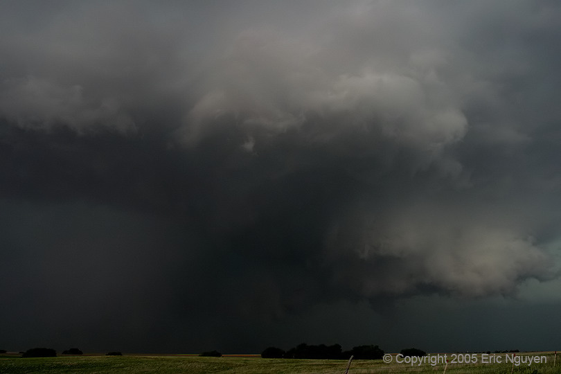
 I then went
south on a very bad muddy road to catch the supercell crossing I-70 near Trego Center, KS.
The storm didn't disappoint me as it produced two or three more tornadoes.
I then went
south on a very bad muddy road to catch the supercell crossing I-70 near Trego Center, KS.
The storm didn't disappoint me as it produced two or three more tornadoes.
 This tornado is just north of I-70.

 The DOW's finally arrived on this storm and were scanning a weak tornado.