- 2005 April 10
- © Copyright 2005 Eric Nguyen
-
- Chase Area: Western / Central Kansas
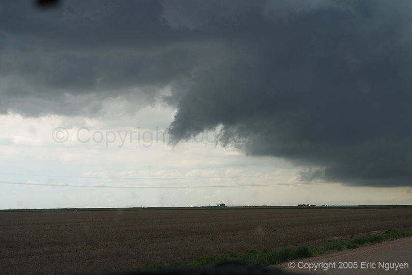
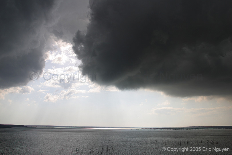
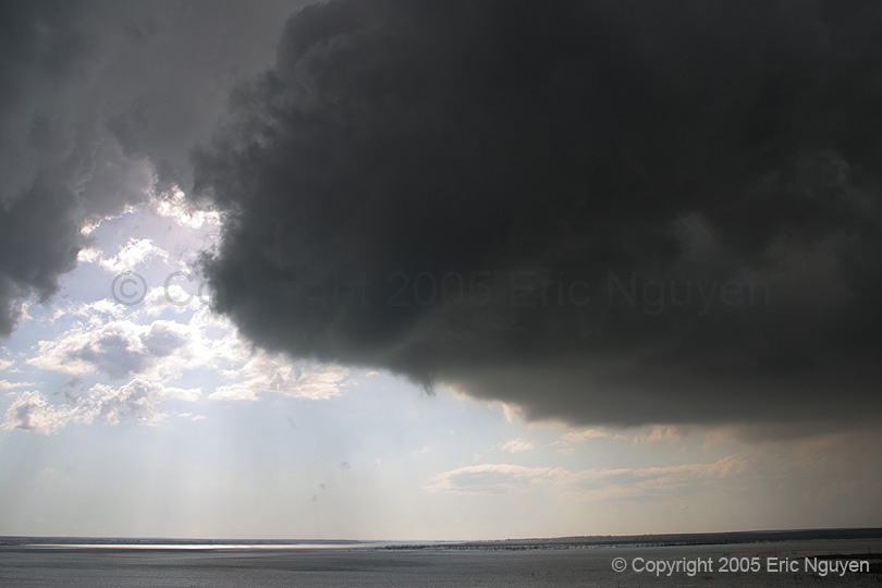
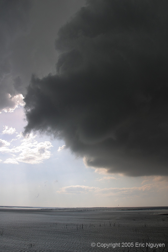
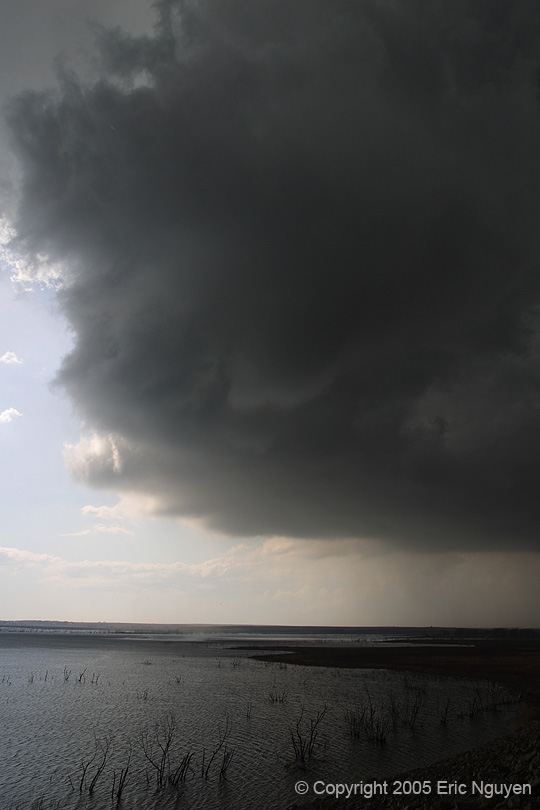
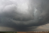
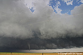
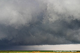
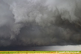
- Scott Currens and I were very interested in the cold core setup in
western Kansas, with RUC forecasting ESE surface winds over the warm sector, north of the
dryline and south of the warm front. There was late night / early morning convection
that developed in the TX Pan and rapidly moved NE into KS by 12z. The result was a
well defined outflow boundary in NW OK as well as a moist boundary layer. As the day
progressed we noticed that storms would initially develop near the dryline bulge north of
Pratt, KS, and move north up the dryline. There appeared to be a west to east
temperature gradient along with due east winds that lead straight to the dryline/warmfront
intersection, roughly west of Hays, KS. Given the strong midlevel winds, storms
would rapidly move north and once they hit this boundary they significantly slowed down
and tornado warnings would quickly be issued for those cells. This happened time and
time again, which leads me to believe that the outflow boundary in NW OK lifted north and
possibly didn't get past I70 due to the dense cold air to the north. North of this
boundary it was pretty chilly, and storms didn't seem to last long north of the W-E
gradient.
-
- I was very excited about the setup the night before given the similar
setup to March 21 where midlevel temps were -20 to -22 over upper 60 surface temps and low
50 dewpoints. The exciting part was we were going to have strong midlevel winds
which would probably keep precip from falling all around the updrafts, which was the case
on March 21. We considered N TX as a secondary target in case the KS target failed,
but we knew midlevel flow would probably back and the midlevel jet axis would once again
be placed north and west of where the NAM forecasted it. I looked at the 09Z RUC and
it basically did this, with almost due south midlevel flow parallel to the dryline in OK,
but perpendicular to the dryline as it curved back into the surface low. It also
kept the jet axis further west, so I wasn't sure if storms would form until dark south of
the KS/OK border. I was wrong though, an isolated cell did fire SW of OUN and
another SW of DFW. Scott and I eagerly watched the OUN storm as it seemed to just
crawl through town. Given that cold core setups occur early, we departed Norman at
630AM and drove NW where we met up with Amos Magliocco in Woodward, OK. Our plan was
to chase the warm front / dryline intersection north of the SFC low early on, and then
head east to the dryline bulge for more storms. We continued northwest to Liberal
and then northward to Garden City.

-
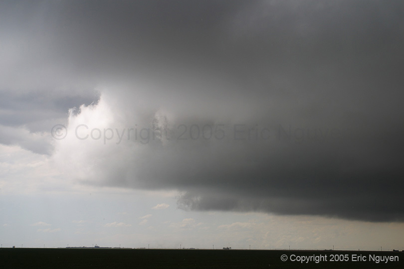
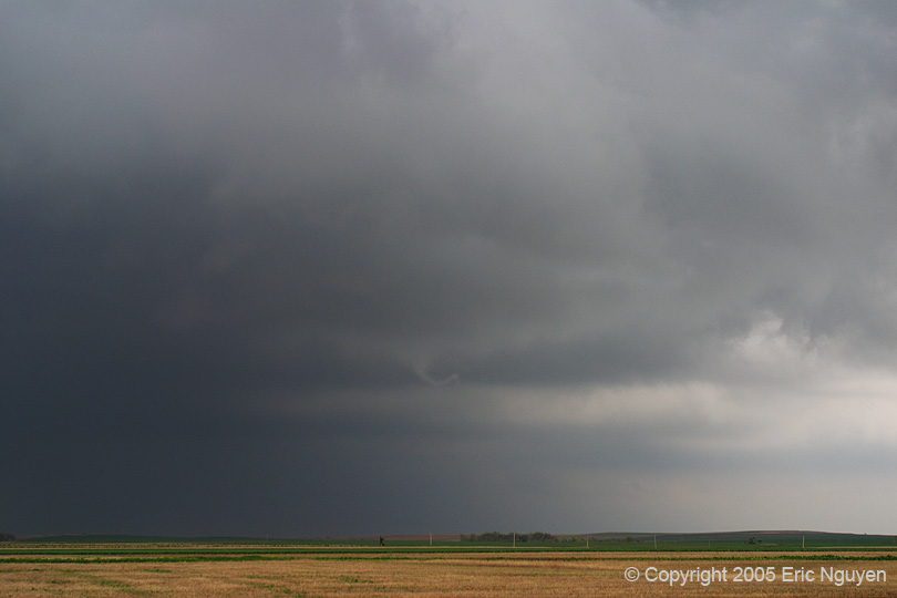
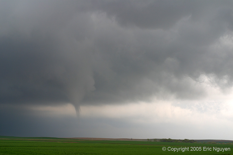
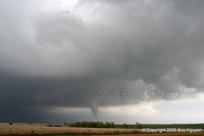
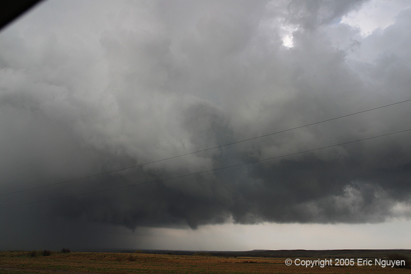
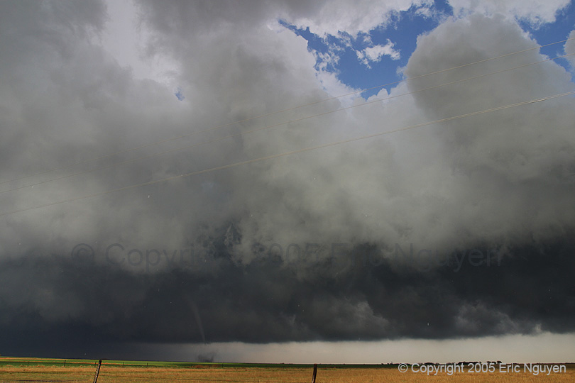
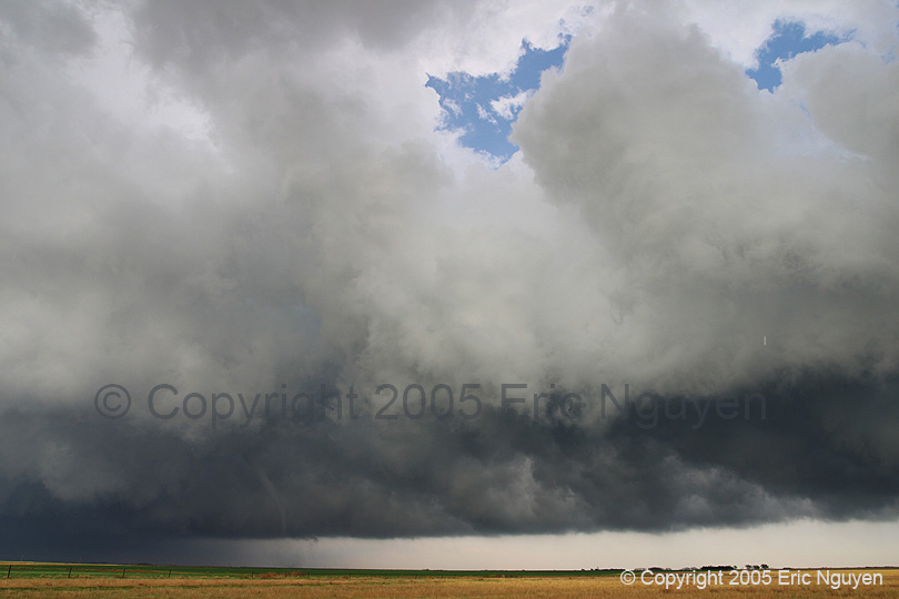
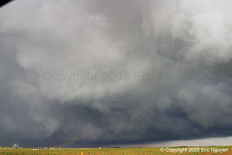
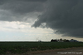
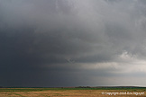
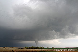
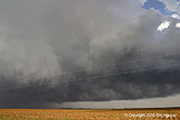
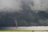
- Tornadic #1 - Scott City, Kansas
- Storms quickly developed along the dryline and warm front and
appeared once again to be small compact rotating storms. We watched as each storm
developed south of Scott City, KS and moved NW while slowly intensifying. They
would lower and developed a wall cloud, and then become high based and dissipate due to
what appeared to be a gust front to our north that curved south. Clouds were
scrapping the ground up there, so we knew it was cold north of this gust front. So
storms that hit this boundary seemed to rapidly dissipate. We moved east a bit and
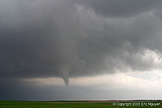
continued to watch each storm. One in particular began to look good on radar as well
as visually. It had a small compact meso and quickly spun up a weak tornado just
west of Scott City. There is a reservoir that was to our east by about 6 miles, so
I'm not sure where that is in relation to Scott City. This lasted about 2 min and
was moving north. We allowed the meso to pass over us and observed some of the
strongest cloud base rotation we saw the entire day, however we never saw it touch down
again. We watched it go north and left it for more cells to our east. This
storm apparently produced a second tornado about 20 minutes later to the north, that was
reported by law enforcement.
-
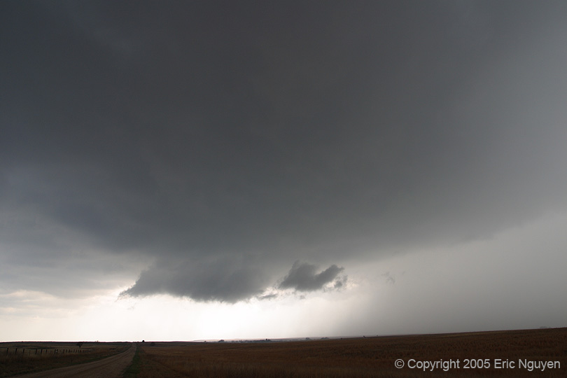
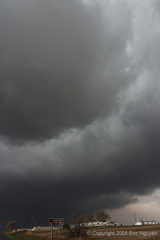
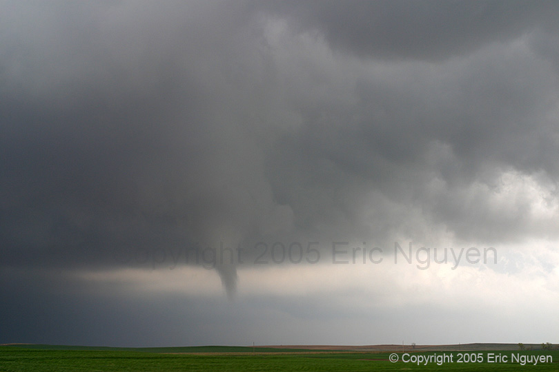
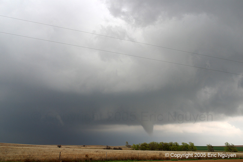
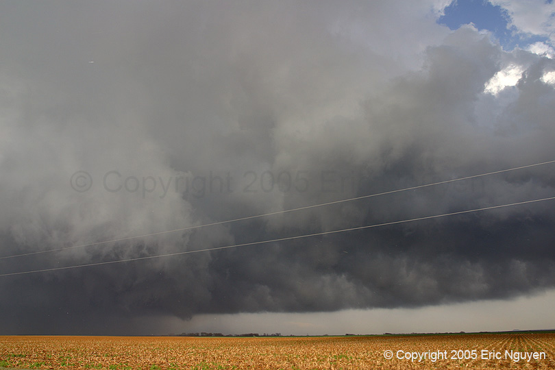
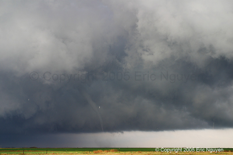
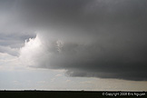
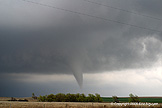
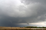
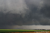
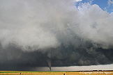
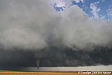
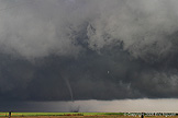
- Tornado #2 - Ness City, Kansas
- We packed up our stuff when it appeared that the warm front was too
socked in with storms and precipitation, and went east to our second target along the
dryline bulge. We arrived before storms began to get interesting, with our first
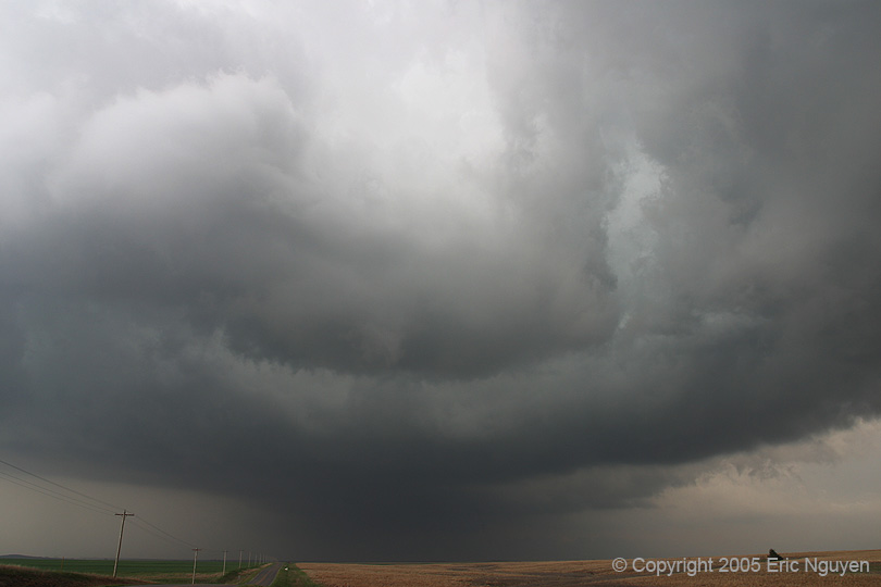
storm developed well to our south moving north near Ness City, KS. This storm
finally developed a precip core and eventually a wall cloud which was nicely displaced
well south of the precip core. It slowed and began to rotate hard. As it
approached the Cedar Bluff Reservoir, we joked about a tornado going right through the
reservoir. Fortunately a cigar shaped funnel developed and did just that! We
watched as multiple vorticies inside a larger circulation slowly moved northward across
the reservoir (2135UTC). We luckily stopped on an overlook that was part of the dam,
so we had a birds eye view of the circulation. Scott and I followed this as it moved
NNE over land and noticed that a large mass of cloud began to wrap around the south side
of the tornado at cloud base. This was similar to the June 10, 2004 Big Spring, NE
tornado, where it started at the southern edge of the meso and intensified with time,
rather then intensifying before hand. We watched as the circulation moved through
the field and began to pick up tumble weeds. I think I can safely say this was a
true F0 tornado. During the life cycle of this tornado, the RFD notched completely
wrapped around the tornado and had a spiral appearance. The tornado dissipated at
2149 UTC, lasting 14 minutes.


-
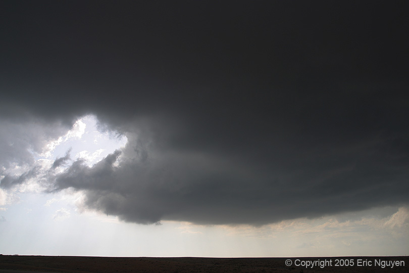
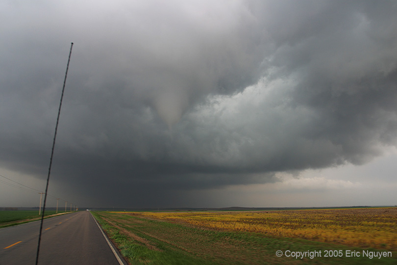
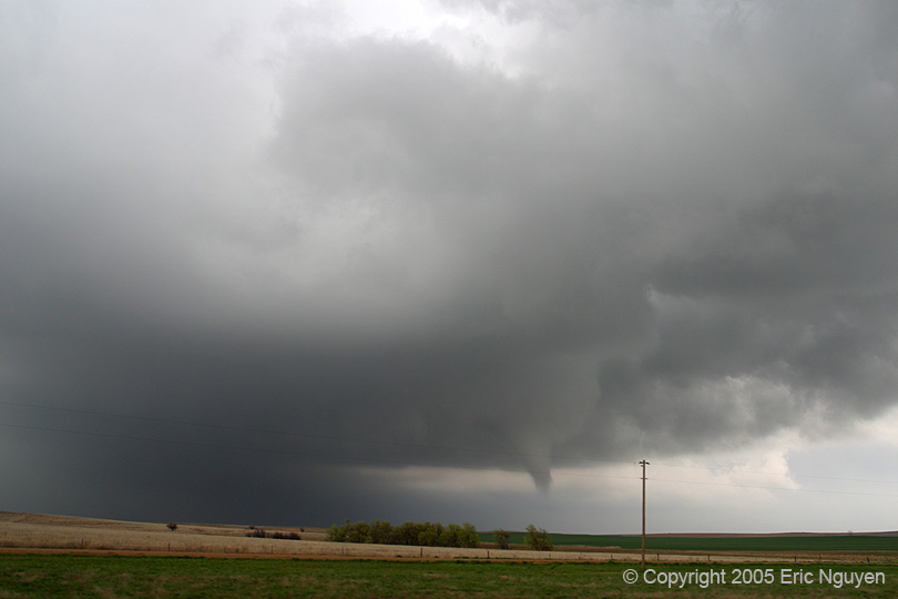
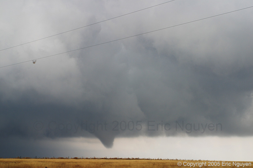
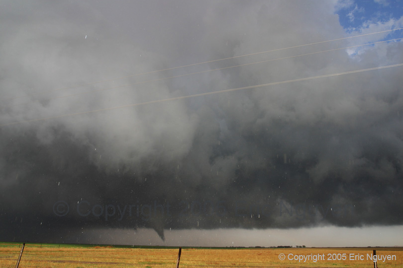
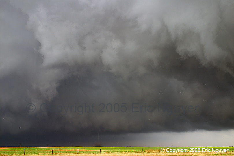
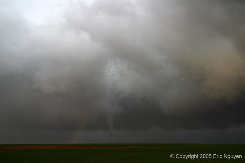
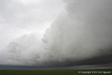
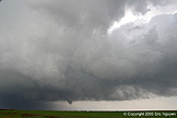
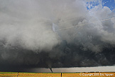
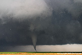
- Tornado #3 - Ness City, Kansas
- Just as this tornado dissipated another large meso developed north of
it, and quickly developed a tornado just north of the old one (2150 UTC). This
tornado had condensation all the way to the ground and took on a typical cone appearance.
This was your typical tornado so not much to say about this one. During this
tornado though we did notice that a new meso developed quickly to it's NW. It wasn't
long before this tornado dissipated and a new one developed, only this time the contrast
was much better. Dissipation was at 2155 UTC.


-
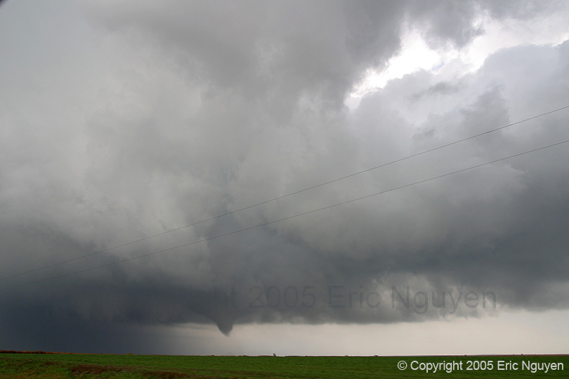
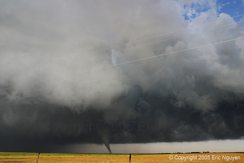
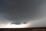
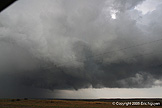
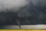
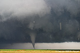
- Tornado #4 - Ness City, Kansas
- The sun came out a little and lit up the western side of the updraft
along with the tornado. This resulted in one of the most beautiful tornadoes I've
ever seen. We really had no choice but to be on the western side of the meso, but
this turned out to be a lucky spot. Just before the tornado developed into a cone,
my CF card on my SLR said "CF FULL", Scott's camcorder started flashing
"TAPE END", and when we finally decided to go north a little later, the truck
didn't move due to the mud. So there was a frantic 2 min period where we were
changing stuff out and trying to rock the truck back and forth to get out of the mud.
Luckily we did so quickly enough that we didn't miss much. Changing a CF card
is similar to running out of film, which I hasn't happened to me for probably 2 years.
The tornado dissipated at 2209 UTC.


-
- Tornado #5 - Russell, Kansas
- Once that tornado dissipated we went north and east to try and get
ahead of it since our visibility was becoming degraded. We knew the storm was north
of the W-E boundary but we weren't sure if it had one last tornado to go. I think I
heard reports of a tornado after ours but we never saw it due to rain and fog. We
blasted east and south towards the Hays, KS stuff but figured we probably wouldn't make it
in time. Once we got north of Hays we saw what was left of the once tornadic storm
that may have dropped a tornado south of Hays, KS. We went east towards Russell for
yet another tornadic storm that had reports of a tornado crossing I70 west of
Russell. We missed that one and went north to see what the storm looked like.
We were treated to a thin cone tornado which quickly got wrapped in rain. This was
pretty much it as it began to get dark. Tornado first observed at 2352 UTC and we
lost sight of it at 2355 UTC.


- © Copyright 2005 Eric Nguyen
-
- or