- 2005 March 21
- © Copyright 2005 Eric Nguyen
-
- Chase Area: Northern Oklahoma
- Scott Currens and I targeted the cold core setup in northern
Oklahoma. Convection prior to storm development was rock hard despite low CAPE
values. Prior and after the two tornadoes observed, we noticed a line of bases that
were rapidly rotating. Only after occlusion by the RFD would these updrafts develop
a tornado. These were clearly not landspout type tornadoes, as some working the
radar have noted. Obviously the horizontal scale of these storms won't be detected
well by radar.
-
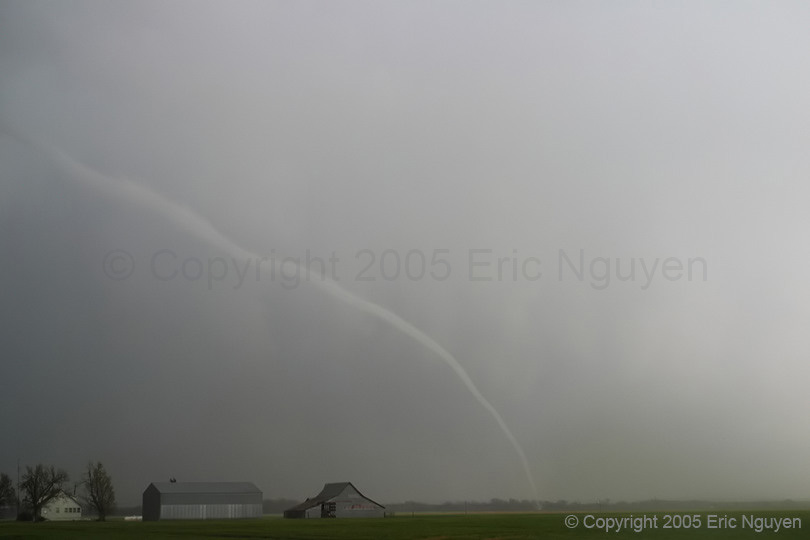
- Tornado #1 - Driftwood, Oklahoma
- We observed the first tornado ~ 3 miles SE of Amorita, OK, which is
in the county south of Harper County, Kansas. It touched down sometime around 3:12
as a ragged cone tornado and developed into a smooth cone / rope. As it roped out
the circulation on the ground was amazingly small, looked like a small dust devil size
circulation with a very long rope extending to our NE over the road. The shot I got
as it roped out are all wide angle (17mm minus the fact that I'm shooting with digital)
and I probably only got 50% of the tornado in the shot! It dissipated at 3:26PM.
Prior to the tornado we were watching two meso's, one to our north and another to
the south. Naturally the one we almost left was the tornadic one.

-
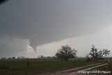
- Tornado #2 - Amorita, Oklahoma
- After the first tornado roped out we were once again watching two
tight circulations, one to our north and another to the south. This time the
northern one tornadoed and was wrapped in rain with very low contrast. This second
tornado was very close to Amorita, probably east-southeast of Amorita by 2-3 miles.
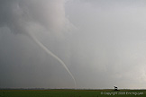
Our roads were too muddy to head after it so we went after another circulation to our SE
after we lost site of it. We ended the day by watching some very strong rotation /
wall cloud west of Medford, OK, which eventually wrapped in rain and appeared to
dissipate. Our line of storms eventually began to bow east with the individual updrafts
moving north along the arc. This pretty much halted the tornado threat and no more
tornado warnings were issued in our area. The storms appeared to be getting undercut
and a large shelf developed.
- © Copyright 2005 Eric Nguyen
-
- or