- 2004 March 27
- © Copyright 2004 Eric Nguyen
-
- Chase Area: Western Oklahoma
- Scott Currens and I left before noon and was targeting the dryline
just north and south of Elk City, OK. On our way out there we heard about the red
box that was issued for all of W OK. We also kept an eye on two cells that developed
in the eastern TX Panhandle. The northern storm became a supercell and produced a
large tornado in Woodward county near Vici, and the southern one slowed down and became a
supercell prior to reaching Elk City. We caught up with the cell before it reached
Elk City and observed great structure as well as a few tornadoes.
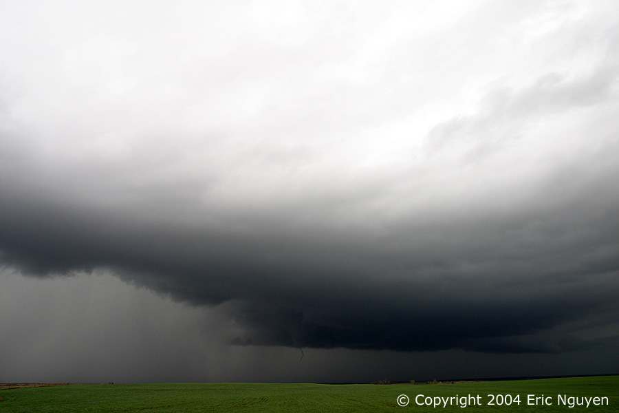
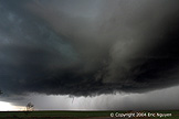
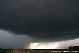
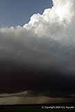
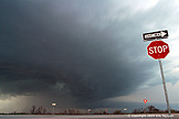
- Supercell Near Elk City, Oklahoma
- We arrived in Elk City, Oklahoma, and observed a rotating supercell
crossing I-40 heading slowly northeast.


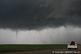
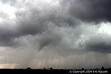
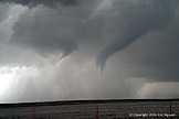
- Tornado #1
- We followed the storm northeast to a town named Butler, Oklahoma,
when we were surprised to see this storm produce a weak thin tornado. This tornado
lasted only a few minutes.


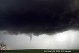
- Tornado #2
- After that meso occluded we observed a similar setup north of Custer
City, Oklahoma. We flanked the storm from the east as it began to produce a new
tornado that also lasted several minutes. We stopped across the street from a farm
house with a family on the front porch asking if they should take cover. I told them
they were okay for the moment and to look on the other side of the house to view the
tornado. They were pretty excited when they saw it! After that they took
shelter to be on the safe side.


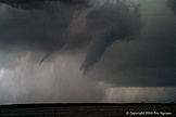
- Tornado #3
- Third tornado was even more of a surprise then the first two as the
meso was completely occluded before it developed into a small cone and had vorticies on
the ground observed a few chasers. I was very surprised to see fast moving thin
vorticies underneath this very elevated funnel. When we went back and looked at the
video we certainly confirmed that it was indeed a tornado. This tornado was located
near Thompson, Oklahoma.


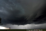
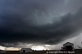
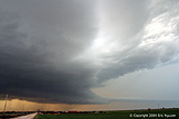
- Storm Structure
- As we drove south to a new storm near Weatherford, Oklahoma, we
looked back and saw the structure from our tornadic storm.

- New Southern Tornadic Supercell
- We watched as a strong RFD cut developed wrapping around the
wallcloud to our north. We were blasting east to flank it and get in position.
Once again, we observed another tornado, however, this one had a satellite funnel
associated with it. I'm not sure if it was anticyclonic or not, I'm assuming both
were cyclonic. Due to darkness it was more difficult to get good stills of this
tornado.


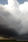
- A Last Look At Our Storm
- The structure at nightfall was decent as we drove southeast back to
Norman, Oklahoma.
- © Copyright 2004 Eric Nguyen
-
- or