Area Chased: SD
Significant Observations:
- 02:25 UTC - Occasional 2 inch hail falling 5 north of Reliance, SD (not measured)
- 02:39 UTC - Large rapidly rotating funnel 2 miles NE of Reliance, SD, possible brief tornado.
Discussion: Scott Blair and I targeted about 30 miles west of Pierre, SD where convection rapidly fired at 4pm along a dryline bulge. Storms rapidly organized just east of Pierre, SD with occasional wallclouds and funnels. Our storm seemed to gust out so we dove south to a new meso 5 miles south of the older one. This organized and slowly weakened with time, however, the structure of these storms were excellent.
We dove south to a new storm which had a huge wallcloud as we approached. After this wallcloud gusted out, a new wallcloud formed east of the old one just northeast of Reliance, SD. A tornado warning was promptly issued as the wallcloud began to occlude. During the occlusion process, large hail began to fall so I had to switch to shooting video rather than expose my camera to golf ball hail. This strong area of rotation had several funnels which rapidly merged into a cone. Strong rotation on this wallcloud developed around 02:32 UTC and seemed to peak at 02:39 UTC in which a tornado probably touched down. Giving the uncertainty in the situation, i.e., I had a poor view of the sfc underneath the cone, I did not report this to the NWS as a tornado. At approximately 02:45 UTC the strong area of rotation began to gust out and I no longer observed the storm as it got too dark to continue the chase. Based on radar trends it seemed to rapidly weakened as it went south of Reliance, SD.
After the storm passage, Scott and I were treated with a spectacular lightning show on the backside of the updraft.
Pictures:
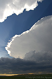
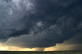
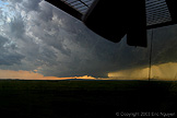
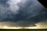 A supercell developing just east of Pierre, SD, with a lowering developing as
it slowly moved east-northeast.
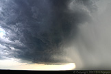
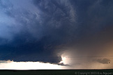
 Large hail shaft as the southern meso moves southward.
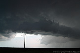 A new storm developed on the south side of the Missouri river. When we
arrived it already had a rotating wallcloud and inflow tail. It eventually occluded
but the thin updraft remained with a funnel developing in the center.
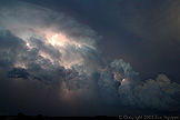
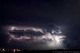 Our storm moved off to the SE giving Scott and I a spectacular
lightning show!!