Area Chased: NE/SD BORDERS
Significant Observations:
- 00:05 UTC - Tornado touched down 8 N of Atkinson, NE. Occurred from @ 00:05 UTC to 00:13 UTC +/- one minute.
- 00:26 UTC - Large tornado 4 miles north of Emmet, NE. Duration @ 00:26 UTC to UNK (still on ground at 00:34 UTC
- with small satellite tornadoes merging into it on NW side of tornado.
Discussion: Scott Blair and I targeted Valentine, NE along the dryline bulge. A storm developed by late afternoon east of Valentine, NE and moved eastward along Hwy 12. We flanked the storm watching it from the ENE as it occasionally had small lowerings. We went south on Hwy 11 towards Atkinson, NE to get due east of it. At about 8 miles north of Atkinson, Scott and I stopped to watch what appeared to be a more significant lowering to our due west. We drove west on a small farm road as the tornado began to develop to our west. The tornado developed at 00:05 UTC and lasted for about 8-9 minutes. Path width was about 0.2 miles wide and tracked for approximately 2 miles.
After that tornado, the storm completely occluded and a new meso formed due south of the older one which began to move eastward. At approximately 00:26 UTC 4 miles north of Emmet, NE, a large funnel formed and rapidly developed into a barrel shaped tornado. Our view was from the due north as we drove south on Hwy 11 towards Atkinson. During our drive south I observed a few thin satellite tornadoes merging with the larger tornado north of Emmet. We went east on Hwy 20 and observed at times a large tornado wrapped in rain and dust. When we approached the town of O'Neill, NE, small pieces of debris were falling from the sky as the rain wrapped tornado ripped through portions of the town. This tornado lasted for quite a while and did moderate to strong damage to property along its path from 4 N of Emmet to 3 N of O'Neill (NWS has track beyond O'Neill). This tornado was rated F3 and was at times 1/3 a mile wide.
After the storm passed O'Neill, Scott and I went SE to get gas in Ewing, NE. We went north on a small road to get east of the (new?) meso along Hwy 20. We had strong east winds into the meso which was wrapped in rain and hail. Once the area of rotation got close we lost all light as heavy rain/hail/wind over took the vehicles, so we fled south. We discontinued to chase the storm as nightfall was making it too dangerous to chase a storm of this magnitude. We were once again treated to a great lightning show as the storm moved southeastward toward Norfolk, NE.
Pictures:


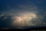
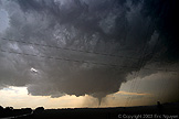
 Supercell developing looking due south. Same supercell with lowering looking due
west as lowering develops, all of these images are shot using a 20mm wide angle lens.


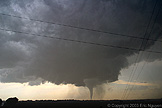
 Tornado on ground north of Atkins, NE. View is
looking due west.

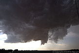
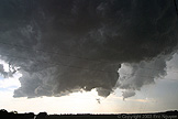
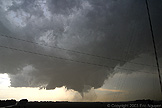
 Tornado lifts, however, strong rotation is still evident
and a small thin tube develops and disappears as the entire meso weakens.
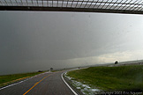

 A new RFD notch develops as a tornado forms to our due
south in low contrast. Dusty looking tornado just right of the rain / hail shaft.
We lost visual on the tornado as it got shrouded in moisture.
 Rain / hail begins to wrap around the meso / tornado, and
eventually small pieces of debris fall out of the sky over O'Neill.
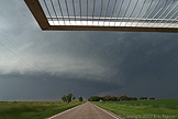
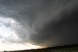 Distant meso as we race back north after getting much
needed gas. Rear flank gust front approaches with small hail and wind.

