Area Chased: SW KS / OK PAN
Discussion: I'm late writing this report so it will be brief. I saw a very nice supercell which began near Dodge City, KS, and then moved south picking up speed with time, toward the Oklahoma Panhandle. I also observed a very brief spin-up under the wallcloud and funnel. I didn't know if it was indeed a tornado until confirmation came from another chaser much closer then I was. A second rapid spin-up occurred close to the KS/OK border along an occluded wallcloud. It caught me off guard as it was only lightning lit due to nightfall. This was probably a gustnado, however, it did make SPC Storm Data. It was an excellent August chase!!
Pictures:
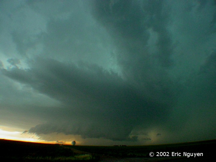
 Supercell just SW of DDC. Several wallclouds developed
early in its life, this is probably the third one of the day from this storm. Where
the inflow tail and wallcloud intersection was, a brief tornado was reported and a small
dusty debris cloud shows up on video when I zoomed in, however, it didn't show in this
wide angle digital image.
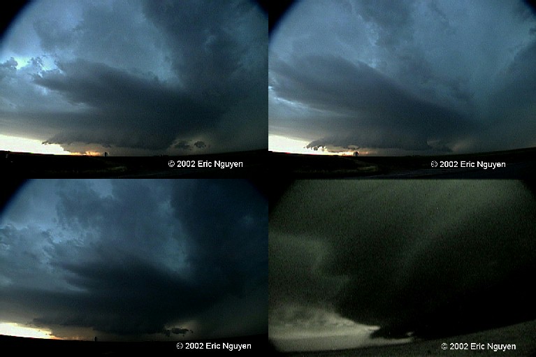
Supercell just SW of DDC. Several wallclouds developed
early in its life, this is probably the third one of the day from this storm. Where
the inflow tail and wallcloud intersection was, a brief tornado was reported and a small
dusty debris cloud shows up on video when I zoomed in, however, it didn't show in this
wide angle digital image.