Area Chased: W TX
Discussion: Despite everyone heading down to SPC's moderate risk, we targeted the Plainview to Lubbock area. Our first supercell developed just east of Highway 27 SE of Plainview, TX. It was a spiral updraft, however, too inflow dominant and seemed to lack moisture which caused it to dissipated. We dove south to another developing supercell near Abernathy, TX off of Highway 27. This storm didn't look great at first. We went into the core a few times and were surprised at the wall of pea to quarter sized hail. We continued to stay ahead of this hail letting it hit us to see how big it was. While doing this a tornado developed 3/4 of a mile south of us. It was weak and small, however, up close video that other chasers got showed it to have pretty strong rotation and mulitvortex structure located just north of Ralls, TX. This dissipated and we went into Ralls, TX to gas up. We went east of town to continued chasing it. It had a strange lowering scud that had dust feeding into it. Another tornado developed rapidly between Ralls, TX and Crosbyton, TX. This lasted for a few minutes and was multivortex. After this dissipated we hung around in Crosbyton while golf ball and larger sized hail began to fall. We went south to stay ahead of the storm and that's when baseball sized hail (measured 3.1 inch hail) began to fall south of Crosbyton, TX. This storm moved off the caprock and began to weaken. At that time a new LP supercell formed back to the west near Crosbyton, TX and had a huge wallcloud on it. Once we got back on the caprock we got site of this new classic rotating supercell with a nice wallcloud developing. We were certain it would tornado, however, no such luck! Despite it looking twice as good as the other tornadic supercells, it only produced marginal hail.
Pictures:
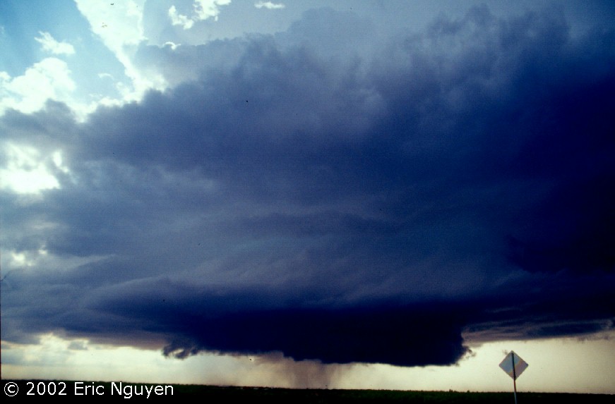
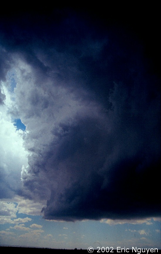 The first supercell of the day which had great structure, however, seemed to
dry up and dissipated.
The first supercell of the day which had great structure, however, seemed to
dry up and dissipated.
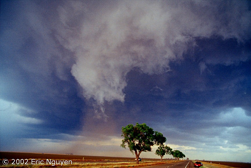
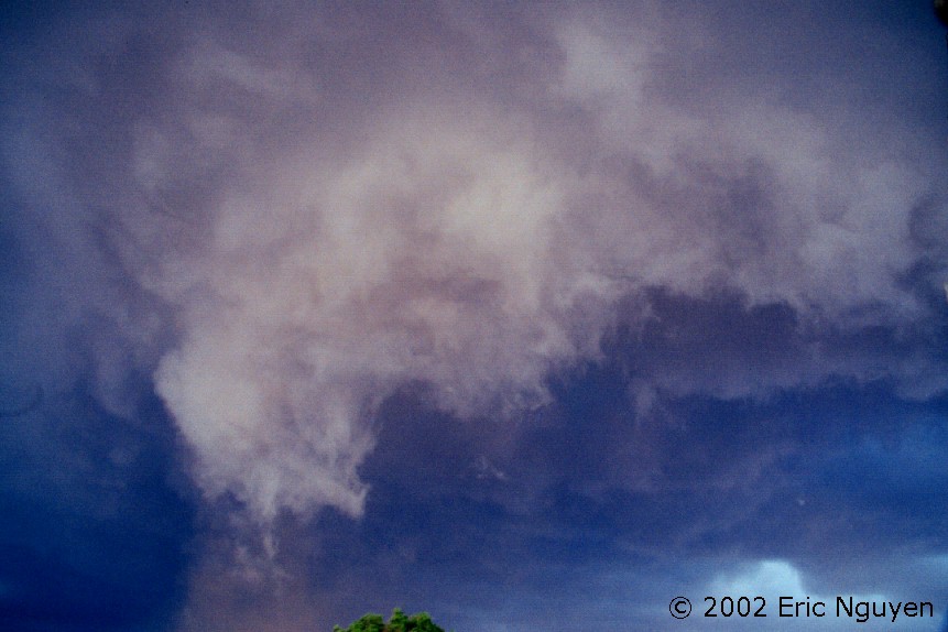
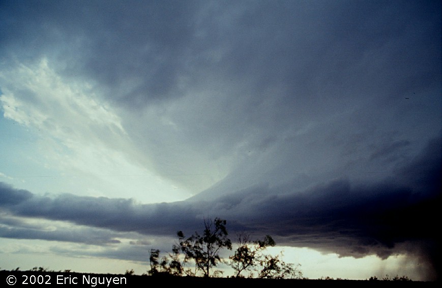
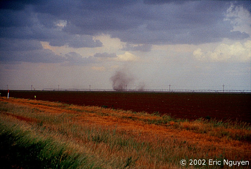 This lowering scud had dust feeding into it while a multivortex
tornado developed ahead of it under the updraft. I'm not quite sure what to call the
two left hand images, scud / smaller updraft with dusty inflow.
This lowering scud had dust feeding into it while a multivortex
tornado developed ahead of it under the updraft. I'm not quite sure what to call the
two left hand images, scud / smaller updraft with dusty inflow.
 Crosbyton, TX while golf ball and larger sized hail is falling.
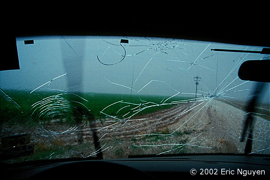

 Hail falling south of Crosbyton damaged the windshield. It
started out small shown in the far right image, and soon spiked clear baseball hail began
to fall shown below.
Hail falling south of Crosbyton damaged the windshield. It
started out small shown in the far right image, and soon spiked clear baseball hail began
to fall shown below.

 The spiked stones we collected on the side of the road. It
was very interesting to observe hail as strange as this. Some of the stones had 1/2
inch long frozen spikes.
The spiked stones we collected on the side of the road. It
was very interesting to observe hail as strange as this. Some of the stones had 1/2
inch long frozen spikes.
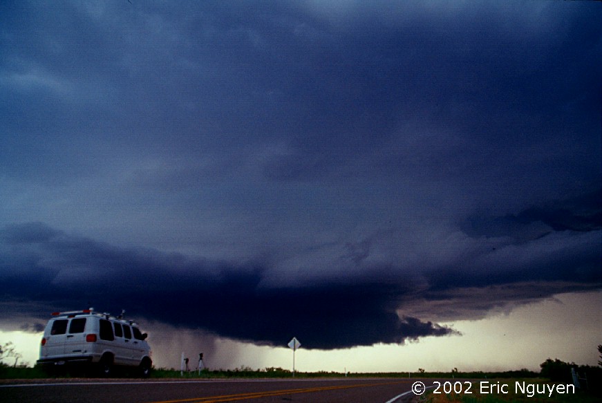
 This is the second supercell, the hail producing one, moving east
and dissipating.
This is the second supercell, the hail producing one, moving east
and dissipating.
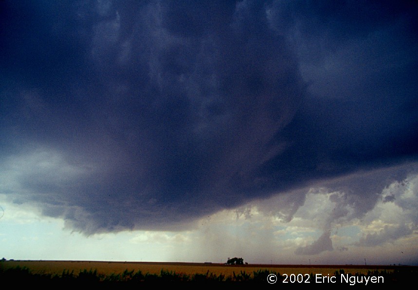
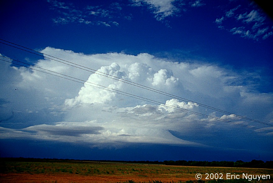
 A new supercell developed to our west on the caprock. Here
are images of it as we parked on the ridge and waited for it to become tornadic.
Despite it remaining nontornadic, it was a monster supercell rotating violently.
A new supercell developed to our west on the caprock. Here
are images of it as we parked on the ridge and waited for it to become tornadic.
Despite it remaining nontornadic, it was a monster supercell rotating violently.
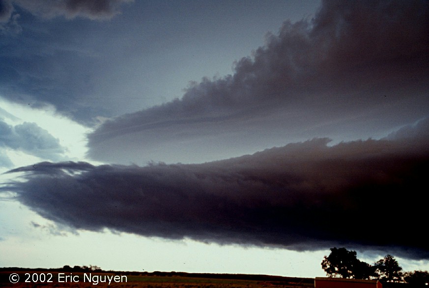 The previously classic supercell morphed into a linear stacked
plate band which moved southward. The image here only shows half of it, as we were
too close to get the entire linear band on one still.
The previously classic supercell morphed into a linear stacked
plate band which moved southward. The image here only shows half of it, as we were
too close to get the entire linear band on one still.
Additional Information:
SEVERE WEATHER STATEMENT
NATIONAL WEATHER SERVICE LUBBOCK TX
736 PM CDT MON MAY 27 2002
...A TORNADO WARNING CONTINUES FOR CROSBY COUNTY UNTIL 800 PM CDT...
AT 736 PM CDT NATIONAL WEATHER SERVICE DOPPLER RADAR INDICATED A
SEVERE THUNDERSTORM CAPABLE OF PRODUCING A TORNADO 7 MILES NORTHWEST
OF WHITE RIVER LAKE...OR 8 MILES SOUTH OF CROSBYTON...MOVING
SOUTHEAST AT 15 MPH.
WHITE RIVER LAKE IS IN THE PATH OF THIS STORM.
AT 732 PM CDT AN OFF DUTY NATIONAL WEATHER SERVICE EMPLOYEE
REPORTED TENNIS BALL TO BASEBALL SIZED HAIL 7 MILES SOUTH OF
CROSBYTON AT THE INTERSECTION OF FM 40 AND FM 651.